Home
Browse
Ask Us
Chat
Harmful Language Statement
Log in
Advanced Search
Year
1915
1916
1917
1918
1919
1920
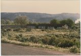
1921
1922
1923
1924
1925
1926
1927
1928
1929
1930
1931
1932
1933
1934
1935
1936
1937
1938
1939
1940
1941
1942
1943
1944
1945
1946
1947
1948
1949
1950
1951
1952
1953
1954
1955
1956
1957
1958
1959
1960
1961
1962
1963
1964
1965
1966
1967
1968
1969
1970
1971
1972
1973
1974
1975
1976
1977
1978
1979
1980
1981
1982
1983
1984
1985
TO
1915
1916
1917
1918
1919
1920
1921
1922
1923
1924
1925
1926
1927
1928
1929
1930
1931
1932
1933
1934
1935
1936
1937
1938
1939
1940
1941
1942
1943
1944
1945
1946
1947
1948
1949
1950
1951
1952
1953
1954
1955
1956
1957
1958
1959
1960
1961
1962
1963
1964
1965
1966
1967
1968
1969
1970
1971
1972
1973
1974
1975
1976
1977
1978
1979
1980
1981
1982
1983
1984
1985
Type
Image
304
Format
image/jpeg
289
application/pdf
15
Collection
Beckwith Photograph Collection
7
Photo Archives
271
Utah River Running Photo Archives
23
Westminster University Photographs
3
Filters:
Spatial Coverage:
"Garfield County (Utah)"
Type:
"Image"
1
-
25
of
304
<
1
2
3
4
5
6
7
8
9
10
>
Gallery view
Number of results to display per page
10
25
50
100
200
Sort by Relevance
Sort by Title A-Z
Sort by Title Z-A
Sort by Date Ascending
Sort by Date Descending
Sort by Last Modified Ascending
Sort by Last Modified Descending
Title
Date
Type
Setname
1
"Cleopatra" North Wash
1951-05-02
Image
uum_map_rr
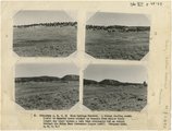
2
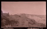
(Panorama A, B, C, D) Blue Springs Meadows. A stream leading south (left) to Mammoth Creek blocked by basalts from Miller Knoll (right sky line) became a lake that eventuallly cut an outlet through the Brian Head formation (upper left).
1944
Image
uum_map
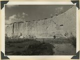
3
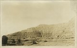
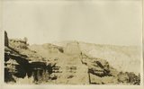
Alluvial wall of trench dug since 1920(?), post Wasatch marls at base. Red Creek. Garfield County, UT, 1940
1940
Image
uum_map
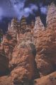
4
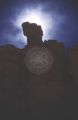
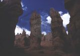
Along Navajo Trail, Bryce Canyon [1]
1959-06-25
Image
uum_map
5
Along Navajo Trail, Bryce Canyon [2]
1959-06-25
Image
uum_map
6
Along Navajo Trail, Bryce Canyon [3]
1959-06-25
Image
uum_map
7
Along Navajo Trail, Bryce Canyon [4]
1959-06-25
Image
uum_map
8
Along Navajo Trail, Bryce Canyon [5]
1959-06-25
Image
uum_map
9
Along Navajo Trail, Bryce Canyon [6]
1959-06-25
Image
uum_map
10
Along Navajo Trail, looking up switchbacks Bryce Canyon
1959-06-25
Image
uum_map
11
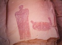
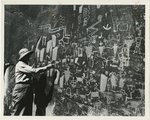
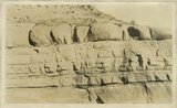
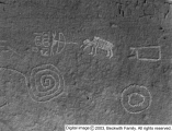
Angus Woodbury at Smith Fork petroglyphs
1957-09
Image
uum_map
12
Approaching Cedar Edge Mtn. pass, Hwy 14
1985-05-10; 1985-05-11; 1985-05-12
Image
uum_map
13
Approaching Hite Crossing Bridge, Garfield County, Utah
1966-07-26
Image
uum_map
14
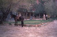
Art [Arth] Chaffin Lodge and P.O. [post office]
1951-05-02
Image
uum_map_rr
15
Art [Arth] Chaffin; Ferry at Hite
1951-05-02
Image
uum_map_rr
16
Back of Circle D
1985-05-10; 1985-05-11; 1985-05-12
Image
uum_map
17
Banded red and white sands. 'Marine Jurassic', immediately west of Cannonville
1924
Image
uum_map
18
Banded red and white sands. 'Marine Jurassic', immediately west of Cannonville
1924
Image
uum_map
19
Banded red and white sands. 'Marine Jurassic', immediately west of Cannonville
1924
Image
uum_map
20
Banded red and white sands. 'Marine Jurassic', immediately west of Cannonville
1924
Image
uum_map
21
Banded red and white sands. 'Marine Jurassic', immediately west of Cannonville, Garfield County, Utah
Image
uum_map
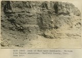
22
Bank of Wash near Escalante. Texture like Dakota sandstone. Garfield County, UT. June 1918
1918
Image
uum_map
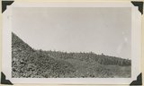
23
Basalt, head of Rock Creek. Old lava (foreground) and end of newer flow (center). Garfield County, UT, 1944
1944
Image
uum_map
24
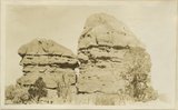
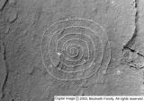
Beautiful spiral
1933-05-28
Image
dc_bpc
25
Beautiful spiral
1933-05-28
Image
dc_bpc
1
-
25
of
304
<
1
2
3
4
5
6
7
8
9
10
>