| Title | Date | Type | Setname | ||
|---|---|---|---|---|---|
| 1 |  | A1 Mt., N. Fork Stillwater | 1930; 1931; 1932; 1933; 1934; 1935; 1936 | Image/StillImage | uum_map |
| 2 |  | Afternoon shadows (Mt. Lovenia) | 1930; 1931; 1932; 1933; 1934; 1935; 1936 | Image/StillImage | uum_map |
| 3 |  | Agendas for meetings of Citizens for a Responsible Central Utah Project | 1977; 1978; 1980 | Text | wwdl_neh |
| 4 |  | Approach to Tokewanna, Black's Fork | 1934 | Image/StillImage | uum_map |
| 5 |  | Approach to Tokewanna, Black's Fork: Deer | 1934 | Image/StillImage | uum_map |
| 6 |  | As done in Colorado | 1930; 1931; 1932; 1933; 1934; 1935; 1936 | Image/StillImage | uum_map |
| 7 |  | Ashley National Forest - Analysis Units - High Uintas Roadless Area Study | Image/StillImage | ucl_maps | |
| 8 |  | August 11 - 12, 1928 Trial Lake [01] | 1928-08-11; 1928-08-12 | Image/StillImage | uum_map |
| 9 |  | August 11 - 12, 1928 Trial Lake [02] | 1928-08-11; 1928-08-12 | Image/StillImage | uum_map |
| 10 |  | August 11 - 12, 1928 Trial Lake [03] | 1928-08-11; 1928-08-12 | Image/StillImage | uum_map |
| 11 |  | August 11 - 12, 1928 Trial Lake [04] | 1928-08-11; 1928-08-12 | Image/StillImage | uum_map |
| 12 |  | August 11 - 12, 1928 Trial Lake [05] | 1928-08-11; 1928-08-12 | Image/StillImage | uum_map |
| 13 |  | August 11 - 12, 1928 Trial Lake trip and a view of Hayden Peak 12,473 ft. | 1928-08-11; 1928-08-12 | Image/StillImage | uum_map |
| 14 |  | August 11 - 12, 1928 Trial Lake trip and a view of Reid's Peak | 1928-08-11; 1928-08-12 | Image/StillImage | uum_map |
| 15 |  | August 11 and 12, 1928 on top of Mt. Baldy about 11,500 Ft. Elevation of roadway 10,800 in the Uinta Mountains | 1928-08-11; 1928-08-12 | Image/StillImage | uum_map |
| 16 |  | Baldy and Hayden from Lamotte | 1930; 1931; 1932; 1933; 1934; 1935; 1936 | Image/StillImage | uum_map |
| 17 |  | Baldy, 11,970 ft. and Reid's Peak | 1930; 1931; 1932; 1933; 1934; 1935; 1936 | Image/StillImage | uum_map |
| 18 |  | Bear River - Uinta Mountains | 2007-08-24 | Sound | uu_wss |
| 19 |  | Bear River Ranger Station | 1960; 1961; 1962; 1963; 1964; 1965; 1966; 1967; 1968; 1969; 1970; 1971; 1972; 1973; 1974; 1975; 1976; 1977; 1978; 1979 | Image/StillImage | uum_map_usa |
| 20 |  | Bear River, Uintas | 1960; 1961; 1962; 1963; 1964; 1965; 1966; 1967; 1968; 1969; 1970; 1971; 1972; 1973; 1974; 1975; 1976; 1977; 1978; 1979 | Image/StillImage | uum_map_usa |
| 21 |  | Central Utah Project, Bonneville Unit correspondence, 1978 | 1978 | Text | wwdl_neh |
| 22 | 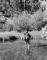 | Charles Lesley crossing Smith's Fork on the way to Kings Peak during the Summer of 1961; Photo by Ken Jessen. | 1961 | Image | uum_map |
| 23 |  | Christmas Meadows | 1960; 1961; 1962; 1963; 1964; 1965; 1966; 1967; 1968; 1969; 1970; 1971; 1972; 1973; 1974; 1975; 1976; 1977; 1978; 1979 | Image/StillImage | uum_map_usa |
| 24 | | Christmas Meadows - Uinta Mountains | 2007-08-24 | Sound | uu_wss |
| 25 |  | Citizens for a Responsible Central Utah Project, correspondence, 1979 | 1979 | Text | wwdl_neh |