| Title | Date | Type | Setname | ||
|---|---|---|---|---|---|
| 1476 |  | "Salt Shakers," Chamber of Commerce, June 11, 1986 | 1981-09-18 | Image | uum_hu |
| 1477 | 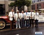 | "Salt Shakers," Chamber of Commerce, June 11, 1986 | 1981-09-18 | Image | uum_hu |
| 1478 |  | "Salt Shakers," Chamber of Commerce, June 11, 1986 | 1981-09-18 | Image | uum_hu |
| 1479 |  | "Sammy the Clown" and wife at "After Hours" event | 1970; 1971; 1972; 1973; 1974; 1975; 1976; 1977; 1978; 1979; 1980; 1981; 1982; 1983; 1984; 1985 | Image/StillImage | uum_map |
| 1480 |  | "San Juan entering Colorado River. Joe and I high looking down on River." | 1951-05-14 | uum_map_rr | |
| 1481 | 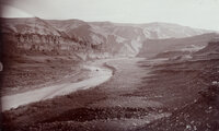 | "San Juan Oil Basin at Raplee's Camp. Lime Ridge Dome in background." | 1894-12 | Image | uum_map_rr |
| 1482 | 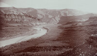 | "San Juan Oil Basin at Raplee's Camp. Lime Ridge Dome in background." | 1894-12 | Image | uum_map_rr |
| 1483 | 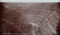 | "San Juan River Canyon at Honaker Trail - 1500 Feet deep." | 1894-12 | Image | uum_map_rr |
| 1484 | 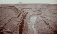 | "San Juan River Canyon at Mendenhall Loop. 1000 feet deep. Alhambra Rock in the distance. Eruptive and 450 feet high, 600 feet long and 90 feet wide." | 1894-12 | Image | uum_map_rr |
| 1485 | 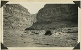 | "Sand waves" just breaking and flattening near Honoker Trail, San Juan canyon, 1921. | 1921 | Image | uum_map |
| 1486 | 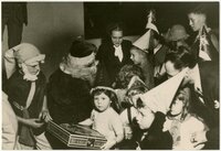 | "Santa" with children | 1925; 1926; 1927; 1928; 1929; 1930; 1931; 1932; 1933; 1934; 1935; 1936; 1937; 1938; 1939; 1940; 1941; 1942; 1943; 1944; 1945; 1946; 1947; 1948; 1949; 1950; 1951; 1952; 1953; 1954; 1955 | Image/StillImage | uum_map |
| 1487 | 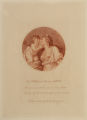 | "Sappho Embracing Love," after Giovanni Battista Cipriani | 1701; 1702; 1703; 1704; 1705; 1706; 1707; 1708; 1709; 1710; 1711; 1712; 1713; 1714; 1715; 1716; 1717; 1718; 1719; 1720; 1721; 1722; 1723; 1724; 1725; 1726; 1727; 1728; 1729; 1730; 1731; 1732; 1733; 1734; 1735; 1736; 1737; 1738; 1739; 1740; 1741; 1742; 1743; 1744; 1745; 1746; 1747; 1748; 1749; 1750; ... | uu_umfa | |
| 1488 | 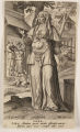 | "Sara," plate no. 2 from the series "The Celebrated Women of the Old Testment" | 1532; 1533; 1534; 1535; 1536; 1537; 1538; 1539; 1540; 1541; 1542; 1543; 1544; 1545; 1546; 1547; 1548; 1549; 1550; 1551; 1552; 1553; 1554; 1555; 1556; 1557; 1558; 1559; 1560; 1561; 1562; 1563; 1564; 1565; 1566; 1567; 1568; 1569; 1570; 1571; 1572; 1573; 1574; 1575; 1576; 1577; 1578; 1579; 1580; 1581 | uu_umfa | |
| 1489 | 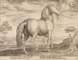 | "Sardonicus," from "Equile" | 1600; 1601; 1602; 1603; 1604; 1605; 1606; 1607; 1608; 1609; 1610; 1611; 1612; 1613; 1614; 1615; 1616; 1617; 1618; 1619; 1620; 1621; 1622; 1623; 1624; 1625; 1626; 1627; 1628; 1629; 1630; 1631; 1632; 1633; 1634; 1635; 1636; 1637; 1638; 1639; 1640; 1641; 1642; 1643; 1644; 1645; 1646; 1647; 1648; 1649; ... | uu_umfa | |
| 1490 |  | "Sat. night at John Hanks. Dinner time" | 1957-05 | Image | uum_map_rr |
| 1491 |  | "Saturday. Five rubber rafts tied together (32 people) in still water - Yampa. [L-R] Enid, Don C, Bob, Lee, __, __, Fred, Larry" | 1957-05 | Image | uum_map_rr |
| 1492 |  | "Scene along Colorado - Ruth, Bill, Melvin." | 1957; 1958; 1959; 1960; 1961; 1962 | uum_map_rr | |
| 1493 | 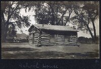 | "School house." Woodside, Utah | 1900; 1901; 1902; 1903; 1904; 1905; 1906; 1907; 1908; 1909; 1910; 1911; 1912; 1913; 1914; 1915; 1916; 1917; 1918; 1919 | uum_map_rr | |
| 1494 | 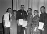 | "Second Miler" Award for outstanding Service | 1968-02-22 | Image | ucl_vep |
| 1495 | 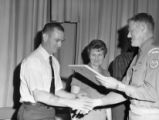 | "Second Miler" Award for outstanding Service | 1968-02-22 | Image | ucl_vep |
| 1496 |  | "Sentinel formation." Contact upper sandstone Section A with banded portion beneath, Section B. Cottonwood Canyon. Kane County, UT. 1922 | 1922 | Image | uum_map |
| 1497 |  | "Sentinel formation." Section B banded strata below heavy sandstone. Kaiparowitz region. Kane County, UT. 1922 | 1922 | Image | uum_map |
| 1498 |  | "Sentinel formation." Section B banded strata below heavy sandstone. Kaiparowitz region. Kane County, UT. 1922 | 1922 | Image | uum_map |
| 1499 |  | "Sentinel Rock at Wahweap [Canyon]. 16 miles more to go." | 1951-05 | uum_map_rr | |
| 1500 | 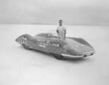 | The "Shadoff Special Streamliner" on the Bonneville Salt Flats Raceway. | 1960; 1961; 1962; 1963; 1964; 1965; 1966; 1967; 1968; 1969 | Image | uum_map |