TO
Filters: Date: "1998"
| Title | Date | Type | Setname | ||
|---|---|---|---|---|---|
| 101 |
 |
[Unidentified mountain scene with foundations?] | 1980; 1981; 1982; 1983; 1984; 1985; 1986; 1987; 1988; 1989; 1990; 1991; 1992; 1993; 1994; 1995; 1996; 1997; 1998; 1999; 2000 | Image | uum_map |
| 102 |
 |
[Unidentified mountain scene with foundations?] | 1980; 1981; 1982; 1983; 1984; 1985; 1986; 1987; 1988; 1989; 1990; 1991; 1992; 1993; 1994; 1995; 1996; 1997; 1998; 1999; 2000 | Image | uum_map |
| 103 |
 |
[Unidentified mountain scene with foundations?] | 1980; 1981; 1982; 1983; 1984; 1985; 1986; 1987; 1988; 1989; 1990; 1991; 1992; 1993; 1994; 1995; 1996; 1997; 1998; 1999; 2000 | Image | uum_map |
| 104 |
 |
[Unidentified mountain scene with foundations?] | 1980; 1981; 1982; 1983; 1984; 1985; 1986; 1987; 1988; 1989; 1990; 1991; 1992; 1993; 1994; 1995; 1996; 1997; 1998; 1999; 2000 | Image | uum_map |
| 105 |
 |
[Unidentified mountain scene with foundations?] | 1980; 1981; 1982; 1983; 1984; 1985; 1986; 1987; 1988; 1989; 1990; 1991; 1992; 1993; 1994; 1995; 1996; 1997; 1998; 1999; 2000 | Image | uum_map |
| 106 |
 |
[Unidentified mountain scene with foundations?] | 1980; 1981; 1982; 1983; 1984; 1985; 1986; 1987; 1988; 1989; 1990; 1991; 1992; 1993; 1994; 1995; 1996; 1997; 1998; 1999; 2000 | Image | uum_map |
| 107 |
 |
[Unidentified mountain scene with foundations?] | 1980; 1981; 1982; 1983; 1984; 1985; 1986; 1987; 1988; 1989; 1990; 1991; 1992; 1993; 1994; 1995; 1996; 1997; 1998; 1999; 2000 | Image | uum_map |
| 108 |
 |
[Unidentified mountain scene with foundations?] | 1980; 1981; 1982; 1983; 1984; 1985; 1986; 1987; 1988; 1989; 1990; 1991; 1992; 1993; 1994; 1995; 1996; 1997; 1998; 1999; 2000 | Image | uum_map |
| 109 |
 |
[Unidentified mountain scene with foundations?] | 1980; 1981; 1982; 1983; 1984; 1985; 1986; 1987; 1988; 1989; 1990; 1991; 1992; 1993; 1994; 1995; 1996; 1997; 1998; 1999; 2000 | Image | uum_map |
| 110 |
 |
[Unidentified mountain scene with foundations?] | 1980; 1981; 1982; 1983; 1984; 1985; 1986; 1987; 1988; 1989; 1990; 1991; 1992; 1993; 1994; 1995; 1996; 1997; 1998; 1999; 2000 | Image | uum_map |
| 111 |
 |
[Unidentified mountain scene with foundations?] | 1980; 1981; 1982; 1983; 1984; 1985; 1986; 1987; 1988; 1989; 1990; 1991; 1992; 1993; 1994; 1995; 1996; 1997; 1998; 1999; 2000 | Image | uum_map |
| 112 |
 |
[Unidentified mountain scene with foundations?] | 1980; 1981; 1982; 1983; 1984; 1985; 1986; 1987; 1988; 1989; 1990; 1991; 1992; 1993; 1994; 1995; 1996; 1997; 1998; 1999; 2000 | Image | uum_map |
| 113 |
 |
[Unidentified mountain scene with foundations?] | 1980; 1981; 1982; 1983; 1984; 1985; 1986; 1987; 1988; 1989; 1990; 1991; 1992; 1993; 1994; 1995; 1996; 1997; 1998; 1999; 2000 | Image | uum_map |
| 114 |
 |
[Unidentified mountain scene with foundations?] | 1980; 1981; 1982; 1983; 1984; 1985; 1986; 1987; 1988; 1989; 1990; 1991; 1992; 1993; 1994; 1995; 1996; 1997; 1998; 1999; 2000 | Image | uum_map |
| 115 |
 |
[Unidentified mountain scene with rocky landscape and vegetation] | 1978; 1979; 1980; 1981; 1982; 1983; 1984; 1985; 1986; 1987; 1988; 1989; 1990; 1991; 1992; 1993; 1994; 1995; 1996; 1997; 1998; 1999; 2000; 2001; 2002 | Image | uum_map |
| 116 |
 |
[Unidentified mountain scene] | 1980; 1981; 1982; 1983; 1984; 1985; 1986; 1987; 1988; 1989; 1990; 1991; 1992; 1993; 1994; 1995; 1996; 1997; 1998; 1999; 2000 | Image | uum_map |
| 117 |
 |
[Unidentified mountain scene] | 1980; 1981; 1982; 1983; 1984; 1985; 1986; 1987; 1988; 1989; 1990; 1991; 1992; 1993; 1994; 1995; 1996; 1997; 1998; 1999; 2000 | Image | uum_map |
| 118 |
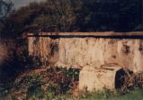 |
[Unidentified ruins.] | 1990; 1991; 1992; 1993; 1994; 1995; 1996; 1997; 1998; 1999 | Image | uum_map |
| 119 |
 |
A blind adaptive projection receiver for CDMA systems | 1998 | Text | ir_uspace |
| 120 |
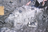 |
A concretionary limestone unit with a number of bones enclosed. | 1950; 1951; 1952; 1953; 1954; 1955; 1956; 1957; 1958; 1959; 1960; 1961; 1962; 1963; 1964; 1965; 1966; 1967; 1968; 1969; 1970; 1971; 1972; 1973; 1974; 1975; 1976; 1977; 1978; 1979; 1980; 1981; 1982; 1983; 1984; 1985; 1986; 1987; 1988; 1989; 1990; 1991; 1992; 1993; 1994; 1995; 1996; 1997; 1998; 1999 | Image | uum_map |
| 121 |
 |
A geologic map of Utah, illustrates the strata conventionally colored differently according to geological age. Notice the San Rafael Swell, the dominant geologic and geographic feature in the eastcentral part of the State. The Cleveland-Lloyd Dinosaur Quarry (C-LDQ) is located on the northern end or nose of the Swell. | 1950; 1951; 1952; 1953; 1954; 1955; 1956; 1957; 1958; 1959; 1960; 1961; 1962; 1963; 1964; 1965; 1966; 1967; 1968; 1969; 1970; 1971; 1972; 1973; 1974; 1975; 1976; 1977; 1978; 1979; 1980; 1981; 1982; 1983; 1984; 1985; 1986; 1987; 1988; 1989; 1990; 1991; 1992; 1993; 1994; 1995; 1996; 1997; 1998; 1999 | Image | uum_map |
| 122 |
 |
A History of Daggett County | 1998 | Text | dha_hpp |
| 123 |
 |
A History of Duchesne County | 1998 | Text | dha_hpp |
| 124 |
 |
A History of Garfield County | 1998 | Text | dha_hpp |
| 125 |
 |
A History of Iron County | 1998 | Text | dha_hpp |
