Home
Browse
Ask Us
Chat
Harmful Language Statement
Log in
Advanced Search
Year
1847
1848
1849
1850
1851
1852
1853
1854
1855
1856
1857
1858
1859
1860
1861
1862
1863
1864
1865
1866
1867
1868
1869
1870
1871
1872
1873
1874
1875
1876
1877
1878
1879
1880
1881
1882
1883
1884
1885
1886
1887
1888
1889
1890
1891
1892
1893
1894
1895
1896
1897
1898
1899
1900
1901
1902
1903
1904
1905
1906
1907
1908
1909
1910
1911
1912
1913
1914
1915
1916
1917
1918
1919
1920
1921
1922
1923
1924
1925
1926
1927
1928
1929
1930
1931
1932
1933
1934
1935
1936
1937
1938
1939
1940
1941
1942
1943
1944
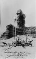
1945
1946
1947
1948
1949
1950
1951
1952
1953
1954
1955
1956
1957
1958
1959
1960
1961
1962
1963
1964
1965
1966
1967
1968
1969
1970
1971
1972
1973
1974
1975
1976
1977
1978
1979
1980
1981
1982
1983
1984
1985
1986
1987
1988
1989
1990
1991
1992
1993
1994
1995
1996
1997
1998
1999
2000
2001
2002
2003
2004
2005
2006
2007
2008
2009
2010
2011
TO
1847
1848
1849
1850
1851
1852
1853
1854
1855
1856
1857
1858
1859
1860
1861
1862
1863
1864
1865
1866
1867
1868
1869
1870
1871
1872
1873
1874
1875
1876
1877
1878
1879
1880
1881
1882
1883
1884
1885
1886
1887
1888
1889
1890
1891
1892
1893
1894
1895
1896
1897
1898
1899
1900
1901
1902
1903
1904
1905
1906
1907
1908
1909
1910
1911
1912
1913
1914
1915
1916
1917
1918
1919
1920
1921
1922
1923
1924
1925
1926
1927
1928
1929
1930
1931
1932
1933
1934
1935
1936
1937
1938
1939
1940
1941
1942
1943
1944
1945
1946
1947
1948
1949
1950
1951
1952
1953
1954
1955
1956
1957
1958
1959
1960
1961
1962
1963
1964
1965
1966
1967
1968
1969
1970
1971
1972
1973
1974
1975
1976
1977
1978
1979
1980
1981
1982
1983
1984
1985
1986
1987
1988
1989
1990
1991
1992
1993
1994
1995
1996
1997
1998
1999
2000
2001
2002
2003
2004
2005
2006
2007
2008
2009
2010
2011
Type
Text
527
Image/StillImage
112
Sound
24
Image
3
Image/MovingImage
1
InteractiveResource
1
More
Format
application/pdf
546
image/jpeg
88
application/zip
2
Collection
Beckwith Photograph Collection
1
College of Law Publications
2
Electronic University Archive
2
Land Use - Transportation Scenario Pl...
99
Shipler Commercial Photographers
1
UAIDA Main Collection
506
UScholar Works
1
Utah Historical Society Oral History ...
23
Water Wise Utah
1
Western Waters Documents
1
Western Waters Electronic Resources
6
More
Filters:
Subject:
"Land use"
101
-
125
of
643
<
1
2
3
4
5
6
7
8
9
10
>
Gallery view
Number of results to display per page
10
25
50
100
200
Sort by Relevance
Sort by Title A-Z
Sort by Title Z-A
Sort by Date Ascending
Sort by Date Descending
Sort by Last Modified Ascending
Sort by Last Modified Descending
Title
Date
Type
Setname
101
Annual Report of the Commissioner of Indian Affairs for the Year 1868
1868
Text
uaida_main
102
Annual Report of the Commissioner of Indian Affairs to the Secretary of the Interior for the Fiscal Year Ending June 30, 1922
1922
Text
uaida_main
103
Annual Report of the Commissioner of Indian Affairs Transmitted with the Message of the President at the Opening of the Second Session of the Thirty-Second Congress, 1852
1852
Text
uaida_main
104
Annual Reports of the Department of the Interior for the Fiscal Year Ending June 30, 1905 (Pt I)
1905
Text
uaida_main
105
Appeal to the People for the Water - Goshute Tribal Chairman
Image/MovingImage
uaida_main
106
Artician Well No.3 Bluff, Utah 100 Gal per minute
Image/StillImage
uaida_main
107
Atlanta Regional Commission (ARC), 2009 Livable Centers Initiative (LCI) Indicators and Benefits Study
2009
Text
uu_lu_tsp
108
Atlanta Regional Transportation Plan, Volume 1
2007-08-31
Text
uu_lu_tsp
109
Baltimore, Vision 2030: Shaping Our Region's Future Together, Final Report
2003-01
Text
uu_lu_tsp
110
Basis of American history, 1500-1900, by Livingston Farrand
Image/StillImage
uaida_main
111
Bill to define exterior boundary of the Ute Indian Reservation in the State of Utah August 16, 1935
Text
uaida_main
112
Birmingham Regional Transportation Corridor Alternatives Analysis
Text
uu_lu_tsp
113
Blue and white truck parked in canyon, river
1970; 1971; 1972; 1973; 1974; 1975; 1976; 1977; 1978; 1979; 1980; 1981; 1982; 1983; 1984; 1985; 1986; 1987; 1988; 1989
Image/StillImage
uaida_main
114
Blueprint Denver Concept
Text
uu_lu_tsp
115
Boundary Change Report
Text
uaida_main
116
Boundary of Shoshone Indian Territory according to Swanton, 1952
1952
Image/StillImage
uaida_main
117
Boundary of Shoshone Indian Territory and Neighboring Tribes
1957
Image/StillImage
uaida_main
118
Boundary of Shoshone Indian Territory, Linguistic Boundaries of Shoshone and Bannock.
1941
Image/StillImage
uaida_main
119
Boundary of Shoshone Indian Territory, showing the locations of the Bannock
1957
Image/StillImage
uaida_main
120
Boundary of Shoshone Indian Territory, showing the locations of the Bannock from 1819 to 1951
1957
Image/StillImage
uaida_main
121
Boundary of Shoshone Indian Territory, showing the locations where the Bannock and Shoshone reported together 1819-1956
1957
Image/StillImage
uaida_main
122
Boundary of Shoshone Indian Territory; Doty Map of 1863 Indian Claims Commission
1957
Image/StillImage
uaida_main
123
Brownsville Transportation and Land Use Study
2009-09
Text
uu_lu_tsp
124
Building Livable Communities: Jefferson Area Eastern Planning Initiative
2000
Text
uu_lu_tsp
125
Central Jersey Transportation Forum Executive Summary
2002-07
Text
uu_lu_tsp
101
-
125
of
643
<
1
2
3
4
5
6
7
8
9
10
>