Home
Browse
Ask Us
Chat
Harmful Language Statement
Log in
Advanced Search
Year
1915
1916
1917
1918
1919
1920
1921
1922
1923
1924
1925
1926
1927
1928
1929
1930
1931
1932
1933
1934
1935
1936
1937
1938
1939
1940
1941
1942
1943
1944
1945
1946
1947
1948
1949
1950
1951
1952
1953
1954
1955
1956
1957
1958
1959
1960
1961
1962
1963
1964
1965
1966
1967
1968
1969
1970
1971
1972
1973
1974
1975
1976
1977
1978
1979
1980
1981
1982
1983
1984
1985
1986
1987
1988
1989
1990
1991
1992
1993
1994
1995
1996
1997
1998
1999
2000
2001
2002
TO
1915
1916
1917
1918
1919
1920
1921
1922
1923
1924
1925
1926
1927
1928
1929
1930
1931
1932
1933
1934
1935
1936
1937
1938
1939
1940
1941
1942
1943
1944
1945
1946
1947
1948
1949
1950
1951
1952
1953
1954
1955
1956
1957
1958
1959
1960
1961
1962
1963
1964
1965
1966
1967
1968
1969
1970
1971
1972
1973
1974
1975
1976
1977
1978
1979
1980
1981
1982
1983
1984
1985
1986
1987
1988
1989
1990
1991
1992
1993
1994
1995
1996
1997
1998
1999
2000
2001
2002
Type
Image
270
Text
2
Format
image/jpeg
269
application/pdf
1
Collection
Art and Art History
169
Beckwith Photograph Collection
8
Classified Photographs
52
Clifton Bray Film Negatives
10
Extractions from the Land: Mining and...
2
Olympic Legacy
5
Peoples of Utah Revisited
2
Photo Archives
8
Shipler Commercial Photographers
6
Ski and Snow Sports Archives
1
Vernal Express Photographs
2
Westminster University Photographs
5
More
Filters:
Subject:
"Maps"
Type:
"Image"
176
-
200
of
270
<
2
3
4
5
6
7
8
9
10
11
>
Gallery view
Number of results to display per page
10
25
50
100
200
Sort by Relevance
Sort by Title A-Z
Sort by Title Z-A
Sort by Date Ascending
Sort by Date Descending
Sort by Last Modified Ascending
Sort by Last Modified Descending
Title
Date
Type
Setname
176
Map: Nigeria in West Africa
Image
uu_aah_art
177
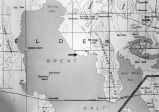
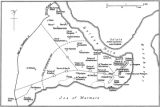
Map: Northen Great Salt Lake Area
Image
uu_aah_art
178
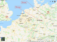
Map: Northern Europe showing Dessau and Weimar, Germany
Image
uu_aah_art
179
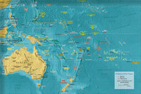
Map: Oceania
Image
uu_aah_art
180
Map: Osogbo
Image
uu_aah_art
181
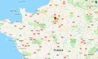
Map: Paris and Versailles, France
Image
uu_aah_art
182
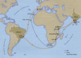
Map: Pedro Álvares Cabral's Voyage to and from India with the discovery of Brazil
Image
uu_aah_art
183
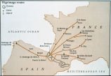
Map: Pilgrimage Routes of France and Spain
Image
uu_aah_art
184
Map: Plan of Constantinople during the Middle Byzantine Period
Image
uu_aah_art
185
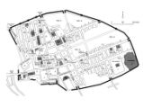
Map: Pompeii
Image
uu_aah_art
186
Map: Pompeii in 79 CE
Image
uu_aah_art
187
Map: Portuguese America in 1750
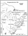
Image
uu_aah_art
188
Map: Portuguese Voyage Routes, 15th and 16th Century CE
Image
uu_aah_art
189
Map: Prehistoric Europe and the Near East
Image
uu_aah_art
190
Map: Principal Sites of Ancient Egypt
Image
uu_aah_art
191
Map: Pueblo Cultures in the American Southwest
Image
uu_aah_art
192
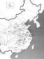
Map: Qin Dynasty, China
Image
uu_aah_art
193
Map: Regional bronze-using cultures during the Shang Dynasty
Image
uu_aah_art
194
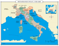
Map: Renaissance Italy 1350 - 1600 CE
Image
uu_aah_art
195
Map: Rio de Janeiro
Image
uu_aah_art
196
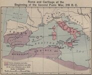
Map: Roman and Carthaginian Territories at the beginning of the Second Punic War, 218 BCE
Image
uu_aah_art
197
Map: Route of Mansa Musa's hajj
Image
uu_aah_art
198
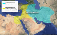
Map: Sasanian Empire showing original territory and extended territory in early 7th century CE
Image
uu_aah_art
199
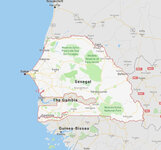
Map: Senegal
Image
uu_aah_art
200
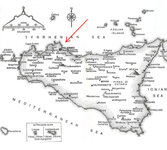
Map: Sicily
Image
uu_aah_art
176
-
200
of
270
<
2
3
4
5
6
7
8
9
10
11
>