Home
Browse
Ask Us
Chat
Harmful Language Statement
Log in
Advanced Search
Year
1920
1921
1922
1923
1924
1925
1926
1927
1928
1929
1930
1931
1932
1933
1934
1935
1936
1937
1938
1939
1940
1941
1942
1943
1944
1945
1946
1947
1948
1949
1950
1951
1952
1953
1954
1955
1956
1957
1958
1959
1960
1961
1962
1963
1964
1965
1966
1967
1968
1969
1970
1971
1972
1973
1974
1975
1976
1977
1978
1979
1980
1981
1982
1983
1984
1985
1986
1987
1988
1989
1990
1991
1992
1993
1994
1995
1996
1997
1998
1999
2000
2001
2002
TO
1920
1921
1922
1923
1924
1925
1926
1927
1928
1929
1930
1931
1932
1933
1934
1935
1936
1937
1938
1939
1940
1941
1942
1943
1944
1945
1946
1947
1948
1949
1950
1951
1952
1953
1954
1955
1956
1957
1958
1959
1960
1961
1962
1963
1964
1965
1966
1967
1968
1969
1970
1971
1972
1973
1974
1975
1976
1977
1978
1979
1980
1981
1982
1983
1984
1985
1986
1987
1988
1989
1990
1991
1992
1993
1994
1995
1996
1997
1998
1999
2000
2001
2002
Type
Image
739
Image/StillImage
102
Text
1
Format
image/jpeg
2,251
application/pdf
1
Collection
Peoples of Utah Revisited
31
Photo Archives
979
Ski and Snow Sports Archives
521
University Archival Photographs (P0305)
19
Utah River Running Photo Archives
702
Filters:
Genre:
"color slides"
701
-
725
of
2,252
<
24
25
26
27
28
29
30
31
32
33
>
Gallery view
Number of results to display per page
10
25
50
100
200
Sort by Relevance
Sort by Title A-Z
Sort by Title Z-A
Sort by Date Ascending
Sort by Date Descending
Sort by Last Modified Ascending
Sort by Last Modified Descending
Title
Date
Type
Setname
701
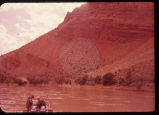
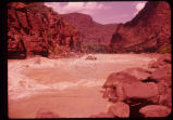
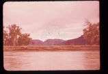
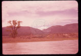
Flaming Gorge. 6-12-55
1955-06-12
Image
uum_map_rr
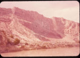
702
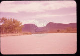
Flaming Gorge. 6-12-55
1955-06-12
Image
uum_map_rr
703
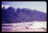
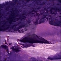
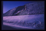
Flooding from snow runoff, mouth of Weber Canyon. Weber River has overtopped its normal channel banks and covers its flood plain. Periodically, structures situated on this flood plain become inundated. Note: ancient Lake Bonneville terraces may be seen on the mountain front.
Image
uum_map
704
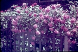
Flowers.
1940; 1941; 1942; 1943; 1944; 1945; 1946; 1947; 1948; 1949; 1950; 1951; 1952; 1953; 1954; 1955; 1956; 1957; 1958; 1959
Image
uum_map
705
Foothill terrain at base of Wasatch Mountains experienced failure illustrated above.
Image
uum_map
706
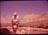
Ford Ranch Wagon at mouth of Split Mountain
1955
uum_map_rr
707
Fossils [1]
1940; 1941; 1942; 1943; 1944; 1945; 1946; 1947; 1948; 1949; 1950; 1951; 1952; 1953; 1954; 1955; 1956; 1957; 1958; 1959
Image
uum_map
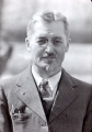
708
Frank A. Beckwith [2]
1920; 1921; 1922; 1923; 1924; 1925; 1926; 1927; 1928; 1929; 1930; 1931; 1932; 1933; 1934; 1935; 1936; 1937; 1938; 1939
Image
uum_map
709
Fred Reese, April 3, 1948
1948-04-03
Image/StillImage
uum_map
710
Fred Reese, April 3, 1948
1948-04-03
Image/StillImage
uum_map
711
Fred Wood and Dr. Robert Parsons at Ashley Falls.
1955
uum_map_rr
712
Fred Wood and Dr. Robert Parsons, Lodore Cabin.
1955
uum_map_rr
713
Fred Wood waiting for rapids inspectors.
1955
uum_map_rr
714
Fred Wood, Al Galloway, Dick, Stern, Clark, and Bruce Lium.
1956
uum_map_rr
715
Fred Wood, Tony Tuttle, Bruce Lium, stopping to inspect 1st rapids, Cataract
1955
uum_map_rr
716
Fred, Don, Chuck, Tony. Ladore [sic] (Lodore) Upper Disaster. 6-15-55
1955-06-15
Image
uum_map_rr
717
Fred, Les, Mrs. Sumner. Afternoon. 6-11-55
1955-06-11
Image
uum_map_rr
718
From 1st lunch stop. B.F. 6-11-55
1955-06-11
Image
uum_map_rr
719
Front end view of the slide (p1274n030).
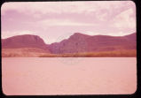
Image
uum_map
720
Gate of Ladore [sic] (Lodore). 6-14-55
1955-06-14
Image
uum_map_rr
721
Gate of Ladore [sic] (Lodore). 6-14-55
1955-06-14
Image
uum_map_rr
722
Gate of Ladore [sic] (Lodore). 6-14-55
1955-06-14
Image
uum_map_rr
723
Gate of Ladore [sic] (Lodore). 6-14-55
1955-06-14
Image
uum_map_rr
724
Gate of Ladore [sic] (Lodore). 6-14-55
1955-06-14
Image
uum_map_rr
725
Gate of Ladore [sic] (Lodore). 6-14-55
1955-06-14
Image
uum_map_rr
701
-
725
of
2,252
<
24
25
26
27
28
29
30
31
32
33
>