|
|
Author | Title | Subject | Date | Publication Type |
| 76 |
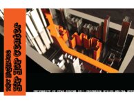 |
Soto, Melina | NYC highline hip hop center | | 2011 | thesis |
| 77 |
 |
Dalness, William Michael | Parunuweap formation in the vicinity of Zion National Park, Utah-Maps | | 1969-06 | thesis |
| 78 |
 |
Dalness, William Michael | Parunuweap formation in the vicinity of Zion National Park, Utah: Georeferenced map files | | 1969-06 | thesis |
| 79 |
 |
Condie, Kent C. | Petrogeneis of the Mineral Range Pluton, Southwestern Utah | Petrology -- Utah -- Beaver County; Millard County; Geology -- Utah -- Beaver County; Millard County; Mineral Range (Utah) | 1960-06 | thesis |
| 80 |
|
Condie, Kent C. | Petrogeneis of the Mineral Range Pluton, Southwestern Utah: Georeferenced map files | Petrology -- Utah -- Beaver County; Millard County; Geology -- Utah -- Beaver County; Millard County; Mineral Range (Utah) | 1960-06 | thesis |
| 81 |
 |
Neff, Thomas Rodney | Petrology and structure of the Little Willow Series, Wasatch Mountains, Utah-Maps | Petrology -- Utah -- Wasatch Mountains | 1962-11 | thesis |
| 82 |
|
Neff, Thomas Rodney | Petrology and structure of the little willow series, Wasatch Mountains, Utah: Georeferenced map files | Petrology -- Utah -- Wasatch Mountains | 1962-11 | thesis |
| 83 |
 |
Vlam, Heber Adolf Arien | Petrology of Lake Bonneville Gravels Salt Lake County, Utah | Petrology; Utah; Salt Lake County; Bonneville; Thesis and dissertation georeferencing project | 1963-05 | thesis |
| 84 |
|
Vlam, Heber Adolf Arien | Petrology of Lake Bonneville Gravels Salt Lake County, Utah: Georeferenced map files | Petrology; Utah; Salt Lake County; Bonneville; Lake | 1963-05 | thesis |
| 85 |
 |
Smith, Hugh Preston | Plate 1 Fence diagram Moenkopi group (Google Earth map overlay KMZ file) | Geology; Utah; Thaynes Formation; Moenkopi group | 1969-06 | thesis |
| 86 |
|
Mann, Daven Craig | Plate 1 Generalized geologic map of the Laramide orogenic sediments of the Wasatch Hinterland (Google Earth map overlay KMZ file) | Sediments (Geology); Utah; Wasatch Hinterland | 1974 | thesis |
| 87 |
|
Chapusa, Frank W. P. | Plate 1 Geologic map of Stansbury Island, Tooele County, Utah (Google Earth map overlay KMZ file) | Geology; Utah; Stansbury Island | 1969-06 | thesis |
| 88 |
|
Cohenour, Robert E. | Plate 1 Geologic map of the Sheeprock Mountains area, Utah (Google Earth map overlay KMZ file) | Geology -- Utah -- Sheeprock Mountains; Geology -- Utah -- Tooele County; Geology -- Utah -- Juab County; Thesis and dissertation georeferencing project | 1957-08 | thesis |
| 89 |
 |
Rodriguez, Enrique Levy | Plate 1: Geologic map and vertical cross section of the Sulphurdale sulphur deposits, Beaver and Millard Counties, Utah | | 1960-08 | thesis |
| 90 |
|
Rodriguez, Enrique Levy | Plate 1: Geologic map and vertical cross section of the Sulphurdale sulphur deposits, Beaver and Millard Counties, Utah (Google Earth map overlay KMZ file) | Geology, Economic -- Utah -- Sulphurdale; Mines and mineral resources -- Utah -- Sulphurdale; Sulphur mines and mining -- Utah -- Sulphurdale; Thesis and dissertation georeferencing project | 1960-08 | thesis |
| 91 |
 |
Brox, George Stanley | Plate 1: Geologic map of Northern Bryce Canyon National Park | | 1961-06 | thesis |
| 92 |
 |
Neff, Thomas Rodney | Plate 1: Geologic map of the Little Willow Series, Wasatch Mountains, Utah | | 1962-11 | thesis |
| 93 |
 |
Blakey, Ronald Clyde | Plate 1: Geologic map of the Paria NW quadrangle, Kane County, Utah | | 1970-08 | thesis |
| 94 |
|
Baker, Walker Holcombe | Plate 1: Geologic map of the Southern Grouse Creek Mountains, Box Elder County, Utah (Google Earth map overlay KMZ file) | Geology--Utah; Thesis and dissertation georeferencing project | 1959-06 | thesis |
| 95 |
 |
Sadeghi, Ali Reza | Plate 1: Geologic map of the Willard Peak area, North-Central Wasatch Mountains, Utah | | 1972-12 | thesis |
| 96 |
|
Sadeghi, Ali Reza | Plate 1: Geologic map of the Willard Peak area, North-Central Wasatch Mountains, Utah (Google Earth map overlay KMZ file) | Geology -- Structural -- Utah -- Willard Peak area; Thesis and dissertation georeferencing project | 1972-12 | thesis |
| 97 |
|
Blue, Donald McCoy | Plate 1: Lucin mining district and vicinity, Northern Pilot Range, Box Elder County, Utah - Elko County, Nevada (Google Earth map overlay KMZ file) | Thesis and dissertation georeferencing project | 1960-08 | thesis |
| 98 |
 |
Schaeffer, Frederick Ernst Jr. | Plate 1B: Geologic map of the Central and Southern Silver Island Mountains, Box Elder and Tooele Counties, Utah, and Elko County, Nevada | | 1961-06 | thesis |
| 99 |
|
Schaeffer, Jr. Frederick Ernst | Plate 1B: Geologic map of the Central and Southern Silver Island Mountains, Box Elder and Tooele Counties, Utah, and Elko County, Nevada (Google Earth map overlay KMZ file) | Thesis and dissertation georeferencing project | 1961-06 | thesis |
| 100 |
 |
Schaeffer, Frederick Ernst Jr. | Plate 1C: Geologic cross sections of the Central and Southern Silver Island Mountains, Box Elder and Tooele Counties, Utah and Elko County, Nevada | | 1961-06 | thesis |