| Title | Date | Type | Setname | ||
|---|---|---|---|---|---|
| 126 |
 |
Boundary of Shoshone Indian Territory, showing the locations where the Bannock and Shoshone reported together 1819-1956 | 1957 | Image/StillImage | uaida_main |
| 127 |
 |
Boundary of Shoshone Indian Territory; Doty Map of 1863 Indian Claims Commission | 1957 | Image/StillImage | uaida_main |
| 128 |
 |
Bowman, James-Gravestone P.1 | 1935 | Image | dha_cp |
| 129 |
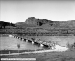 |
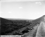
Bridge at Perrines | 1912-06-04 | Image | dha_scp |
| 130 |
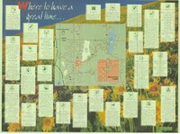 |
Bridgerland, Cache County, Brochure | Image/StillImage | ucl_maps | |
| 131 |
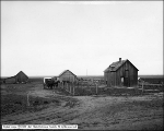 |
Brown Residence near Aberdeen, Idaho | 1911-05-17 | Image | dha_scp |
| 132 |
 |
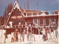
Brundage Mountain Resort [01] | 1930; 1931; 1932; 1933; 1934; 1935; 1936; 1937; 1938; 1939; 1940; 1941; 1942; 1943; 1944; 1945; 1946; 1947; 1948; 1949; 1950; 1951; 1952; 1953; 1954; 1955; 1956; 1957; 1958; 1959 | Image/StillImage | uum_map_usa |
| 133 |
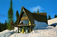 |
Brundage Mountain Resort [02] | 1950; 1951; 1952; 1953; 1954; 1955; 1956; 1957; 1958; 1959; 1960; 1961; 1962; 1963; 1964; 1965; 1966; 1967; 1968; 1969 | Image/StillImage | uum_map_usa |
| 134 |
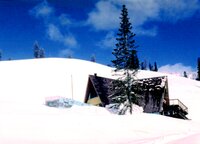 |
Brundage Mountain Resort [03] | 1950; 1951; 1952; 1953; 1954; 1955; 1956; 1957; 1958; 1959; 1960; 1961; 1962; 1963; 1964; 1965; 1966; 1967; 1968; 1969 | Image/StillImage | uum_map_usa |
| 135 |
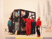 |
Brundage Mountain Resort [04] | 1950; 1951; 1952; 1953; 1954; 1955; 1956; 1957; 1958; 1959; 1960; 1961; 1962; 1963; 1964; 1965; 1966; 1967; 1968; 1969 | Image/StillImage | uum_map_usa |
| 136 |
 |
Brundage Mountain Resort [05] | 1950; 1951; 1952; 1953; 1954; 1955; 1956; 1957; 1958; 1959; 1960; 1961; 1962; 1963; 1964; 1965; 1966; 1967; 1968; 1969 | Image/StillImage | uum_map_usa |
| 137 |
 |
Brundage Mountain Resort [06] | 1960; 1961; 1962; 1963; 1964; 1965; 1966; 1967; 1968; 1969; 1970; 1971; 1972; 1973; 1974; 1975; 1976; 1977; 1978; 1979 | Image/StillImage | uum_map_usa |
| 138 |
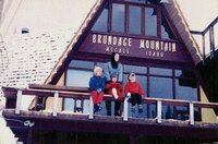 |
Brundage Mountain, McCall, Idaho | 1950; 1951; 1952; 1953; 1954; 1955; 1956; 1957; 1958; 1959; 1960; 1961; 1962; 1963; 1964; 1965; 1966; 1967; 1968; 1969 | Image/StillImage | uum_map_usa |
| 139 |
 |
Brundage Mountain, McCall, Idaho | 1950; 1951; 1952; 1953; 1954; 1955; 1956; 1957; 1958; 1959; 1960; 1961; 1962; 1963; 1964; 1965; 1966; 1967; 1968; 1969 | Image/StillImage | uum_map_usa |
| 140 |
 |
California Trail--Scenery-City of Rocks P.2 | Image | dha_cp | |
| 141 |
 |
California Trail--Scenery-Twin Sisters P.1 | Image | dha_cp | |
| 142 |
 |
Campers in Bear Lake at Fish Haven | 1912-08-09 | Image | dha_scp |
| 143 |
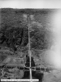 |
Cedar Creek Dam Site | 1912-06-06 | Image | dha_scp |
| 144 |
 |
Cedar Creek Dam Site | 1912-06-06 | Image | dha_scp |
| 145 |
 |
Cedar Creek Dam Site | 1912-06-06 | Image | dha_scp |
| 146 |
 |
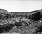
Cedar Creek Reservoir Site | 1912-06-06 | Image | dha_scp |
| 147 |
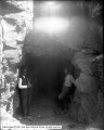 |
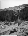
Cedar Creek, Mouth of Tunnel | 1912-06-06 | Image | dha_scp |
| 148 |
 |
Celebrations. Indian man on horse | Image/StillImage | uaida_main | |
| 149 |
 |
Celebrations. Indian woman mounted on horse | Image/StillImage | uaida_main | |
| 150 |
 |
Celebrations. Indian woman on horse, carriages behind her | Image/StillImage | uaida_main |