|
|
Title | Date | Type | Setname |
| 751 |
 | Aerial view of University of Utah Special Events Center and Health, Physical Education, and Recreation buildings | 1950; 1951; 1952; 1953; 1954; 1955; 1956; 1957; 1958; 1959; 1960; 1961; 1962; 1963; 1964; 1965; 1966; 1967; 1968; 1969; 1970; 1971; 1972; 1973 | Image/StillImage | uum_map |
| 752 |
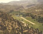 | AERIAL VIEW OF WILCOX RANCH WITH AIRSTRIP | 1950; 1951; 1952; 1953; 1954; 1955; 1956; 1957; 1958; 1959; 1960; 1961; 1962; 1963; 1964; 1965; 1966; 1967; 1968; 1969; 1970; 1971; 1972; 1973; 1974; 1975; 1976; 1977; 1978; 1979 | Image | uum_map |
| 753 |
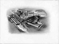 | Aerial views of factories | 1940; 1941; 1942; 1943; 1944; 1945; 1946; 1947; 1948; 1949; 1950; 1951; 1952; 1953; 1954; 1955; 1956; 1957; 1958; 1959; 1960; 1961; 1962; 1963; 1964; 1965; 1966; 1967; 1968; 1969; 1970 | Image | uum_map |
| 754 |
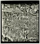 | Aerial views of Ogden [01] | 1940; 1941; 1942; 1943; 1944; 1945; 1946; 1947; 1948; 1949; 1950; 1951; 1952; 1953; 1954; 1955; 1956; 1957; 1958; 1959; 1960; 1961; 1962; 1963; 1964; 1965; 1966; 1967; 1968; 1969; 1970 | Image/StillImage | uum_map |
| 755 |
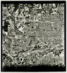 | Aerial views of Ogden [02] | 1940; 1941; 1942; 1943; 1944; 1945; 1946; 1947; 1948; 1949; 1950; 1951; 1952; 1953; 1954; 1955; 1956; 1957; 1958; 1959; 1960; 1961; 1962; 1963; 1964; 1965; 1966; 1967; 1968; 1969; 1970 | Image/StillImage | uum_map |
| 756 |
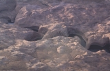
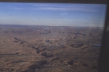
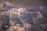
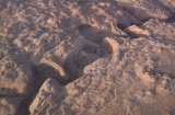
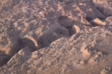
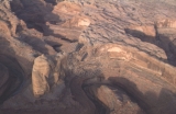
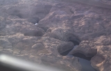
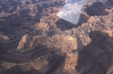
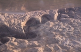
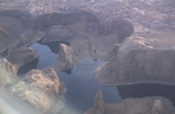
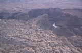
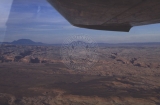 | Aerial views of the Escalante River canyons, post-Lake Powell | 1963; 1964; 1965; 1966; 1967; 1968 | Image | uum_map_rr |
| 757 |
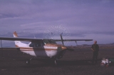 | Aerial views of the Escalante River canyons, post-Lake Powell - Cessna 210, David Thompson. | 1963; 1964; 1965; 1966; 1967; 1968 | Image | uum_map_rr |
| 758 |
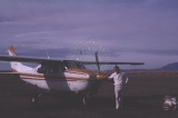 | Aerial views of the Escalante River canyons, post-Lake Powell - Cessna 210, Gregg Dimmitt | 1963; 1964; 1965; 1966; 1967; 1968 | Image | uum_map_rr |
| 759 |
 | Aerial views of the Escalante River canyons, post-Lake Powell - Lagorce Arch. | 1963; 1964; 1965; 1966; 1967; 1968 | Image | uum_map_rr |
| 760 |
 | Aerial views of the Escalante River canyons, post-Lake Powell - looking toward Page, AZ | 1963; 1964; 1965; 1966; 1967; 1968 | Image | uum_map_rr |
| 761 |
 | Aerial views of the Escalante River canyons, post-Lake Powell - Stevens Arch. | 1963; 1964; 1965; 1966; 1967; 1968 | Image | uum_map_rr |
| 762 |
 | Aerial views of the Escalante River canyons, post-Lake Powell - Stevens Arch. | 1963; 1964; 1965; 1966; 1967; 1968 | Image | uum_map_rr |
| 763 |
 | Aerial views of the Escalante River canyons, post-Lake Powell - Stevens Arch. | 1963; 1964; 1965; 1966; 1967; 1968 | Image | uum_map_rr |
| 764 |
 | Aerial views of the Escalante River canyons, post-Lake Powell - Stevens Arch. | 1963; 1964; 1965; 1966; 1967; 1968 | Image | uum_map_rr |
| 765 |
 | Aerial views of the Escalante River canyons, post-Lake Powell - Stevens Arch. | 1963; 1964; 1965; 1966; 1967; 1968 | Image | uum_map_rr |
| 766 |
 | Aerial views of the Escalante River canyons, post-Lake Powell - Stevens Arch. | 1963; 1964; 1965; 1966; 1967; 1968 | Image | uum_map_rr |
| 767 |
 | Aerial views of the Escalante River canyons, post-Lake Powell. | 1963; 1964; 1965; 1966; 1967; 1968 | Image | uum_map_rr |
| 768 |
 | Aerial views of the Escalante River canyons, post-Lake Powell. | 1963; 1964; 1965; 1966; 1967; 1968 | Image | uum_map_rr |
| 769 |
 | Aerial views of the Escalante River canyons, post-Lake Powell. | 1963; 1964; 1965; 1966; 1967; 1968 | Image | uum_map_rr |
| 770 |
 | Aerial views of the Escalante River canyons, post-Lake Powell. | 1963; 1964; 1965; 1966; 1967; 1968 | Image | uum_map_rr |
| 771 |
 | Aerial views of the Escalante River canyons, post-Lake Powell. | 1963; 1964; 1965; 1966; 1967; 1968 | Image | uum_map_rr |
| 772 |
 | Aerial views of the Escalante River canyons, post-Lake Powell. | 1963; 1964; 1965; 1966; 1967; 1968 | Image | uum_map_rr |
| 773 |
 | Aerial views of the Escalante River canyons, post-Lake Powell. - David Thompson, 7?mile canyon | 1963; 1964; 1965; 1966; 1967; 1968 | Image | uum_map_rr |
| 774 |
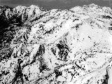 | Aerial, east side of Twin Peaks, with Mineral Basin and Marry Ellen Gulch | 1937; 1938; 1939; 1940; 1941; 1942; 1943; 1944; 1945; 1946; 1947; 1948; 1949; 1950; 1951; 1952; 1953; 1954; 1955; 1956; 1957; 1958; 1959; 1960; 1961; 1962; 1963; 1964; 1965; 1966; 1967; 1968; 1969 | | uum_map_usa |
| 775 |
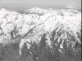 | Aerial, Twin Peaks | 1937; 1938; 1939; 1940; 1941; 1942; 1943; 1944; 1945; 1946; 1947; 1948; 1949; 1950; 1951; 1952; 1953; 1954; 1955; 1956; 1957; 1958; 1959; 1960; 1961; 1962; 1963; 1964; 1965; 1966; 1967; 1968; 1969 | | uum_map_usa |