Over 70,000 photos covering a variety of topics from Marriott Library Special Collections
TO
Filters: Date: "1898" Collection: "uum_map"
| Title | Collection Number And Name | Photo Number | ||
|---|---|---|---|---|
| 101 |
 |
James C. Liddle, Merchant; James N. Louder, editor and merchant; Scipio A. Kenner, editor; The men who mined the ore for the last mill run, November 1903, Silver Reef, Utah | P0008 Mark A. Pendleton Photograph Collection | P0008n01_02_003 |
| 102 |
 |
Harrisburg Mining District [map] | P0008 Mark A. Pendleton Photograph Collection | P0008n01_04_035 |
| 103 |
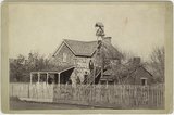 |
Toquerville mission chapel | P0008 Mark A. Pendleton Photograph Collection | P0008n01_07_068 |
| 104 |
 |
Miss Frances R. Burke, missionary in Toquerville | P0008 Mark A. Pendleton Photograph Collection | P0008n01_07_069 |
| 105 |
 |
Probably an interior view of the old Washington cotton mill ca. 1900 | P0008 Mark A. Pendleton Photograph Collection | P0008n01_09_081 |
| 106 |
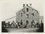 |
Washington cotton & woolen mill: copy of a photograph taken about 1900 by H. L. Reid | P0008 Mark A. Pendleton Photograph Collection | P0008n01_09_082 |
| 107 |
 |
Washington factory about 1901 | P0008 Mark A. Pendleton Photograph Collection | P0008n01_09_083 |
| 108 |
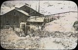 |
Brundage Mill at Barbee-Walker Mine at Silver Reef, circa 1885 | P0008 Mark A. Pendleton Photograph Collection | P0008n01_11_107 |
| 109 |
 |
Illustration of a miner and his pack mule | P0008 Mark A. Pendleton Photograph Collection | P0008n01_11_138 |
| 110 |
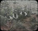 |
Three men, identity unknown | P0008 Mark A. Pendleton Photograph Collection | P0008n01_11_139 |
| 111 |
 |
Desert village | P0008 Mark A. Pendleton Photograph Collection | P0008n01_11_140 |
| 112 |
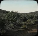 |
Desert vegetation probably in Washington County, Utah | P0008 Mark A. Pendleton Photograph Collection | P0008n01_11_141 |
| 113 |
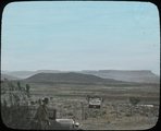 |
View of mesas from highway | P0008 Mark A. Pendleton Photograph Collection | P0008n01_11_142 |
| 114 |
 |
Flat-lying Tertiary on tilted Mesa-verde Choiskai Mesa; looking north at Choiskai Peak, NM. Shaler, photo | P0013 Herbert E. Gregory Photograph Collection | P0013n05_08_0681 |
| 115 |
 |
Bennett Peak, NM, looking northwest. Shaler, photo | P0013 Herbert E. Gregory Photograph Collection | P0013n05_11_0687 |
| 116 |
 |
Lava remnants and Mesaverde sandstone-capped mesas, looking north 35° west from 3 mi. north of mouth of Cottonwood Arroyo, NM. Shiprock farthest peaks to left. Shaler, photo | P0013 Herbert E. Gregory Photograph Collection | P0013n05_12_0688 |
| 117 |
 |
Monchiquite dike, looking south from Needle Peak, NM. Shaler, photo | P0013 Herbert E. Gregory Photograph Collection | P0013n05_12_0689 |
| 118 |
 |
Needle Peak (Shiprock) looking north 68° west from a distance of 1 1/2 mi. south of Shiprock, NM. Shaler, photo | P0013 Herbert E. Gregory Photograph Collection | P0013n05_13_0690 |
| 119 |
 |
Ford Peak, NM, looking northeast. Shaler, photo | P0013 Herbert E. Gregory Photograph Collection | P0013n05_13_0691 |
| 120 |
 |
Lava lying on Tertiary, Cottonwood Pass, Choiskai Mesa, east of Manning's store, NM. Shaler, photo | P0013 Herbert E. Gregory Photograph Collection | P0013n05_14_0692 |
| 121 |
 |
Eliza Partridge Warren Kingsbury (4th wife) | P0029 Joseph Kingsbury Photograph Collection | P0029n01_01_01 |
| 122 |
 |
Joseph Corrodon Kingsbury | P0029 Joseph Kingsbury Photograph Collection | P0029n01_01_03 |
| 123 |
 |
F. Kesler | P0029 Joseph Kingsbury Photograph Collection | P0029n01_02_04 |
| 124 |
 |
Weiler | P0029 Joseph Kingsbury Photograph Collection | P0029n01_02_09 |
| 125 |
 |
N. Davis | P0029 Joseph Kingsbury Photograph Collection | P0029n01_02_24 |
