Home
Browse
Ask Us
Chat
Harmful Language Statement
Log in
Advanced Search
Year
1849
1850
1851
1852
1853
1854
1855
1856
1857
1858
1859
1860
1861
1862
1863
1864
1865
1866
1867
1868
1869
1870
1871
1872
1873
1874
1875
1876
1877
1878
1879
1880
1881
1882
1883
1884
1885
1886
1887
1888
1889
1890
1891
1892
1893
1894
1895
1896
1897
1898
1899
1900
1901
1902
1903
1904
1905
1906
1907
1908
1909
1910
1911
1912
1913
1914
1915
1916
1917
1918
1919
1920
1921
1922
1923
1924
1925
1926
1927
1928
1929
1930
1931
1932
1933
1934
1935
1936
1937
1938
1939
1940
1941
1942
1943
1944
1945
1946
1947
1948
1949
1950
1951
1952
1953
1954
1955
1956
1957
1958
1959
1960
1961
1962
1963
1964
1965
1966
1967
1968
1969
1970
1971
1972
1973
1974
1975
1976
1977
1978
1979
1980
1981
1982
1983
1984
1985
1986
1987
1988
1989
1990
1991
1992
1993
1994
1995
1996
1997
1998
1999
2000
2001
2002
2003
2004
2005
2006
2007
2008
2009
2010
2011
2012
2013
2014
2015
2016
2017
2018
2019
TO
1849
1850
1851
1852
1853
1854
1855
1856
1857
1858
1859
1860
1861
1862
1863
1864
1865
1866
1867
1868
1869
1870
1871
1872
1873
1874
1875
1876
1877
1878
1879
1880
1881
1882
1883
1884
1885
1886
1887
1888
1889
1890
1891
1892
1893
1894
1895
1896
1897
1898
1899
1900
1901
1902
1903
1904
1905
1906
1907
1908
1909
1910
1911
1912
1913
1914
1915
1916
1917
1918
1919
1920
1921
1922
1923
1924
1925
1926
1927
1928
1929
1930
1931
1932
1933
1934
1935
1936
1937
1938
1939
1940
1941
1942
1943
1944
1945
1946
1947
1948
1949
1950
1951
1952
1953
1954
1955
1956
1957
1958
1959
1960
1961
1962
1963
1964
1965
1966
1967
1968
1969
1970
1971
1972
1973
1974
1975
1976
1977
1978
1979
1980
1981
1982
1983
1984
1985
1986
1987
1988
1989
1990
1991
1992
1993
1994
1995
1996
1997
1998
1999
2000
2001
2002
2003
2004
2005
2006
2007
2008
2009
2010
2011
2012
2013
2014
2015
2016
2017
2018
2019
Type
Image
270
Image/StillImage
181
Text
84
Format
image/jpeg
413
application/pdf
114
application/xml
3
application/zip
3
Collection
Art and Art History
169
Aziz Suryal Atiya papers
5
Beckwith Photograph Collection
8
Classified Photographs
62
Clifton Bray Film Negatives
10
Extractions from the Land: Mining and...
2
Marriott Library Digital Stacks
1
Olympic Legacy
5
Peoples of Utah Revisited
6
Photo Archives
12
Salt Lake Tribune Negative Collection
14
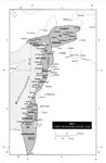
Shipler Collection Negative Preservat...
18
Shipler Commercial Photographers
6
Ski and Snow Sports Archives
1
Theses & Dissertations
1
UAIDA Main Collection
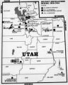
201
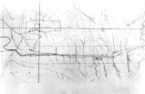
Vernal Express Photographs
2
Western Waters Electronic Resources
4
Westminster College Finding Aids (EAD)
3
Westminster College Photographs
5
More
Filters:
Subject:
"Maps"
376
-
400
of
535
<
11
12
13
14
15
16
17
18
19
20
>
Gallery view
Number of results to display per page
10
25
50
100
200
Sort by Relevance
Sort by Title A-Z
Sort by Title Z-A
Sort by Date Ascending
Sort by Date Descending
Sort by Last Modified Ascending
Sort by Last Modified Descending
Title
Date
Type
Setname
376
Map: The Crusader States 1118 CE
Image
uu_aah_art
377
Map: The Empire on the Eve of the French Revolution, 1789
Image
uu_aah_art
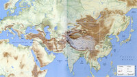
378
Map: The greatest extent of Napoleon I's First Empire, 1812
Image
uu_aah_art
379
Map: The Greek World
Image
uu_aah_art
380
Map: The Han Empire and the Silk Road
Image
uu_aah_art
381
Map: The Hohenstaufen Empire under Frederick II
Image
uu_aah_art
382
Map: The Mali Empire
Image
uu_aah_art
383
Map: The Rise of Constantine, 306 - 324 CE
Image
uu_aah_art
384
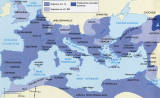
Map: The Roman Empire
Image
uu_aah_art
385
Map: The Roman Empire in the Second Century CE
Image
uu_aah_art
386
Map: The Silk Road
Image
uu_aah_art
387
Map: The Silk Roads, ca. 200-900 CE
Image
uu_aah_art
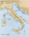
388
Map: Topographical Map of Italy
Image
uu_aah_art
389
Map: Trans Saharan Trade and Sea Routes
Image
uu_aah_art
390
Map: Tunisia
Image
uu_aah_art
391
Map: Umayyad Emirate, c. 850 CE, Umayyad Caliphate, c. 950 CE
Image
uu_aah_art
392
Mapping of the Terr. West of the Rocky Mts. P.1
Image
dha_cp
393
Mapping the Trans-Mississippi West P.1
Image
dha_cp
394
Mapping the world in medieval and early modern Western and Arabic Travel Accounts
2017
Text
ir_etd
395
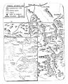
Meeker Incident
Image/StillImage
uaida_main
396
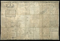
Mercator world map of 1569 (Nova et Aucta Orbis Terrae Descriptio ad Usum Navigantium Emendate Accommodata)
Image
uu_aah_art
397
Mercator's Map of the World
Image
uu_aah_art
398
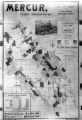
Mercur, Utah P.1
Image
dha_cp
399
Military Installations, Utah P.1
Image
dha_cp
400
Mining Map of Big & Little Cottonwood P.1
Image
dha_cp
376
-
400
of
535
<
11
12
13
14
15
16
17
18
19
20
>