Home
Browse
Ask Us
Chat
Harmful Language Statement
Log in
Advanced Search
Year
1872
1873
1874
1875
1876
1877
1878
1879
1880
1881
1882
1883
1884
1885
1886
1887
1888
1889
1890
1891
1892
1893
1894
1895
1896
1897
1898
1899
1900
1901
1902
1903
1904
1905
1906
1907
1908
1909
1910
1911
1912
1913
1914
1915
1916
1917
1918
1919
1920
1921
1922
1923
1924
1925
1926
1927
1928
1929
1930
1931
1932
1933
1934
1935
1936
1937
1938
1939
1940
1941
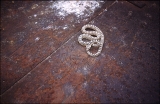
1942
1943
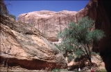
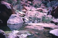
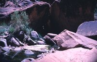
1944
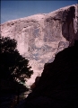
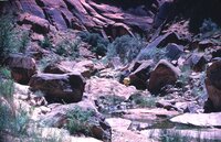
1945
1946
1947
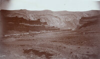
1948
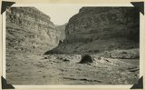
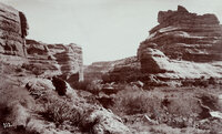
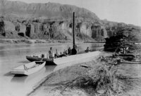
1949
1950
1951
1952
1953
1954
1955
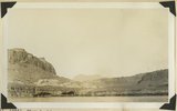
1956
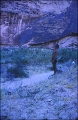
1957
1958
1959
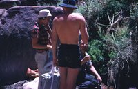
1960
1961
1962
1963
1964
1965
1966
1967
1968
1969
1970
1971
1972
1973
1974
1975
1976
1977
1978
1979
1980
1981
1982
1983
1984
1985
1986
1987
1988
1989
1990
1991
1992
1993
1994
1995
1996
1997
1998
1999
2000
2001
2002
2003
2004
2005
2006
2007
2008
2009
2010
TO
1872
1873
1874
1875
1876
1877
1878
1879
1880
1881
1882
1883
1884
1885
1886
1887
1888
1889
1890
1891
1892
1893
1894
1895
1896
1897
1898
1899
1900
1901
1902
1903
1904
1905
1906
1907
1908
1909
1910
1911
1912
1913
1914
1915
1916
1917
1918
1919
1920
1921
1922
1923
1924
1925
1926
1927
1928
1929
1930
1931
1932
1933
1934
1935
1936
1937
1938
1939
1940
1941
1942
1943
1944
1945
1946
1947
1948
1949
1950
1951
1952
1953
1954
1955
1956
1957
1958
1959
1960
1961
1962
1963
1964
1965
1966
1967
1968
1969
1970
1971
1972
1973
1974
1975
1976
1977
1978
1979
1980
1981
1982
1983
1984
1985
1986
1987
1988
1989
1990
1991
1992
1993
1994
1995
1996
1997
1998
1999
2000
2001
2002
2003
2004
2005
2006
2007
2008
2009
2010
Type
Image/StillImage
2,013
Image
1,955
Text
286
Image/MovingImage
5
Sound
1
Format
image/jpeg
3,836
application/pdf
727
video/mp4
5
audio/mpeg
1
Collection
Beckwith Photograph Collection
2
Home Movie Collection
5
Photo Archives
1,412
Ski and Snow Sports Archives
43
UAIDA Main Collection
948
Utah Humanities Research Foundation
25
Utah Quilt Heritage Records
2
Utah River Running Photo Archives
2,136
Western Soundscape
1
Western Waters NEH
1
More
Filters:
Spatial Coverage:
"San Juan County (Utah)"
76
-
100
of
4,575
<
1
2
3
4
5
6
7
8
9
10
>
Gallery view
Number of results to display per page
10
25
50
100
200
Sort by Relevance
Sort by Title A-Z
Sort by Title Z-A
Sort by Date Ascending
Sort by Date Descending
Sort by Last Modified Ascending
Sort by Last Modified Descending
Title
Date
Type
Setname
76
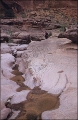
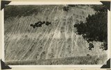
"Sand waves" just breaking and flattening near Honoker Trail, San Juan canyon, 1921.
1921
Image
uum_map
77
"Smokey the Bear."
1957; 1958; 1959; 1960; 1961; 1962
uum_map_rr
78
"Snake in dump car at Gerhart mine."
1951-05-12
uum_map_rr
79
"Some rocks, Bluff, Utah. Blue lime forms the background while deep shaded parts are red lime ot trias rocks. View from San Juan Oil Field."
1890; 1891; 1892; 1893; 1894; 1895; 1896; 1897; 1898; 1899; 1900
Image
uum_map_rr
80
"Stepping Stone, Mini Bath Tubs down Rainbow Creek."
1951-05-15
uum_map_rr
81
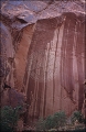
"Tapestry Wall in Mystery Canyon."
1951-05-14
uum_map_rr
82
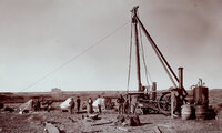
"The first Goodridge Oil Well. Oil struck March 4, 1908."
1908
Image
uum_map_rr
83
"The Twins," LaPlata strata, Bluff, Utah, 1910 (Photo G134)
1910
Image
uum_map
84
"The Washboard," head of North Canyon, looking west. Erosion caused by sheep grazing. Abajo Mountains. Utah, San Juan, 1915.
1915
Image
uum_map
85
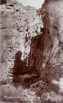
"Trails to Honaker's Camp, San Juan Canyon, Utah."
1894
Image
uum_map_rr
86
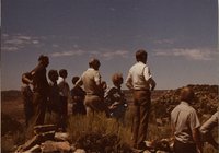
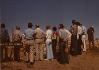
"Vee Carlisle at Edge of the Cedars, Blanding"
1971; 1972; 1973; 1974; 1975; 1976; 1977; 1978; 1979; 1980; 1981; 1982; 1983; 1984; 1985; 1986
uum_map
87
"Vee Carlisle at Edge of the Cedars, Blanding"
1971; 1972; 1973; 1974; 1975; 1976; 1977; 1978; 1979; 1980; 1981; 1982; 1983; 1984; 1985; 1986
uum_map
88
"Vee Carlisle at Edge of the Cedars, Blanding"
1971; 1972; 1973; 1974; 1975; 1976; 1977; 1978; 1979; 1980; 1981; 1982; 1983; 1984; 1985; 1986
uum_map
89
"Vee Carlisle at Edge of the Cedars, Blanding"
1971; 1972; 1973; 1974; 1975; 1976; 1977; 1978; 1979; 1980; 1981; 1982; 1983; 1984; 1985; 1986
uum_map
90
"Vee Carlisle at Edge of the Cedars, Blanding"
1971; 1972; 1973; 1974; 1975; 1976; 1977; 1978; 1979; 1980; 1981; 1982; 1983; 1984; 1985; 1986
uum_map
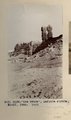
91
"Victoria Camp, Grand Gulch, San Juan County, Utah. Queen Vic's profiled is seen on top of cliff, right side."
1890; 1891; 1892; 1893; 1894; 1895; 1896; 1897; 1898; 1899; 1900
Image
uum_map_rr
92
"View looking across Colorado River at mouth of White canyon. Trees mark location of the abandoned settlement of Hite. "Frey" (Organ Rock) strata at rives edge: Navajo sandstone at left top Henry Mountains in middle distance, San Juan County, Utah, 1932."
1932
Image
uum_map
93
"Walking out Moki canyon to boats."
1951-05
uum_map_rr
94
"Walking up Moki (Moqui) Canyon, mile 145."
1951-05
uum_map_rr
95
"Williams-Cahn placer mining dredge, mouth of Copper Canyon, San Juan River, 1894."
1894
Image
uum_map_rr
96
"Wyman, Joe and Frank descending."
1951-05-15
uum_map_rr
97
"Y" Canyon, San Juan River, people and scenery, 1962
1962-06
Image/StillImage
uum_map_rr
98
"Y" Canyon, San Juan River, people and scenery, 1962 [01]
1962
Image/StillImage
uum_map_rr
99
"Y" Canyon, San Juan River, people and scenery, 1962 [02]
1962
Image/StillImage
uum_map_rr
100
"Y" Canyon, San Juan River, people and scenery, 1962 [03]
1962
Image/StillImage
uum_map_rr
76
-
100
of
4,575
<
1
2
3
4
5
6
7
8
9
10
>