| Title |
Selective Reconnaissance Survey Lake Bottom Area (Geneva Road) Utah County, Utah |
| Grouping |
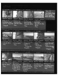
479 |
| State |
Utah |
| County |
Utah County |
| City |
Provo, Orem, Vineyard, Lindon, Pleasant Grove |
| Scanning Institution |
Utah Correctional Institute |
| Collection |
Utah Historic Buildings Reports Collection |
| Date |
2003 |
| UTSHPO Collection |
Utah County RLS |
| Spatial Coverage |
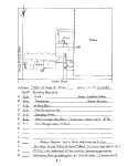
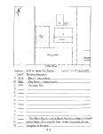
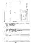
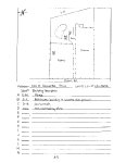
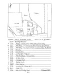
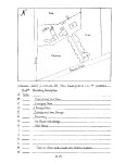
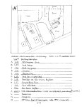
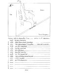
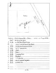
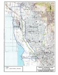
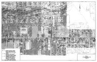
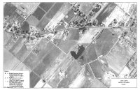
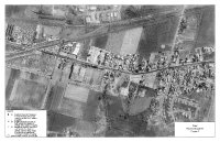
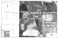
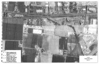
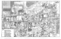
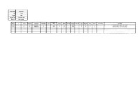
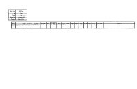
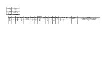
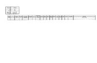
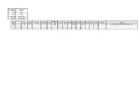
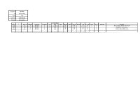
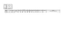
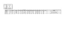
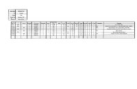
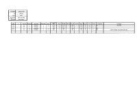
The survey was conducted within the area of Utah County originally known as Lake Bottom, which covers the entire length of Geneva Rd. I-15 crosses Geneva Rd within the city boundaries of Lindon, the survey boundaries south of this point are from the west side of I-15 to Utah Lake beginning on the south side of Center St in Provo. Up to the crossing point in Lindon, I-15 runs basically parallel with Geneva Rd on the outer edge of the bench lands of Provo and Orem. After the crossing point the survey boundaries are from the east side of Geneva Rd, west to Utah Lake to the point where Utah Lake curves to the west (approximately 200 S in Lindon). The west boundary of the survey from that point will run straight north to approximately 400 S in Pleasant Grove. |
| Rights Management |
Digital Image © 2025 Utah State Historic Preservation Office. All Rights Reserved. |
| Publisher |
Utah State Historic Preservation Office |
| Genre |
Historic Buildings Reports |
| Type |
Text |
| Format |
application/pdf |
| Date Digital |
2025-06-17 |
| Language |
eng |
| ARK |
ark:/87278/s6pwzhtf |
| Setname |
dha_uhbrep |
| ID |
2735710 |
| Reference URL |
https://collections.lib.utah.edu/ark:/87278/s6pwzhtf |