| Title |
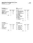
Erda, Ophir and Stockton Reconnaissance Level Surveys 2008 Tooele County, Utah |
| Grouping |
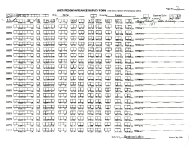
546 |
| State |
Utah |
| County |
Tooele County |
| City |
Erda, Ophir, Stockton |
| Scanning Institution |
Utah Correctional Institute |
| Collection |
Utah Historic Buildings Reports Collection |
| Date |
2008 |
| UTSHPO Collection |
Tooele County RLS |
| Spatial Coverage |
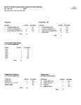
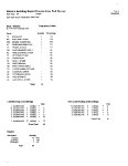
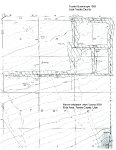
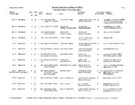
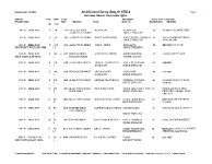
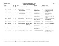
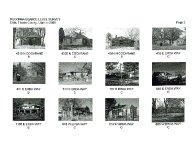
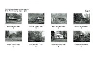
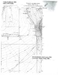
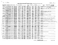
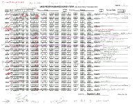
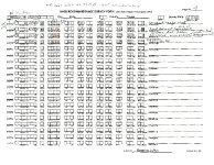
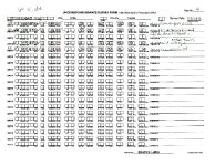
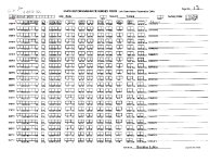
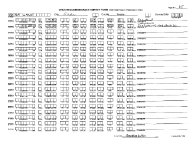
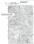
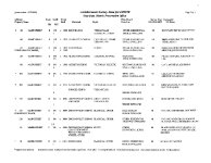
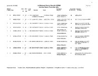
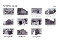
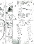
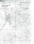
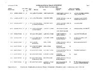
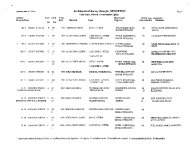
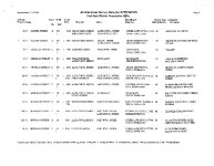
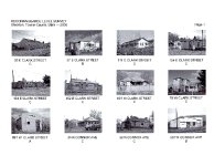
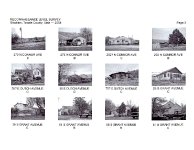
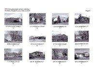
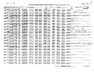
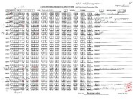
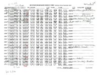
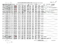
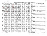
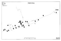
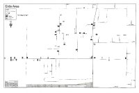
The area of Erda surveyed is contained roughly within the boundary streets of Airport Rd to the west, Bates Canyon Rd to the north, Droubay Rd to the east and Erda Way to the south. Streets surveyed are Bates Canyon Rd; Bryan Rd; Church Rd; Clover Cochrane; Erda Way; Hwy 36 (SR-36); Liddell Ln; Toms Ln; Warr Ln. The area of Ophir surveyed is located along Main St or Ophir Canyon Rd. Streets surveyed are Cliff St; Main St/Ophir Canyon rd.; Miner/Back St; Moore Ave. The area of Stockton surveyed is located on either side of Utah SR-36 (Connor Ave) with most structures on the east side. Streets surveyed are Clark St; Connor Ave; Dutch Ave; Grant Ave; Johnson St; Old Country Rd; Railroad Ln; Railroad St; Rogers St; Sheridan St; Sherman St; Silver Ave. |
| Rights Management |
Digital Image © 2025 Utah State Historic Preservation Office. All Rights Reserved. |
| Publisher |
Utah State Historic Preservation Office |
| Genre |
Historic Buildings Reports |
| Type |
Text |
| Format |
application/pdf |
| Date Digital |
2025-06-17 |
| Language |
eng |
| ARK |
ark:/87278/s6ve6qbq |
| Setname |
dha_uhbrep |
| ID |
2734671 |
| Reference URL |
https://collections.lib.utah.edu/ark:/87278/s6ve6qbq |