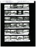
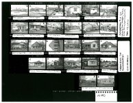
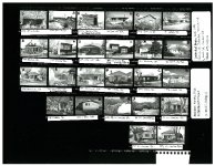
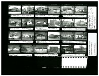
| Title |
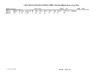
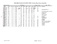
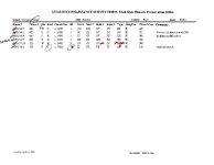
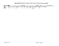
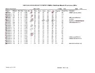
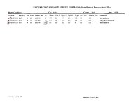
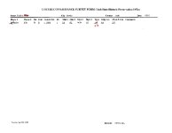
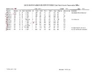
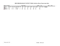
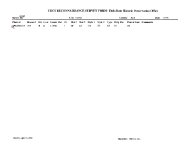
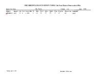
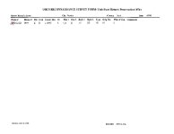
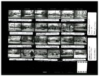
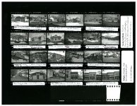
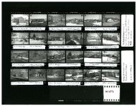
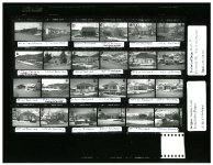
EUREKA, STANDARD RLS, 2001 |
| Grouping |
463 |
| State |
Utah |
| County |
Juab |
| City |
Eureka |
| Scanning Institution |
Utah Correctional Institute |
| Collection |
Utah Historic Buildings Reports Collection |
| Date |
2001 |
| Spatial Coverage |
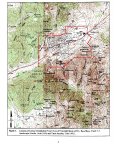
North of Highway 6, South of Highway 6, Southwest to Knightsville Road, Southeasterly along Knightsville Road for roughly 700 feet, East of Gardner Canyon, South of the Snowflake, Eagle, and Bluebell Shaft |
| Rights Management |
Digital Image © 2025 Utah State Historic Preservation Office. All Rights Reserved. |
| Publisher |
Utah State Historic Preservation Office |
| Genre |
Historic Buildings Reports |
| Type |
Text |
| Format |
application/pdf |
| Date Digital |
2025-03-06 |
| Language |
eng |
| ARK |
ark:/87278/s6me1z4q |
| Setname |
dha_uhbrep |
| ID |
2724504 |
| Reference URL |
https://collections.lib.utah.edu/ark:/87278/s6me1z4q |