| OCR Text |
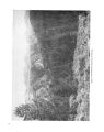
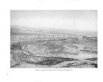
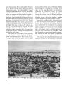
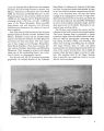
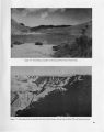
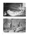
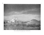
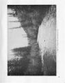
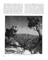
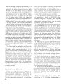
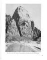
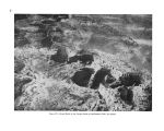
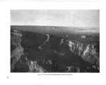
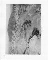
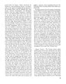
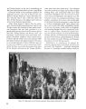
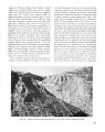
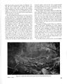
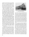
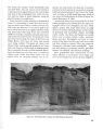
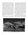
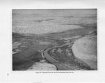
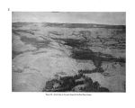
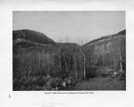
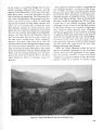
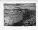
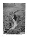
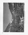
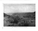
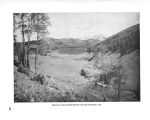
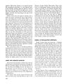
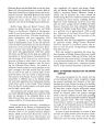
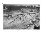
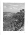
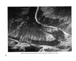
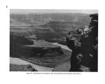
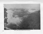
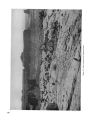
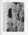
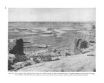
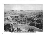
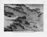
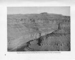
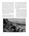
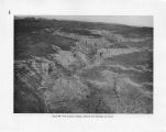
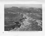
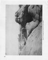
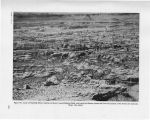
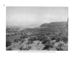
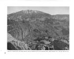
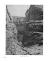
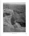
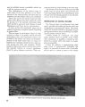
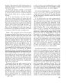
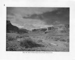
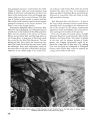
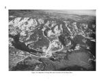
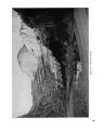
Show CHAPTER VII THE GRAND CANYON From the mouth of the Nankoweap Canyon on the east to the Grand Wash Cliffs on the west- more than 200 miles by river- the Grand Canyon maintains approximately the same 5,000- foot depth and a width between rims measured in terms of miles. All sections of the Grand Canyon are parts of one natural physiographic unit. Although the general character and form of the canyon change greatly from place to place, there is an imperceptible transition from one section to the next, and all are inseparable parts of the one great canyon. Man- made boundaries in the Grand Canyon mean nothing as to the relative value of different portions. It is not possible to say that one part is either inferior or superior to another; each is different but each is great and part of the whole. BRIDGE CANYON RESERVOIR SECTION The inner part of the Grand Canyon which would be affected by the proposed Bridge Canyon Reservoir may be divided both scenically and geologically into four main divisions. The eastern division of the inner canyon, starting some miles above the mouth of Havasu Creek and extending almost to Toroweap Valley, is characterized by extreme narrowness of the gorge and by very high sheer walls of sedimentary rocks. Near the mouth of Havasu Creek, for instance, resistant beds of Muav limestone wall in the river and the soft shales that normally form the flat Tonto Platform below are not exposed, with the result that the inner canyon to a height of nearly 2,000 feet is extremely narrow, probably the narrowest within the entire canyon. From Toroweap Valley to Whitmore Wash and beyond, the scenery has been changed by the introduction of vast quantities of volcanic materials and the cutting of the river progressively deeper into the sedimentary rocks, with consequent widening of the gorge. The Toroweap section is one of the most spectacular and remarkable parts of the Grand Canyon. At the foot of Toroweap Valley the nearly vertical walls of the inner gorge rise almost 3,000 feet above the river. Great lava flows have cascaded down into the gorge and cinder cones perch on slopes within the canyon. On the rim of the gorge at the foot of Toroweap Valley stands a large cinder cone known as Vulcans Throne. Below Whitmore Wash the river turns south following the trend of several major fault lines- especially the Hurricane Fault to the north and the Peach Springs Fault to the south. The entire aspect of the canyon changes. It is considerably wider and cut into older rocks than those exposed in the Toroweap area. The most impressive part of this section is known as Granite Park. From the great bend of the Colorado River at the mouth of Diamond Creek westward to and beyond the Bridge Canyon Dam site, the Colorado flows through the lower Granite Gorge, and the scenery near the river resembles that in the inner gorge of the Bright Angel section. Above the inner gorge the Tonto Platform also shows a resemblance to the corresponding feature in the eastern section of Grand Canyon. On the south side of the canyon the great Cataract Plain extends west from the Williams- Grand Canyon Road to the Aubrey Cliffs- unbroken except for Cataract Canyon. West of the Aubrey Cliffs to the Grand Wash Cliffs are vast colorful canyons, plateaus, and mountains. Prospect Canyon, which parallels the Aubrey Cliffs, provides a means of access to the high east rim of the canyon overlooking Granite Park. In this section, from Granite Park to Diamond Creek, the Grand Canyon reaches its greatest depth. The rim attains an elevation of 6,890 feet while the river at the mouth of Diamond Creek is at an elevation of 1,335 feet. From the pifion- and juniper- covered 128 |