| OCR Text |
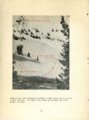
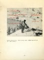
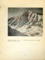
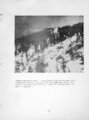
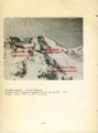
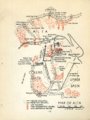
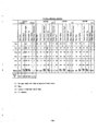
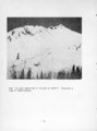
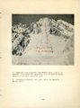
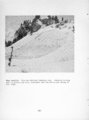
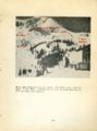
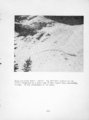
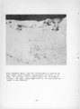
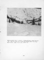
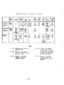
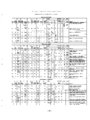
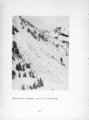
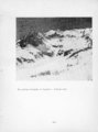
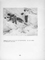
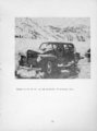
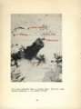
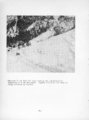
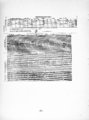
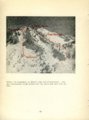
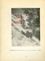
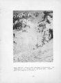
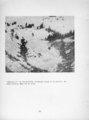
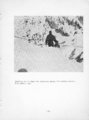
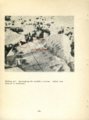
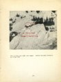
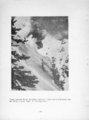
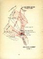
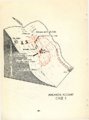
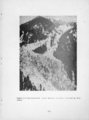
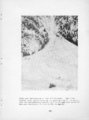
Show unknown quantity. In 10 or 20 years, vegetation and forest growth hide the scars. They may run in paths not readily identifiable. The Emma slidepath at Alta is well defined and is in fact the scene of annual avalanches of importance. But Coal Pit would scarcely be chosen as a likely place for a climax avalanche to develop among a host of more impressive slopes. Argenta, in Big Cottonwood, is impressive enough, but the trained observer would be likely to cross it off his list because of the natural obstacles. In any plan for the development or operation of an alpine ski area, the climax avalanches must be considered. But they are certain to take place when the right conditions are present. And they are the most likely to result in major disaster. A short-term investigation of a new area, for instance, might reveal no data whatever. Permanent improvements or main ski runs, seeking to avoid a lesser hazard, might be located in the path of major destruction. Historical records, no matter how fragmentary, are of value in calculating the climax avalanche hazard. They will at least point out some of the locations. Dae to the early day mining activity at Alta records in this area are fairly extensive. They have been of great assistance in planning and operating the area. During the season of two climax avalanches ran; Coal Pit in Little Cottonwood and Argenta in Big Cottonwood. With modern methods of recording and analyzing data, it is possible to work out rather complete case histories for those two which reflect some light on others where only fragmentary information is available. Emma Mine History: As mentioned above, the Emma is an annual slide path. avalanches have been recorded. Four climax I87U. The slide destroyed the mining town of Alta, killing 60 persons. Other fatalities occurred during the fire that ensued. No weather data are given. March 7> 1S8U, Twelve persons wore killed; 1 . 7 1 inches of rain are mentioned, February l6, 1939. January 7t Violent storm in .progress. Damaged cars and tows west of Emma; 8 inches damp new snow. Terrain Data: The Emma slide path.lies on the north side of Little Cottonwood Canyon overlooking the upper parking area. Forest and grass cover is deficient due to heavy cutting during early mining days and the hillside has been cut by erosion into many gullies. There is a 1700-foot difference in elevation between the canyon floor and the ridge summit. The upper third of the slide path is above 30 degrees in grade. At its approximate center there is a sort of terrace or definite change in grade of considerable width after -90- |