| Title |
Geology of the Northern Silver Island Mountains, Box Elder and Tooele Counties, Utah |
| Publication Type |
thesis |
| School or College |
College of Mines & Earth Sciences |
| Department |
Geology & Geophysics |
| Author |
Anderson, Warren L. |
| Date |
1957-06 |
| Description |
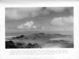
Field work in the northern Silver Island Mountains was carried out in 1956, continuously from late March to mid-July and alternately during August and September. The range is in the northeast part of the Basin and Range province. It rises abruptly from the barren, salt-covered plains of the Great Salt Lake Desert, and trends north easterly from Wendover, Utah for a distance of about 30 miles. The historically famous Hastings1 Cutoff trail passes through the mapped area, and tracks of the Donner Party and several other emigrant and gold-rush groups are still plainly visible on the salt desert east and west of the range. The stratigraphic section is 10,650 feet thick and includes every period of the Paleozoic era. Limestone is the dominant rock type, followed by dolomite, quartzite, and siltstone. The Ordovician and Devonian sections are thicker and the Mississippian and Pennsylvanian sections are thinner than those of correlative areas in Utah and eastern Nevada. A Paleozoic positive area to the north influenced the stratigraphic section commencing about late Middle Devonian time and continuing into Early Permian time. Two lithofacies of the Upper Pennsylvanian-Lower Permian are recognized. The range is not typical of Basin and Range structure in that it apparently is not bounded on both sides by faults. There is no evidence for a west border fault; whereas, physiographic evidence indicates the possibility of an east border fault. On Crater Island to the north there are north-south high-angle faults and east-west step faults, probably caused by east-west compression. To the south on northern Silver Island there is one large east-west fault and associated structures that apparently were formed by an early period of normal faulting followed at a later time by compressive forces from the south. Four igneous stocks composed of granodiorite, monzonite, quartz monzonite, and gradations of these rocks are present. Geologically younger igneous dikes composed mainly of andesite, rhyodacite, laraphrophyre, and aplite are abundant. Lake Bonneville of Pleistocene time left its mark on the range in the form of wave-cut terraces, pebble beaches, spits, bars, and calcareous tuffa and diatomaceous deposits. Evidence for mining and prospecting activity on Crater Island in past years is abundant. Some mineralized veins containing mainly copper minerals are present on Crater Island, and a small barite vein is present on northern Silver Island. None of the deposits is judged to be of commercial value. |
| Type |
Text; Image |
| Publisher |
University of Utah |
| Subject |
Geology; Utah; Silver Island Mountains |
| Dissertation Institution |
University of utah |
| Dissertation Name |
Master of Science |
| Language |
eng |
| Relation is Version of |
Digital reproduction of Geology of the Northern Silver Island Mountains, Box Elder and Tooele Counties, Utah, J. Willard Marriott Library Special Collections, QE3.5 1957 .A5 |
| Rights Management |
In the public domain use of this file is allowed in accordance with the Creative Commons Attribution-Noncommercial-No Derivative Works 3.0 United States License, http://creativecommons.org/licenses/by-nc-nd/3.0/us |
| Format |
application/pdf |
| Format Medium |
application/pdf; image/jpeg |
| Format Extent |
17,020,405 bytes |
| Identifier |
us-etd3,19064 |
| Source |
Original: University of Utah J. Willard Marriott Library Special Collections |
| Conversion Specifications |
Original scanned on Epson GT-30000/Epson Expression 836XL as 400 dpi to pdf using ABBYY FineReader 9.0 Professional Edition. |
| ARK |
ark:/87278/s65q59v4 |
| Setname |
ir_etd |
| ID |
195171 |
| Reference URL |
https://collections.lib.utah.edu/ark:/87278/s65q59v4 |


