| Title |
Cedar City projects, maps and charts |
| Description |
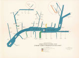
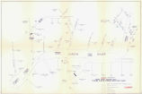
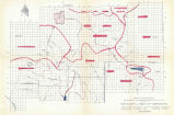
Maps and diagrams related to Cedar City water development projects |
| Subject |
Kolob Dam; Kolob Project; Dixie Project; Dams--Design and construction; Water resources development--Utah--Washington County; Water-supply--Utah--Cedar City; Water resources development--Utah--Iron County; Water-supply--Utah--Iron County |
| Contributor |
Cedar City Corporation; Utah Water and Power Board |
| Additional Information |
Includes maps of: Kolob Creek Reservoir, property description; Ultimate development, Virgin River system, stream flow & stream depletion chart (1958); Proposed development, Virgin River system, stream flow & stream depletion chart (1958); Project planning map for expanding the water resources and facilities of Iron County & Cedar City Corporation (1959) |
| Spatial Coverage |
Kolob Reservoir (Utah); Virgin River; Virgin River Watershed; Kolob Creek (Utah); Cedar City (Utah) |
| Collection Number and Name |
Accn0823 bx 30 fd 2; John S. Boyden papers |
| Rights Management |
Digital Image Copyright 2009, University of Utah. All Rights Reserved. |
| Holding Institution |
J. Willard Marriott Library, University of Utah |
| Date |
1958; 1959 |
| Digitization Specifications |
Original scanned on Epson Expression 10000 XL and saved as 400 ppi TIFF. Display image generated in CONTENTdm. |
| Publisher |
Digitized by J. Willard Marriott Library, University of Utah |
| Type |
Text |
| ARK |
ark:/87278/s6sq8zb0 |
| Setname |
wwdl_neh |
| ID |
1147681 |
| Reference URL |
https://collections.lib.utah.edu/ark:/87278/s6sq8zb0 |


