| Title |
Subsurface geology of the Mesozoic formations overlying the Uncompahgre Uplift in Grand County, Utah |
| Publication Type |
thesis |
| School or College |
College of Mines & Earth Sciences |
| Department |
Geology & Geophysics |
| Author |
Groenewold, Bernard Cyrus |
| Date |
1961-06 |
| Description |
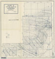
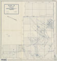
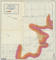
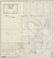
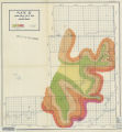
The area of study, located in northeastern Grand County, Utah, has had oil and gas production from Mesozoic rocks for several years. The subsurface stratigraphy of the Mesozoie formations was studied, with particular emphasis on the Entrada Sandstone, Morrison Formation, Dakota Group, Mancos Shale and the Castlegate Sandstone, which have been the main oil and gas producers. Oil and gas production on top of the Uneompahgre Uplift, except from the Entrada Sandstone, seems to be controlled more by s t r a t i - graphic conditions than by structural conditions. Facts are presented that indicate that sand-shale ratios are an important index to possible productive conditions. The sand-shale ratio maps presented in this thesis are believed by the writer to represent, in graphic form, the total amount and relative abundance of shale permeability barriers in the Morrison Formation and the Dakota Group. Isopach maps of the Dakota Group and the Morrison Formation are presented and a structural contour map constructed on the top of the Greenhorn Member of/the Mancos Skale is included. North-south and east~west stratigraphic cross section which traverse the area of study are inpluded. Typical electric log sections, with tops of each formation denoted, are included in the text. Appendixes with iii sample descriptions and electric log formation tops are placed at the end of the text. Facts are presented which indicate that the Uncompahgre Uplift was an active structural element through, at least, Glen Canyon time (Late Triassic-Early Jurassic). The secondary anticlines and syn- clines which overlie the Uncompahgre Uplift were folded sometime after Green River deposition^(Eocene) and not at the close of Cretaceous, Evidence is presented which indicates that the Uncompahgre Uplift and the salt domes of the Paradox Basin are related, in so far as time of uplift or intrusion is concerned. |
| Type |
Text; Image |
| Publisher |
University of Utah |
| Subject |
Geology; Utah; Grand County; Stratigraphic; Mesozoic |
| Dissertation Institution |
University of Utah |
| Dissertation Name |
Master of Science |
| Language |
eng |
| Relation is Version of |
Digital reproduction of Subsurface geology of the Mesozoic formations overlying the Uncompahgre Uplift in Grand County, Utah, J. Willard Marriott Library Special Collections, QE3.5 1961 .G75 |
| Rights Management |
In the public domain use of this file is allowed in accordance with the Creative Commons Attribution-Noncommercial-No Derivative Works 3.0 United States License, http://creativecommons.org/licenses/by-nc-nd/3.0/us |
| Format |
application/pdf |
| Format Medium |
application/pdf; image/jpeg |
| Identifier |
us-etd3,15573 |
| Source |
Original: University of Utah J. Willard Marriott Library Special Collections |
| Conversion Specifications |
Original scanned on Epson GT-30000/Epson Expression 836XL as 400 dpi to pdf using ABBYY FineReader 9.0 Professional Edition. |
| ARK |
ark:/87278/s6h70wkz |
| Setname |
ir_etd |
| ID |
195094 |
| Reference URL |
https://collections.lib.utah.edu/ark:/87278/s6h70wkz |


