| Description |
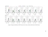
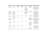
Vegetation disturbances, such as insect outbreaks and wildfires, exist in various terrestrial ecosystems across the entire world. In this dissertation, I implemented two vegetation-related disturbances studies in the western United States: (1) Mapping and spectroscopic analysis of tamarisk defoliation by the northern tamarisk beetle in eastern Utah, and (2) Analysis and modeling of vegetation response following fire in shrublands and forests of California using remote sensing, Geographical Information Science (GIS), and geospatial statistical methods. By integrating multiple-temporal remote sensing imagery and field-measured hyperspectral data, I monitored tamarisk defoliation caused by beetle herbivory over multiple years and conducted spectroscopic analysis of various tamarisk canopy types. Spatio-temporal patterns of tamarisk defoliation by beetles within the study area were quantified, while robustness and performances of two mapping methods (disturbance index and random forests) were compared. The spectroscopic analysis results indicated the step of feature selection can help improve the accuracy of remote sensing classifications and decrease the computation task. The red, near-infrared, and shortwave-infrared wavelength regions were also found to be important for discriminating desiccated and dead canopy spectra. Wildfire is a dominant disturbance in shrubland and forest ecosystems of California. With the aid of remote sensing data and other auxiliary datasets (e.g. climate, topography, and historical wildfires), I evaluated and explored the effects of short interval fires on shrublands recovery. Reduced shrublands cover was found in some lower elevation areas that were burned twice in short interval fires, where nonsprouting species were more common. Many explanatory factors (fire history, climate, and elevation), with the exception of elevation, were moderately or poorly correlated with differences in shrubland recovery following short-interval fires. In another similar study, using the normalized difference vegetation index, I explored and compared the controls of fire severity and postfire climate with topographic factors on the short-term postfire dynamics of red fir and mixed-conifer forests in the Sierra Nevada Mountains of California. Fire severity, postfire wet season precipitation, postfire January minimum temperature, and topographic factors were found to be correlated with short-term postfire normalized difference vegetation index values. The geospatial modeling results indicated the mixed-conifer forest was sensitive to postfire drought, but the red fir forest was sensitive to postfire warmth. |


