Home
Browse
Ask Us
Chat
Harmful Language Statement
Log in
Institutional Repository
Advanced Search
Year
1950
1951
1952
1953
1954
1955
1956
1957
1958
1959
1960
1961
1962
1963
1964
1965
1966
1967
1968
1969
1970
1971
1972
1973
1974
1975
1976
1977
1978
1979
1980
1981
1982
1983
1984
1985
1986
1987
1988
1989
1990
1991
1992
1993
1994
1995
1996
1997
1998
1999
2000
2001
2002
2003
2004
2005
2006
2007
2008
2009
2010
2011
2012
2013
2014
2015
2016
2017
2018
2019
2020
2021
2022
2023
TO
1950
1951
1952
1953
1954
1955
1956
1957
1958
1959
1960
1961
1962
1963
1964
1965
1966
1967
1968
1969
1970
1971
1972
1973
1974
1975
1976
1977
1978
1979
1980
1981
1982
1983
1984
1985
1986
1987
1988
1989
1990
1991
1992
1993
1994
1995
1996
1997
1998
1999
2000
2001
2002
2003
2004
2005
2006
2007
2008
2009
2010
2011
2012
2013
2014
2015
2016
2017
2018
2019
2020
2021
2022
2023
Type
Image
155
Text
17
Image/MovingImage
2
Image/StillImage
2
InteractiveResource
1
Format
image/jpeg
368
Collection
Chicana/o Scholarship Archive
1
EAE Archive
81
Electronic University Archive
116
Marriott Digital Publishing Archive
4
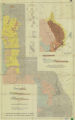
Office of Undergraduate Research Library
1
Sustainability U
2
Theses & Dissertations
10
UScholar Works
152
Utah State Board Of Regents
1
More
Filters:
Format:
"image/jpeg"
Collection:
ir_*
176
-
200
of
368
<
3
4
5
6
7
8
9
10
11
12
>
Gallery view
Number of results to display per page
10
25
50
100
200
Sort by Relevance
Sort by Title A-Z
Sort by Title Z-A
Sort by Date Ascending
Sort by Date Descending
Sort by Last Modified Ascending
Sort by Last Modified Descending
Title
Date
Type
Setname
176
Pit Fired Vase (side B)
2008
Image
ir_uspace
177
Plate 1: Geologic map of Northern Bryce Canyon National Park
1961-06
Image
ir_etd
178
Plate 3: Geologic map and sections of Wanship-Park City region, Utah
1952-06
Image
ir_etd
179
Plate 3: Geologic map of portion of Northwestern Uinta Mountains, Utah
1951
Image
ir_etd
180
Plate1-part1 Geologic map of the Central Mineral Range, Beaver County, Utah
1957-08
Image
ir_etd
181
Plate17 Geologic map and sections of parts of the Magna, Lark, Fairfield, and Jordan Narrows quadrangles, Utah
1955
Text
ir_etd
182
Plate18 Geologic map of Rozel Hills, Utah
1955-06
Text
ir_etd
183
Pole
2005
Image
ir_uspace
184
Porcuball
2018
ir_eae
185
Portal
2005
Image
ir_uspace
186
Portal (detail)
2005
Image
ir_uspace
187
Portia
Image
ir_uspace
188
Prayer Wings I
2002
Image
ir_uspace
189
Prayer Wings II
2002
Image
ir_uspace
190
Present, detail view 1
2007
Image
ir_uspace
191
Present, detail view 2
2007
Image
ir_uspace
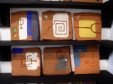
192
Present, detail view of bookstand tile
2007
Image
ir_uspace
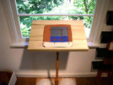
193
Present, installation view
2007
Image
ir_uspace
194
Present, installation view
2007
Image
ir_uspace
195
Present, view from the entrance
2007
Image
ir_uspace
196
Present, view from the entrance
2007
Image
ir_uspace
197
Present, view towards the bookstand
2007
Image
ir_uspace
198
Presente II
2003
Image
ir_uspace
199
Project R.A.T.
2018
ir_eae
200
Range: Undergraduate Research Journal
2022-12
Text
ir_our
176
-
200
of
368
<
3
4
5
6
7
8
9
10
11
12
>