Home
Browse
Ask Us
Chat
Harmful Language Statement
Log in
Photo Archives
Advanced Search
About
Over 70,000 photos covering a variety of topics from Marriott Library Special Collections
Year
1950
1951
1952
1953
1954
1955
1956
1957
1958
1959
1960
1961
1962
1963
1964
1965
1966
1967
1968
1969
1970
1971
1972
1973
1974
1975
TO
1950
1951
1952
1953
1954
1955
1956
1957
1958
1959
1960
1961
1962
1963
1964
1965
1966
1967
1968
1969
1970
1971
1972
1973
1974
1975
Type
Image
594
Format
image/jpeg
594
Collection
Photo Archives
594
Filters:
Collection Name:
"John Stockert"
Format:
image
Setname:
!(ir* OR ehsl*)
101
-
125
of
594
<
1
2
3
4
5
6
7
8
9
10
>
Gallery view
Number of results to display per page
10
25
50
100
200
Sort by Relevance
Sort by Title A-Z
Sort by Title Z-A
Sort by Date Ascending
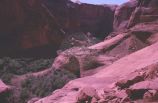
Sort by Date Descending
Sort by Last Modified Ascending
Sort by Last Modified Descending
Title
Date
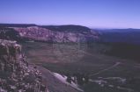
Type
101
Upstream from Gregory Natural Bridge, during lake rise [2]
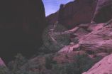
1965-09-21
Image
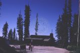
102
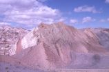
Upturned strata along Cottonwood Wash Road, southern Utah
1963-04-21
Image
103
Utah State Capitol building
1959; 1960
Image
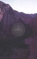
104
Very high arch above Lake Powell [1]
1963-04-25
Image
105
Very high arch above Lake Powell [2]
1963-04-25
Image
106
Very narrow canyon above Gregory Bridge
1963-04-23
Image
107
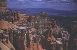
View at Bryce Canyon National Park
1959-06-25
Image
108
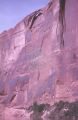
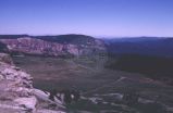
View down Clear Creek Canyon
1963-04-23
Image
109
View from Great Arch Trail, Zion
1959-06-25
Image
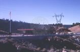
110
View of country around temporary bridge, Flaming Gorge
1959-06-27
Image
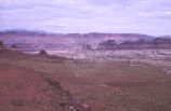
111
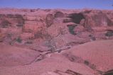
View of Davis Canyon from Moqui Ruin
1963-04-23
Image
112
View of Escalante canyon as we start down into it from mesa
1963-04-22
Image
113
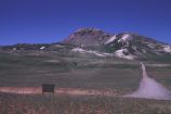
View to Brian Head Peak, highest in southwestern Utah
1966-07-04
Image
114
View toward Cedar Breaks from Brian Head Peak
1966-07-04
Image
115
View toward Cedar Breaks from Brian Head Peak
1966-07-04
Image
116
View up Clear Creek Canyon
1963-04-23
Image
117
View up Clear Creek Canyon from an expansive ledge
1963-04-23
Image
118
Visitor Center at Cedar Breaks National Monument
1966-07-04
Image
119
Visitor Center near Flaming Gorge Dam
1968-10-19
Image
120
Corona Arch, southern Utah [1]
1960-10-25
Image
121
Corona Arch, southern Utah [2]
1960-10-25
Image
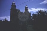
122
Manti Temple, Sanpete County, Utah
1959-06-26
Image
123
Dry falls in Annie's Canyon
1965-09-21
Image
124
East of Hite, Utah on new graded section
1966-07-26
Image
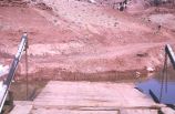
125
End gate or ramp at Hite Ferry
1965-09-21
Image
101
-
125
of
594
<
1
2
3
4
5
6
7
8
9
10
>