Home
Browse
Ask Us
Chat
Harmful Language Statement
Log in
Photo Archives
Advanced Search
About
Over 70,000 photos covering a variety of topics from Marriott Library Special Collections
Year
1872
1873
1874
1875
1876
1877
1878
1879
1880
1881
1882
1883
1884
1885
1886
1887
1888
1889
1890
1891
1892
1893
1894
1895
1896
1897
1898
1899
1900
1901
1902
1903
1904
1905
1906
1907
1908
1909
1910
1911
1912
1913
1914
1915
1916
1917
1918
1919
1920
1921
1922
1923
1924
1925
1926
1927
1928
1929
1930
1931
1932
1933
1934
1935
1936
1937
1938
1939
1940
1941
1942
1943
1944
1945
1946
1947
1948
1949
1950
1951
1952
1953
1954
1955
1956
1957
1958
1959
1960
1961
1962
1963
1964
1965
1966
1967
1968
1969
1970
1971
1972
1973
1974
1975
1976
1977
1978
1979
1980
1981
1982
1983
1984
1985
1986
1987
1988
1989
1990
1991
1992
1993
TO
1872
1873
1874
1875
1876
1877
1878
1879
1880
1881
1882
1883
1884
1885
1886
1887
1888
1889
1890
1891
1892
1893
1894
1895
1896
1897
1898
1899
1900
1901
1902
1903
1904
1905
1906
1907
1908
1909
1910
1911
1912
1913
1914
1915
1916
1917
1918
1919
1920
1921
1922
1923
1924
1925
1926
1927
1928
1929
1930
1931
1932
1933
1934
1935
1936
1937
1938
1939
1940
1941
1942
1943
1944
1945
1946
1947
1948
1949
1950
1951
1952
1953
1954
1955
1956
1957
1958
1959
1960
1961
1962
1963
1964
1965
1966
1967
1968
1969
1970
1971
1972
1973
1974
1975
1976
1977
1978
1979
1980
1981
1982
1983
1984
1985
1986
1987
1988
1989
1990
1991
1992
1993
Type
Image
3,451
Format
image/jpeg
3,451
Collection
Photo Archives
3,451
Filters:
Collection Name:
"Herbert E. Gregory"
Format:
"image/jpeg"
Type:
"Image"
101
-
125
of
3,451
<
1
2
3
4
5
6
7
8
9
10
>
Gallery view
Number of results to display per page
10
25
50
100
200
Sort by Relevance
Sort by Title A-Z
Sort by Title Z-A
Sort by Date Ascending
Sort by Date Descending
Sort by Last Modified Ascending
Sort by Last Modified Descending
Title
Date
Type
101
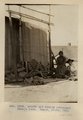
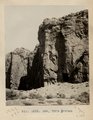
Ancient ladder some rungs recently nailed on leading to Cliff ruins 2 miles above Augusta Bridge, White Canyon
1928
Image
102
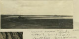
Ancient lagoons inside ridge of fossil dunes, Beachport, South Australia, 1916
1916
Image
103
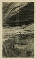
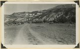
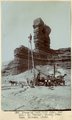
Ancient landslides, 5± mi. southwest of Sunrise Spgs., Ariz. (photo G-44)
1909
Image
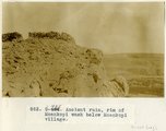
104
Ancient ruin, rim of Moenkopi Wash below Moenkopi village.
1914
Image
105
Ancient talus (right foreground) and talus now forming at base of Kinesava mountain, Zion National Park, Washington County, UT, 1939
1939
Image
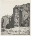
106
Another view of Photo G213. VI, 38 (Photo G213A)
1911
Image
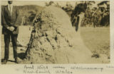
107
Ant hill near Wallerawang, New South Wales
1916
Image
108
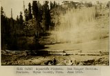
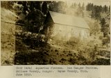
Aquarios Plateau. Box Ranger Station. Pasture. Wayne County, UT. June 1918
1918
Image
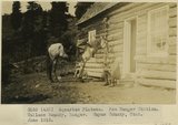
109
Aquarios Plateau. Box Ranger Station. Wallace Roundy, Ranger. Wayne County, UT. June 1918
1918
Image
110
Aquarios Plateau. Box Ranger Station. Wallace Roundy, Ranger. Wayne County, UT. June 1918
1918
Image
111
Arch Canyon, Coconino over Supai
1920; 1921; 1922; 1923; 1924; 1925; 1926; 1927; 1928; 1929; 1930
Image
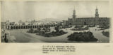
112
Arequipa. The main plaza and Mt. Chachani, from the second story of Morosini's Hotel Anexo.
1911; 1912; 1915
Image
113
Arma Valley. Bumstead and signal on SE side. Arma-Puciura pass.
1912
Image
114
Arnold and family (Chinlee) Navajo loom. Heald, photo, 1911 (Photo G282)
1911
Image
115
Arrangement of formations at Squaw Canyon along the line of the Kanarra fold. Triassic; Navajo upper Jurassic (Carmel, Entrada, Curtis, Winsor); Cretaceous. Steep dips of lower formations progressively flatten eastward (right). Iron County, UT, 1942
1942
Image
116
Arroyo in Cienega (meadow), line of bushes shows position of water table, St. Michaels, Ariz., 1909 (photo G-3)
1909
Image
117
Arroyo in cienega, St. Michaels, Ariz. (negative for G-3)
1909
Image
118
Artesian well (100 gals. per min.) at "Twins," Bluff, Utah. (Chas. Goodman photo)
1909
Image
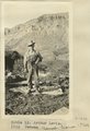
119
Arthur Lewis. Kanab Camp, UT. 1922
1922
Image
120
Ash and tuff near Biddehoche. VI, 84 (Photo G231)
1911
Image
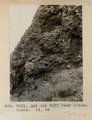
121
Ash, Twin Buttes (Photo G252)
1911
Image
122
Ash, Twin Buttes (Photo G252)
1911
Image
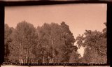
123
Aspen and Yellow Pine near Kigalia Ranger Station, Elk Ridge. San Juan County, UT, 1928
Image
124
Aspen and Yellow Pine near Kigalia Ranger Station, Elk Ridge. San Juan County, UT, 1928
1928
Image
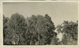
125
Aspen forest, branch of Sevier River, east of Cedar Breaks, Kane County, Utah, 1930.
1930
Image
101
-
125
of
3,451
<
1
2
3
4
5
6
7
8
9
10
>