Home
Browse
Ask Us
Chat
Harmful Language Statement
Log in
University of Utah Marriott Library
Advanced Search
Year
1879
1880
1881
1882
1883
1884
1885
1886
1887
1888
1889
1890
1891
1892
1893
1894
1895
1896
1897
1898
1899
1900
1901
1902
1903
1904
1905
1906
1907
1908
1909
1910
1911
1912
1913
1914
1915
1916
1917
1918
1919
1920
1921
1922
1923
1924
1925
1926
1927
1928
1929
1930
1931
1932
1933
1934
1935
1936
1937
1938
1939
1940
1941
1942
1943
1944
1945
1946
1947
1948
1949
1950
1951
1952
1953
1954
1955
1956
1957
1958
1959
1960
1961
1962
1963
1964
1965
1966
1967
1968
1969
TO
1879
1880
1881
1882
1883
1884
1885
1886
1887
1888
1889
1890
1891
1892
1893
1894
1895
1896
1897
1898
1899
1900
1901
1902
1903
1904
1905
1906
1907
1908
1909
1910
1911
1912
1913
1914
1915
1916
1917
1918
1919
1920
1921
1922
1923
1924
1925
1926
1927
1928
1929
1930
1931
1932
1933
1934
1935
1936
1937
1938
1939
1940
1941
1942
1943
1944
1945
1946
1947
1948
1949
1950
1951
1952
1953
1954
1955
1956
1957
1958
1959
1960
1961
1962
1963
1964
1965
1966
1967
1968
1969
Type
Image
1
Format
image/jpeg
246
application/pdf
1
Collection
Photo Archives
1
Ski and Snow Sports Archives
246
Filters:
Spatial Coverage:
"Little Cottonwood Canyon (Utah)"
51
-
75
of
247
<
1
2
3
4
5
6
7
8
9
10
>
Gallery view
Number of results to display per page
10
25
50
100
200
Sort by Relevance
Sort by Title A-Z
Sort by Title Z-A
Sort by Date Ascending
Sort by Date Descending
Sort by Last Modified Ascending
Sort by Last Modified Descending
Title
Date
Type
Setname
51
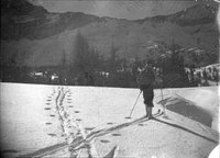
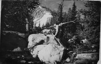
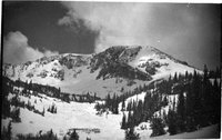
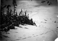
Bill Lence, saddle between Devil's Castle and Sugarloaf back, notice December lack of snow
1937; 1938; 1939; 1940; 1941
uum_map_usa
52
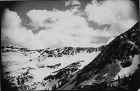
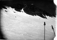
Hidden Peak left, American Fork, Twin right. Good powder just back of trees in middle
1937; 1938; 1939; 1940; 1941
uum_map_usa
53
Cliffs across from Gad Valley, late 1930s
1937; 1938; 1939; 1940; 1941
uum_map_usa
54
Bottom of Gad Valley looking toward Alta, spring snowfall on green vegetation
1937; 1938; 1939; 1940; 1941
uum_map_usa
55
Ted's slope leading into White Pine from Peak of American Fork Twin
1937; 1938; 1939; 1940; 1941
uum_map_usa
56
Hidden Peak
1937; 1938; 1939; 1940; 1941
uum_map_usa
57
Top of White Pine, Ted's Slope at left
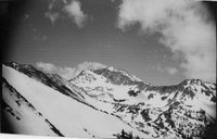
1937; 1938; 1939; 1940; 1941
uum_map_usa
58
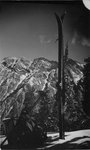
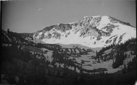
Baldy
1937; 1938; 1939; 1940; 1941
uum_map_usa
59
Baldy, June 17
1937; 1938; 1939; 1940; 1941
uum_map_usa
60
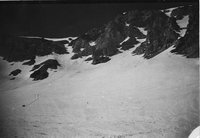
Under the cliffs of Baldy, June 17 late 1930s
1937; 1938; 1939; 1940; 1941
uum_map_usa
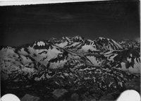
61
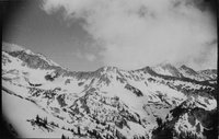
All the Alta peaks, even Lone Peak. Notice slope of shoulder of Baldy and Mt. Lake
1937; 1938; 1939; 1940; 1941
uum_map_usa
62
Under Baldy Cliffs, June 17
1937; 1938; 1939; 1940; 1941
uum_map_usa
63
McConnell nearing shoulder of Baldy
1937; 1938; 1939; 1940; 1941
uum_map_usa
64
Baldy Cliffs, cornice above left is skied from summit
1937; 1938; 1939; 1940; 1941
uum_map_usa
65
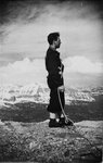
Karl Fahrner on Baldy
1937; 1938; 1939; 1940; 1941
uum_map_usa
66
Cornices on East side of Baldy summit
1937; 1938; 1939; 1940; 1941
uum_map_usa
67
Baldy and Upper Collins
1937; 1938; 1939; 1940; 1941
uum_map_usa
68
Baldy in early morning sun
1937; 1938; 1939; 1940; 1941
uum_map_usa
69
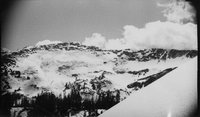
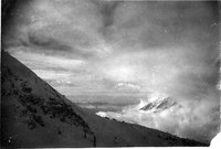
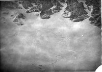
Shoulder of Baldy and Twin Peaks just breaking thru clouds from Alta Germania Pass, the Oquirrhs across the valley fog sea
1937; 1938; 1939; 1940; 1941
uum_map_usa
70
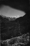
Relict trees protected from slides by cliff above (no couloir), Baldy looking West to shoulder
1937; 1938; 1939; 1940; 1941
uum_map_usa
71
Under the cliffs of Baldy, June 17 late 1930s
1937; 1938; 1939; 1940; 1941
uum_map_usa
72
Baldy and Upper Collins, June 18, 1939
1939-06-18
uum_map_usa
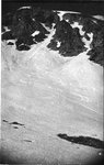
73
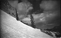
Powder under the Baldy Cliffs
1937; 1938; 1939; 1940; 1941
uum_map_usa
74
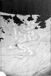
Coming down from West side of cirque
1937; 1938; 1939; 1940; 1941
uum_map_usa
75
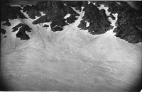
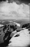
Baldy snowfields
1937; 1938; 1939; 1940; 1941
uum_map_usa
51
-
75
of
247
<
1
2
3
4
5
6
7
8
9
10
>