Over 70,000 photos covering a variety of topics from Marriott Library Special Collections
TO
Filters: Collection Name: "John Stockert" Collection: "uum_map" Format: image Setname: !(ir* OR ehsl*)
| Title | Collection Number And Name | Photo Number | ||
|---|---|---|---|---|
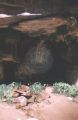
| 51 |
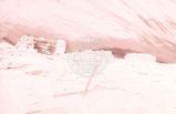 |
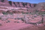
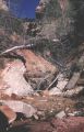
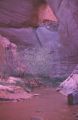
Ruin in Moqui Canyon [2] | P1100 John Stockert Photograph Collection | p1100n283 |
| 52 |
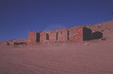 |
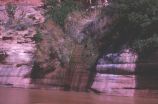
Ruins along Warm Creek (will be flooded) | P1100 John Stockert Photograph Collection | p1100n378 |
| 53 |
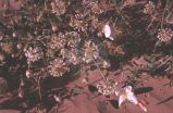 |
Sand Verbenas and evening primrose on bar along Escalante River | P1100 John Stockert Photograph Collection | p1100n004 |
| 54 |
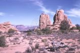 |
Sandstone outcroppings, Arches National Park? | P1100 John Stockert Photograph Collection | p1100n140 |
| 55 |
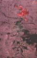 |
Scarlet gilia along Escalante River on bar | P1100 John Stockert Photograph Collection | p1100n003 |
| 56 |
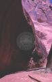 |
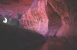
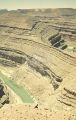
Scene along canyon below Gregory Bridge | P1100 John Stockert Photograph Collection | p1100n181 |
| 57 |
 |
Scene in Onion Creek Canyon [1] | P1100 John Stockert Photograph Collection | p1100n582 |
| 58 |
 |
Scene in Onion Creek Canyon [2] | P1100 John Stockert Photograph Collection | p1100n581 |
| 59 |
 |
Scene near Hite, Utah, west of river on Henry Mountains road | P1100 John Stockert Photograph Collection | p1100n331 |
| 60 |
 |
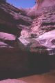
Scenic area of Davis Canyon with high sides above stream | P1100 John Stockert Photograph Collection | p1100n197 |
| 61 |
 |
Scenic area with small cascades, Davis Canyon | P1100 John Stockert Photograph Collection | p1100n198 |
| 62 |
 |
Seep across river from camp, one of many along Escalante River | P1100 John Stockert Photograph Collection | p1100n229 |
| 63 |
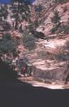 |
Side canyon from highway in Zion National Park | P1100 John Stockert Photograph Collection | p1100n466 |
| 64 |
 |
Side canyon, along Cottonwood Wash Road, southern Utah | P1100 John Stockert Photograph Collection | p1100n062 |
| 65 |
 |
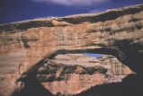
Side view of Roost Arch from upstream, Davis Canyon | P1100 John Stockert Photograph Collection | p1100n193 |
| 66 |
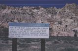 |
Sign about the Cockscomb formation, Cottonwood Canyon, Kane County, Utah | P1100 John Stockert Photograph Collection | p1100n066 |
| 67 |
 |
Sign at Crossing of the Fathers, Gunsight Butte in background | P1100 John Stockert Photograph Collection | p1100n374 |
| 68 |
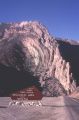 |
Sign showing the entrance to Sheep Creek Canyon Geological Area in the Ashley National Forest. | P1100 John Stockert Photograph Collection | p1100n018 |
| 69 |
 |
Sipapu Natural Bridge, Natural Bridges National Monument | P1100 John Stockert Photograph Collection | p1100n553 |
| 70 |
 |
Small cascade from a small gulch near gaging station and trail down | P1100 John Stockert Photograph Collection | p1100n247 |
| 71 |
 |
South from Angels Landing trailhead | P1100 John Stockert Photograph Collection | p1100n486 |
| 72 |
 |
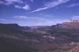
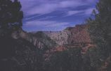
Southern Utah scenery | P1100 John Stockert Photograph Collection | p1100n343 |
| 73 |
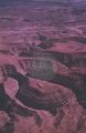 |
Southern Utah scenery | P1100 John Stockert Photograph Collection | p1100n344 |
| 74 |
 |
Southern Utah scenery | P1100 John Stockert Photograph Collection | p1100n529 |
| 75 |
 |
Southern Utah scenery | P1100 John Stockert Photograph Collection | p1100n527 |