TO
Filters: Collection: "ir_etd" Type: "Image"
| Author | Title | Subject | Date | Publication Type | ||
|---|---|---|---|---|---|---|
| 26 |
 |
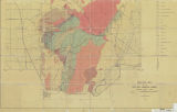
Slentz, Loren William | Tertiary Salt Lake group in the Great Salt Lake Basin: Georeferenced map files | Geology; Stratigraphic; Tertiary; Utah; Great Salt Lake Basin | 1955-07 | thesis |
| 27 |
 |
Slentz, Loren William | Tertiary Salt Lake group in the Great Salt Lake Basin | Geology; Stratigraphic; Tertiary; Utah; Great Salt Lake Basin | 1955-07 | thesis |
| 28 |
 |
Earll, Fred Nelson | Geology of the Central Mineral Range, Beaver County, Utah: Georeferenced map files | Geology -- Utah -- Mineral Mountains; Beaver County | 1957-08 | thesis |
| 29 |
 |
Earll, Fred Nelson | Geology of the Central Mineral Range, Beaver County, Utah | Geology -- Utah -- Mineral Mountains; Beaver County | 1957-08 | thesis |
| 30 |
 |
Earll, Fred Nelson | Plate1-part1 Geologic map of the Central Mineral Range, Beaver County, Utah | Geology -- Utah -- Mineral Mountains; Geology -- Utah -- Beaver County | 1957-08 | thesis |
| 31 |
 |
Groenewold, Bernard Cyrus | Subsurface geology of the Mesozoic formations overlying the Uncompahgre Uplift in Grand County, Utah: Georeferenced map files | Geology; Utah; Grand County; Stratigraphic; Mesozoic | 1961-06 | thesis |
| 32 |
 |
Groenewold, Bernard Cyrus | Subsurface geology of the Mesozoic formations overlying the Uncompahgre Uplift in Grand County, Utah | Geology; Utah; Grand County; Stratigraphic; Mesozoic | 1961-06 | thesis |
| 33 |
 |
Anderson, Warren L. | Geology of the northern Silver Island Mountains, Box Elder and Tooele Counties, Utah: Georeferenced maps | Geology; Utah; Silver Island Mountains | 1957-06 | thesis |
| 34 |
 |
Anderson, Warren L. | Geology of the Northern Silver Island Mountains, Box Elder and Tooele Counties, Utah | Geology; Utah; Silver Island Mountains | 1957-06 | thesis |
| 35 |
 |
O'Toole, Walter L. | Geology of the Keetley-Kamas volcanic area: Georeferenced map files | Geology; Utah; Summit County; Wasatch County | 1951 | thesis |
| 36 |
 |
O'Toole, Walter L. | Geology of the Keetley-Kamas volcanic area | Geology; Utah; Summit County; Wasatch County | 1951 | thesis |
| 37 |
 |
O'Neill, Kelly | Bifurcate: Intersections and Photography | Fine arts; Photography | 2015-04 | honors thesis |
| 38 |
 |
Doyuran, Vedat | Geology and ground-water resources of Ogden Valley, Utah | Geology -- Utah -- Ogden Valley; Groundwater -- Utah -- Ogden Valley; Thesis and dissertation georeferencing project | 1972-06 | thesis |
| 39 |
 |
Madsen, James Henry Jr. | Geology of the Lost Creek-Echo Canyon Area, Morgan and Summit Counties, Utah | Geology -- Utah -- Morgan County; Geology -- Utah -- Summit County; Thesis and dissertation georeferencing project | 1959-06 | thesis |
| 40 |
 |
Eriksson, Yves | Geology of the upper Ogden Canyon, Weber County, Utah: Georeferenced map files | Geology -- Utah -- Weber County | 1960-06 | thesis |
| 41 |
 |
Eriksson, Yves | Geology of the upper Ogden Canyon, Weber County, Utah | Geology -- Utah -- Weber County | 1960-06 | thesis |
| 42 |
 |
Morris, Elliot Cobia | Geology of the Big Piney area, Summit County, Utah: Georeferenced map files | Geology -- Utah -- Summit County | 1953-06 | thesis |
| 43 |
 |
Morris, Elliot Cobia | Geology of the Big Piney area, Summit County, Utah | Geology -- Utah -- Summit County | 1953-06 | thesis |
| 44 |
 |
Condie, Kent C. | Petrogeneis of the Mineral Range Pluton, Southwestern Utah: Georeferenced map files | Petrology -- Utah -- Beaver County; Millard County; Geology -- Utah -- Beaver County; Millard County; Mineral Range (Utah) | 1960-06 | thesis |
| 45 |
 |
Condie, Kent C. | Petrogeneis of the Mineral Range Pluton, Southwestern Utah | Petrology -- Utah -- Beaver County; Millard County; Geology -- Utah -- Beaver County; Millard County; Mineral Range (Utah) | 1960-06 | thesis |
| 46 |
 |
Doelling, Hellmut H. | Geology of the Northern Lakeside Mountains and the Grassy Mountains and vicinity, Tooele and Box Elder Counties, Utah: Georeferenced map files | Geology -- Utah -- Tooele County; Geology -- Utah -- Box Elder County; Geology -- Utah -- Grassy Mountains -- Maps; Geology -- Utah -- Lakeside Mountains -- Maps | 1964-06 | thesis |
| 47 |
 |
Doelling, Hellmut H. | Geology of the Northern Lakeside Mountains and the Grassy Mountains and vicinity, Tooele and Box Elder Counties, Utah | Geology -- Utah -- Tooele County; Geology -- Utah -- Box Elder County; Geology -- Utah -- Grassy Mountains -- Maps; Geology -- Utah -- Lakeside Mountains -- Maps | 1964-06 | thesis |
| 48 |
 |
Johnson, Eric Henry | Plate 2 Topography, resistivity, and chargeability cross-sections along dipole-dipole line 1 on Fumarole Butte | Basalt -- Utah; Geothermal resources -- Utah | 1975-08 | thesis |
| 49 |
 |
Johnson, Eric Henry | Resistivity and induced polarization survey of a basalt flow in a geothermal environment, Western Utah | Basalt -- Utah; Geothermal resources -- Utah | 1975-08 | thesis |
| 50 |
 |
Johnson, Eric Henry | Plate1 Map of Fumarole Butte showing topography, geology, and locations of dipole-dipole profiles and Schlumberger soundings | Basalt -- Utah; Geothermal resources -- Utah | 1975-08 | thesis |
