Home
Browse
Ask Us
Chat
Harmful Language Statement
Log in
Institutional Repository
Advanced Search
Year
1905
1906
1907
1908
1909
1910
1911
1912
1913
1914
1915
1916
1917
1918
1919
1920
1921
1922
1923
1924
1925
1926
1927
1928
1929
1930
1931
1932
1933
1934
1935
1936
1937
1938
1939
1940
1941
1942
1943
1944
1945
1946
1947
1948
1949
1950
1951
1952
1953
1954
1955
1956
1957
1958
1959
1960
1961
1962
1963
1964
1965
1966
1967
1968
1969
1970
1971
1972
1973
1974
1975
1976
1977
1978
1979
1980
1981
1982
1983
1984
1985
1986
1987
1988
1989
1990
1991
1992
1993
1994
1995
1996
1997
1998
1999
2000
2001
2002
2003
2004
2005
2006
2007
2008
2009
2010
2011
2012
2013
2014
2015
2016
2017
2018
2019
2020
2021
2022
2023
TO
1905
1906
1907
1908
1909
1910
1911
1912
1913
1914
1915
1916
1917
1918
1919
1920
1921
1922
1923
1924
1925
1926
1927
1928
1929
1930
1931
1932
1933
1934
1935
1936
1937
1938
1939
1940
1941
1942
1943
1944
1945
1946
1947
1948
1949
1950
1951
1952
1953
1954
1955
1956
1957
1958
1959
1960
1961
1962
1963
1964
1965
1966
1967
1968
1969
1970
1971
1972
1973
1974
1975
1976
1977
1978
1979
1980
1981
1982
1983
1984
1985
1986
1987
1988
1989
1990
1991
1992
1993
1994
1995
1996
1997
1998
1999
2000
2001
2002
2003
2004
2005
2006
2007
2008
2009
2010
2011
2012
2013
2014
2015
2016
2017
2018
2019
2020
2021
2022
2023
Type
Text
939
Image
152
Image/StillImage
1
Format
application/pdf
977
application/vnd.google-earth.kmz
38
application/zip
36
image/jpeg
7
Collection
Electronic University Archive
2
Honors Theses Closed Archive
11
Honors Theses Open Access
4
Sustainability U
2
Theses & Dissertations
764
UScholar Works
275
More
Filters:
School Or College:
"College of Mines & Earth Sciences"
226
-
250
of
1,058
<
5
6
7
8
9
10
11
12
13
14
>
Gallery view
Number of results to display per page
10
25
50
100
200
Sort by Relevance
Sort by Title A-Z
Sort by Title Z-A
Sort by Date Ascending
Sort by Date Descending
Sort by Last Modified Ascending
Sort by Last Modified Descending
Title
Date
Type
Setname
226
Adsorption mechanisms in nonmetallic activation systems
1970
Text
ir_uspace
227
Kinetics of elevated temperature hydrolysis of aluminum sulfate
1970
Text
ir_etd
228
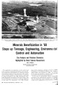
Minerals beneficiation in '69 steps up tonnage, engineering, environmental control and automation: size analysis and flotation chemistry highlighted by basic science researchers
1970
Text
ir_uspace
229
Hydroxamate vs. fatty acid flotation of iron oxide
1970
Text
ir_uspace
230
Pliocene/pleistocene formations in the lower omo basin, southern Ethiopia
1970
Text
ir_uspace
231
Recovery of Iron and Vanadium by Ferrophosphorus Reduction of Copper Smelter Slags
1970
Text
ir_etd
232
Geological and geophysical studies of the Gilson Mountains and vicinity, Juab County, Utah
1970-06
Text
ir_etd
233
Sedimentology and geomorphic significance of the bishop conglomerate and the Browns Park Formation, Eastern Uinta Mountains, Utah, Colorado, And Wyoming (Thesis and maps)
1970-06
Text; Image
ir_etd
234
Geology of the Cedar Mountains,Tooele County, Utah (Thesis and maps)
1970-06
Text; Image
ir_etd
235
Geology of the Paria Northwest quadrangle Kane County, Utah
1970-08
Text
ir_etd
236
Geology of the Paria Northwest quadrangle, Kane County, Utah: Georeferenced map files
1970-08
Image
ir_etd
237
Geology of the Paria Northwest quadrangle Kane County, Utah (Google Earth map overlay KMZ file)
1970-08
Image
ir_etd
238
Mineral deposits of the Deep Creek Mountains, Tooele and Juab Counties, Utah: Georeferenced map files
1970-08
Image
ir_etd
239
Mineral deposits of the Deep Creek Mountains, Tooele and Juab Counties, Utah (Google Earth map overlay KMZ file)
1970-08
Image
ir_etd
240
Mineral deposits of the Deep Creek Mountains, Tooele and Juab Counties, Utah (Thesis and maps)
1970-08
Text; Image
ir_etd
241
Plate 2: Structural sections
1970-08
Image
ir_etd
242
Plate 3: Structural map of the Paria NW quadrangle, Kane County, Utah
1970-08
Image
ir_etd
243
Plate 4: Topographic features of the Paria NW quadrangle, Kane County, Utah
1970-08
Image
ir_etd
244
Plate 3: Structural sections
1970-08
Image
ir_etd
245
Plate 1: Geologic map of the Paria NW quadrangle, Kane County, Utah
1970-08
Image
ir_etd
246
Geology of the Paria Northwest quadrangle Kane County, Utah-Maps
1970-08
Image
ir_etd
247
Boundary layer flow over sloping terrain
1971
Text
ir_etd
248
Mineral processing fundamentals
1971
Text
ir_uspace
249
Stratigraphy and paleontology of Norwood Tuff and Fowkes Formation: northeastern Utah and southwestern Wyoming
1971
Image/StillImage
ir_su
250
A Preliminary study of the use of oxygen isotope ratios as an exploration tool in the Park City District, Utah
1971
Text
ir_etd
226
-
250
of
1,058
<
5
6
7
8
9
10
11
12
13
14
>