Home
Browse
Ask Us
Chat
Harmful Language Statement
Log in
Advanced Search
Year
1915
1916
1917
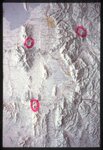
1918
1919
1920
1921
1922
1923
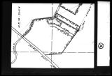
1924
1925
1926
1927
1928
1929
1930
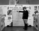
1931
1932
1933
1934
1935
1936
1937
1938
1939
1940
1941
1942
1943
1944
1945
1946
1947
1948
1949
1950
1951
1952
1953
1954
1955
1956
1957
1958
1959
1960
1961
1962
1963
1964
1965
1966
1967
1968
1969
1970
1971
1972
1973
1974
1975
1976
1977
1978
1979
1980
1981
1982
1983
1984
1985
1986
1987
1988
1989
1990
1991
1992
1993
1994
1995
1996
1997
1998
1999
2000
2001
2002
TO
1915
1916
1917
1918
1919
1920
1921
1922
1923
1924
1925
1926
1927
1928
1929
1930
1931
1932
1933
1934
1935
1936
1937
1938
1939
1940
1941
1942
1943
1944
1945
1946
1947
1948
1949
1950
1951
1952
1953
1954
1955
1956
1957
1958
1959
1960
1961
1962
1963
1964
1965
1966
1967
1968
1969
1970
1971
1972
1973
1974
1975
1976
1977
1978
1979
1980
1981
1982
1983
1984
1985
1986
1987
1988
1989
1990
1991
1992
1993
1994
1995
1996
1997
1998
1999
2000
2001
2002
Type
Image
30
Text
1
Format
image/jpeg
30
Collection
Beckwith Photograph Collection
7
Clifton Bray Film Negatives
10
Extractions from the Land: Mining and...
2
Peoples of Utah Revisited
1
Photo Archives
1
Shipler Commercial Photographers
6
Ski and Snow Sports Archives
1
Vernal Express Photographs
2
More
Filters:
Subject:
"Maps"
Type:
"Image"
Year End:
1979
1
-
25
of
30
<
1
2
>
Gallery view
Number of results to display per page
10
25
50
100
200
Sort by Relevance
Sort by Title A-Z
Sort by Title Z-A
Sort by Date Ascending
Sort by Date Descending
Sort by Last Modified Ascending
Sort by Last Modified Descending
Title
Date
Type
Setname
1
1833 Hyrum Reclamation Project Map
1933-01
Image; Text
dha_pour
2
Air View Map
1951-11-07
Image
dha_scp
3
Air View Map
1951-11-07
Image
dha_scp
4
Avalanche tower and map
1940; 1941; 1942; 1943; 1944; 1945; 1946; 1947; 1948; 1949; 1950; 1951; 1952; 1953; 1954; 1955; 1956; 1957; 1958; 1959; 1960; 1961; 1962; 1963; 1964; 1965; 1966; 1967; 1968; 1969
Image
uum_map_usa
5
Dinosaur National Monument
1958-05-29
Image
ucl_vep
6
El Palacio, volume 30, nos.19-20 (May 20, 1931) [02]: Map, Nine Mile Canyon
1931-05-20
Image
dc_bpc
7
Escalante Valley Improvement Company Map
1915-11-19
Image
dha_scp
8
Gunnison Massacre [19] : Map accompanying a transcript of part of Josiah Gibbs' account, from "Lights and Shadows of Mormonism" (1909), pp. 176-189
1926
Image
dc_bpc
9
Kanosh, Black Rock, Pumice and Connor Spring scrapbook [02] : Kanosh mounds inside cover
1930
Image
dc_bpc
10
Kanosh, Black Rock, Pumice and Connor Spring scrapbook [03] : Kanosh mounds
1930
Image
dc_bpc
11
Map of Utah with Cross
1951-10-18
Image
dha_scp
12
Map on Wall at Walgreen Drug Store, May 1936
1936-05-28
Image
dha_cbfm
13
Map on Wall at Walgreen Drug Store, May 1936
1936-05-28
Image
dha_cbfm
14
Map, annotated
1975
Image
dha_eftl
15
Map, July 1938
1938-07-12
Image
dha_cbfm
16
Map, July 1938
1938-07-12
Image
dha_cbfm
17
Map, Mar. 1938
1938-03-03
Image
dha_cbfm
18
Map, Mar. 1938
1938-03-03
Image
dha_cbfm
19
Map, Mar. 1938
1938-03-03
Image
dha_cbfm
20
Map, May 1938
1938-05-16
Image
dha_cbfm
21
Map, Salt Lake Valley
1975
Image
dha_eftl
22
Old Map
1952-03-10
Image
dha_scp
23
PEUP
1949
Image
dc_bpc
24
Safety Exhibit at Coconut Grove, Apr. 1938
1938-04-07
Image
dha_cbfm
25
Safety Exhibit at Coconut Grove, Apr. 1938
1938-04-07
Image
dha_cbfm
1
-
25
of
30
<
1
2
>