| Title | Date | Type | Setname | ||
|---|---|---|---|---|---|
| 1 |
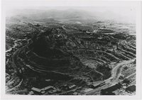 | Sacramento Pit, early Bisbee, Arizona | 1938; 1939; 1940; 1941; 1942 | Image | uum_map |
| 2 |
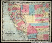 | Bancroft's map of California, Nevada, Utah and Arizona | 1864 | Image | uu_awm |
| 3 |
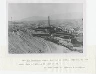 | Old Dominion copper smelter, early Globe, Arizona | 1900; 1901; 1902; 1903; 1904; 1905; 1906; 1907; 1908; 1909; 1910; 1911; 1912; 1913; 1914; 1915; 1916; 1917; 1918; 1919; 1920; 1921; 1922; 1923; 1924; 1925; 1926; 1927; 1928; 1929; 1930; 1931; 1932; 1933; 1934; 1935; 1936; 1937; 1938; 1939; 1940 | Image | uum_map |
| 4 |
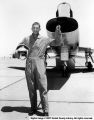 | Larry M. Burke | 1959-07-16 | Image | ucl_vep |
| 5 |
 | Hopi Snake Dance | Image | dc_bpc | |
| 6 |
 | Butterfly Dance | 1938 | Image | dc_bpc |
| 7 |
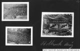 | Kanosh, Black Rock, Pumice and Connor Spring scrapbook [34] | Image | dc_bpc | |
| 8 |
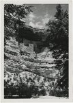 | Indian Dwellings: Cliff Dwellings [01] | 1945; 1946; 1947; 1948; 1949; 1950; 1951; 1952; 1953; 1954; 1955; 1956; 1957; 1958; 1959; 1960; 1961; 1962; 1963; 1964; 1965; 1966; 1967 | Image | uum_map |
| 9 |
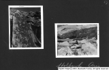 | Kanosh, Black Rock, Pumice and Connor Spring scrapbook [44] | Image | dc_bpc | |
| 10 |
 | Kanosh, Black Rock, Pumice and Connor Spring scrapbook [45] | Image | dc_bpc | |
| 11 |
 | B. P. road in Bonita Canyon | 1940; 1941; 1942; 1943; 1944; 1945; 1946; 1947; 1948; 1949; 1950; 1951; 1952; 1953; 1954; 1955; 1956; 1957; 1958; 1959; 1960 | Image | uum_map |
| 12 |
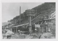 | Early smelter, Bisbee, Arizona | 1900; 1901; 1902; 1903; 1904; 1905; 1906; 1907; 1908; 1909; 1910; 1911; 1912; 1913; 1914; 1915; 1916; 1917; 1918; 1919; 1920; 1921; 1922; 1923; 1924; 1925; 1926; 1927; 1928; 1929; 1930; 1931; 1932; 1933; 1934; 1935; 1936; 1937; 1938; 1939; 1940 | Image | uum_map |
| 13 |
 | First telegraph station in Arizona | 1930; 1931; 1932; 1933; 1934; 1935; 1936; 1937; 1938; 1939; 1940; 1941; 1942; 1943; 1944; 1945; 1946; 1947; 1948; 1949; 1950; 1951; 1952; 1953; 1954; 1955; 1956; 1957; 1958; 1959; 1960 | Image | uum_map |
| 14 |
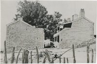
 | Globe, Arizona, late 1880s or '90s | 1887; 1888; 1889; 1890; 1891; 1892; 1893; 1894; 1895; 1896; 1897; 1898; 1899; 1900 | Image | uum_map |
| 15 |
 | Mormon Battalion P.4 | Image | dha_cp | |
| 16 |
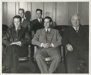 | Utah-Arizona Polygamy: Polygamous husbands who were arrested, convicted and sent to the Utah State Prison [05] | 1945-05-15 | Image | uum_map |
| 17 |
 | Utah-Arizona Polygamy: Polygamous husbands who were arrested, convicted and sent to the Utah State Prison [07] | 1945-05-15 | Image | uum_map |
| 18 |
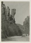
 | Bit of Grand Canyon cornice work | 1920; 1921; 1922; 1923; 1924; 1925; 1926; 1927; 1928; 1929; 1930; 1931; 1932; 1933; 1934; 1935; 1936; 1937; 1938; 1939; 1940; 1941; 1942; 1943; 1944; 1945; 1946; 1947; 1948; 1949; 1950 | Image | uum_map |
| 19 |
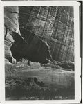 | Canyon de Chelly, Indian ruins | 1873 | Image | uum_map |
| 20 |
 | Farm empire, Salt River Valley, Arizona | 1945; 1946; 1947; 1948; 1949; 1950; 1951; 1952; 1953; 1954; 1955 | Image | uum_map |
| 21 |
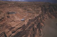 | Aerial of north side of canyon, paved view area. | 1962-08 | Image | uum_map_rr |
| 22 |
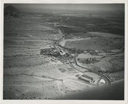
 | Aerial photo of dam site. | 1958-04 | Image | uum_map_rr |
| 23 |
 | Aerial photo of dam site. | 1958-04 | Image | uum_map_rr |
| 24 |
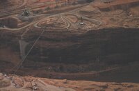 | Aerial photo of dam site. | 1958-10 | Image | uum_map_rr |
| 25 |
 | Aerial photo of dam site. | 1958-04 | Image | uum_map_rr |