Home
Browse
Ask Us
Chat
Harmful Language Statement
Log in
Uintah County Regional History Center Maps
Advanced Search
Year
1825
1826
1827
1828
1829
1830
1831
1832
1833
1834
1835
1836
1837
1838
1839
1840
1841
1842
1843
1844
1845
1846
1847
1848
1849
1850
1851
1852
1853
1854
1855
1856
1857
1858
1859
1860
1861
1862
1863
1864
1865
1866
1867
1868
1869
1870
1871
1872
1873
1874
1875
1876
1877
1878
1879
1880
1881
1882
1883
1884
1885
1886
1887
1888
1889
1890
1891
1892
1893
1894
1895
1896
1897
1898
1899
1900
1901
1902
1903
1904
1905
1906
1907
1908
1909
1910
1911
1912
1913
1914
1915
1916
1917
1918
1919
1920
1921
1922
1923
1924
1925
1926
1927
1928
1929
1930
1931
1932
1933
1934
1935
1936
1937
1938
1939
1940
1941
1942
1943
1944
1945
1946
1947
1948
1949
1950
1951
1952
1953
1954
1955
1956
1957
1958
1959
1960
1961
1962
1963
1964
1965
1966
1967
1968
1969
1970
1971
1972
1973
1974
1975
1976
1977
1978
1979
1980
1981
1982
1983
1984
1985
1986
1987
1988
1989
1990
1991
1992
1993
1994
1995
1996
1997
1998
1999
2000
2001
2002
2003
2004
2005
2006
2007
2008
2009
2010
2011
2012
2013
2014
TO
1825
1826
1827
1828
1829
1830
1831
1832
1833
1834
1835
1836
1837
1838
1839
1840
1841
1842
1843
1844
1845
1846
1847
1848
1849
1850
1851
1852
1853
1854
1855
1856
1857
1858
1859
1860
1861
1862
1863
1864
1865
1866
1867
1868
1869
1870
1871
1872
1873
1874
1875
1876
1877
1878
1879
1880
1881
1882
1883
1884
1885
1886
1887
1888
1889
1890
1891
1892
1893
1894
1895
1896
1897
1898
1899
1900
1901
1902
1903
1904
1905
1906
1907
1908
1909
1910
1911
1912
1913
1914
1915
1916
1917
1918
1919
1920
1921
1922
1923
1924
1925
1926
1927
1928
1929
1930
1931
1932
1933
1934
1935
1936
1937
1938
1939
1940
1941
1942
1943
1944
1945
1946
1947
1948
1949
1950
1951
1952
1953
1954
1955
1956
1957
1958
1959
1960
1961
1962
1963
1964
1965
1966
1967
1968
1969
1970
1971
1972
1973
1974
1975
1976
1977
1978
1979
1980
1981
1982
1983
1984
1985
1986
1987
1988
1989
1990
1991
1992
1993
1994
1995
1996
1997
1998
1999
2000
2001
2002
2003
2004
2005
2006
2007
2008
2009
2010
2011
2012
2013
2014
Type
Image/StillImage
116
Format
application/pdf
59
image/jpeg
57
Collection
Uintah County Regional History Center...
116
Filters:
Collection:
"ucl_maps"
Year End:
1959
101
-
125
of
116
<
1
2
3
4
5
>
Gallery view
Number of results to display per page
10
25
50
100
200
Sort by Relevance
Sort by Title A-Z
Sort by Title Z-A
Sort by Date Ascending
Sort by Date Descending
Sort by Last Modified Ascending
Sort by Last Modified Descending
Title
Date
Type
101
Uintah Indian Reserve, Northeast Boundary - Sept. 1875
1875
Image/StillImage
102
Uintah Indian Reserve, Utah, North-East Boundary - 1875
1875
Image/StillImage
103
Uintah Railway Elevation Map 1930
1930
Image/StillImage
104
Uintah School 1906-1940
1906; 1907; 1908; 1909; 1910; 1911; 1912; 1913; 1914; 1915; 1916; 1917; 1918; 1919; 1920; 1921; 1922; 1923; 1924; 1925; 1926; 1927; 1928; 1929; 1930; 1931; 1932; 1933; 1934; 1935; 1936; 1937; 1938; 1939; 1940
Image/StillImage
105
Uintah School District 1 thru 7, 1910-1917
1910; 1911; 1912; 1913; 1914; 1915; 1916; 1917
Image/StillImage
106
Uintah School District 12 and 13, 1910-1917
1910; 1911; 1912; 1913; 1914; 1915; 1916; 1917
Image/StillImage
107
United States and Texas, Mexico, and Guatemala - 1839
1839
Image/StillImage
108
United States Civilian Conservation Corps - Vernal Camp - D6-31 Company 1507
1938
Image/StillImage
109
Unorganized Mining District, Uinta County (7 Separate Claims)
1922; 1923
Image/StillImage
110
Unorganized Mining District, Uintah County (29 Separate Claims)
1905
Image/StillImage
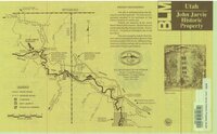
111
Utah - John Jarvie Historic Property - BLM
1949
Image/StillImage
112
Utah Map
1861; 1862
Image/StillImage
113
Utah Map of State Roads - State Road Commission 1915 - 1916
1915; 1916
Image/StillImage
114
Vacation Map of Uintah County, Utah 1948
1948
Image/StillImage
115
West from Fort Bridger, Pioneer Trails Across Utah 1846-1850
1846; 1947; 1948; 1849; 1850
Image/StillImage
116
Whiterocks Ashley National Forest Structural Nose 1957
1957
Image/StillImage
101
-
125
of
116
<
1
2
3
4
5
>