Home
Browse
Ask Us
Chat
Harmful Language Statement
Log in
Advanced Search
Year
1853
1854
1855
1856
1857
1858
1859
1860
1861
1862
1863
1864
1865
1866
1867
1868
1869
1870
1871
1872
1873
1874
1875
1876
1877
1878
1879
1880
1881
1882
1883
1884
1885
1886
1887
1888
1889
1890
1891
1892
1893
1894
1895
1896
1897
1898
1899
1900
1901
1902
1903
1904
1905
1906
1907
1908
1909
1910
1911
1912
1913
1914
1915
1916
1917
1918
1919
1920
1921
1922
1923
1924
1925
1926
1927
1928
1929
1930
1931
1932
1933
1934
1935
1936
1937
1938
1939
1940
1941
1942
1943
1944
1945
1946
1947
1948
1949
1950
1951
1952
1953
1954
1955
1956
1957
1958
1959
1960
1961
1962
1963
1964
1965
1966
1967
1968
1969
1970
1971
1972
1973
1974
1975
1976
1977
1978
1979
1980
1981
1982
1983
1984
1985
1986
1987
1988
1989
1990
1991
1992
1993
1994
1995
1996
1997
1998
1999
2000
2001
2002
2003
2004
2005
2006
2007
2008
2009
TO
1853
1854
1855
1856
1857
1858
1859
1860
1861
1862
1863
1864
1865
1866
1867
1868
1869
1870
1871
1872
1873
1874
1875
1876
1877
1878
1879
1880
1881
1882
1883
1884
1885
1886
1887
1888
1889
1890
1891
1892
1893
1894
1895
1896
1897
1898
1899
1900
1901
1902
1903
1904
1905
1906
1907
1908
1909
1910
1911
1912
1913
1914
1915
1916
1917
1918
1919
1920
1921
1922
1923
1924
1925
1926
1927
1928
1929
1930
1931
1932
1933
1934
1935
1936
1937
1938
1939
1940
1941
1942
1943
1944
1945
1946
1947
1948
1949
1950
1951
1952
1953
1954
1955
1956
1957
1958
1959
1960
1961
1962
1963
1964
1965
1966
1967
1968
1969
1970
1971
1972
1973
1974
1975
1976
1977
1978
1979
1980
1981
1982
1983
1984
1985
1986
1987
1988
1989
1990
1991
1992
1993
1994
1995
1996
1997
1998
1999
2000
2001
2002
2003
2004
2005
2006
2007
2008
2009
Type
Image
417
Image/StillImage
26
Text
8
Image/MovingImage
1
Format
image/jpeg
458
Collection
Al W. Morton Collection, 1930s-1950s
1
American Westward Migration
6
Beckwith Photograph Collection
2
Classified Photographs
129
Multimedia Archives Photographs - Rea...
1
Peoples of Utah
1
Photo Archives
121
Shipler Commercial Photographers
112
Ski and Snow Sports Photo Archives
11
UAIDA Main Collection
26
Utah River Running Photo Archives
48
More
Filters:
Format:
"image/jpeg"
Spatial Coverage:
"Nevada"
1
-
25
of
458
<
1
2
3
4
5
6
7
8
9
10
>
Gallery view
Number of results to display per page
10
25
50
100
200
Sort by Relevance
Sort by Title A-Z
Sort by Title Z-A
Sort by Date Ascending
Sort by Date Descending
Sort by Last Modified Ascending
Sort by Last Modified Descending
Title
Date
Type
Setname
1
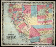
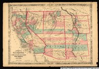
Bancroft's map of California, Nevada, Utah and Arizona
1864
Image
uu_awm
2
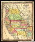
New map of the state of California, the territories of Oregon, Washington, Utah & New Mexico.
1853
Image/StillImage
uu_awm
3
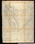
Map no. 2, from the Great Salt Lake to the Humboldt Mountains.
1855
Image/StillImage
uu_awm
4
Goshute Indian Reservation Nevada and Utah
Image/StillImage
uaida_main
5
Kumu-muru
Image
dc_bpc
6
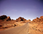
Valley of Fire
1950; 1951; 1952; 1953; 1954; 1955; 1956; 1957; 1958; 1959; 1960
Image/StillImage
dha_alwmc
7
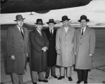
William Dawson, second from left; Senator Russell Long on the right
Image
uum_map
8
Visits to Mountain Meadows by Frank A. Beckwith [67] : Without hatred, without malice, without rancor: September 1857--September 1950 (Page 17)
1950
Image
dc_bpc
9
Johnson's California, with Utah, Nevada, Colorado, New Mexico, and Arizona.
1864
Image/StillImage
uu_awm
10
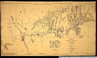
Map showing the different routes travelled over by the detachments of the Overland Command in the spring of 1855 from Salt Lake City, Utah, to the Bay of San Francisco.
1855
Image/StillImage
uu_awm
11
Map of wagon routes in Utah Territory explored and opened by Capt. J. H. Simpson...in 1858-59.
1859
Image/StillImage
uu_awm
12
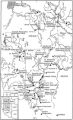
Boundary of Shoshone Indian Territory, showing the locations of the Bannock
1957
Image/StillImage
uaida_main
13
Map of Shoshone Indian Territory, and the Division of Shoshone Boundaries in Nevada
Image/StillImage
uaida_main
14
Nevada - California Hawthorne Quadrangle; 1909
1909
Image
uum_map
15
Photographic copy of U.S. Geologic Survey Publication Geological Chart of the State of Nevada; Showing location of Fairview, Churchill County, Nevada
Image
uum_map
16
Pulitzer-Prize novelist Wally Stegner on location for "Wilderness Journal," Black Rock Desert
1983
Image/StillImage
uum_map
17
Wallace Stegner and William Devane, Nevada
1983
Image/StillImage
uum_map
18
Boundary of Shoshone Indian Territory, showing the locations of the Bannock from 1819 to 1951
1957
Image/StillImage
uaida_main
19
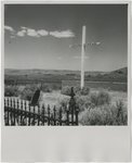
Lucinda Duncan grave marker, Nevada
1945; 1946; 1947; 1948; 1949; 1950; 1951; 1952; 1953; 1954; 1955; 1956; 1957; 1958; 1959; 1960; 1961; 1962; 1963; 1964; 1965
Image
uum_map
20
Machinery
1908; 1909; 1910; 1911; 1912
Image
uum_map
21
Machinery
1908; 1909; 1910; 1911; 1912
Image
uum_map
22
Map of Western Shoshone and Northern Paiute Territory
Image/StillImage
uaida_main
23
Nevada - Carson Sink Quadrangle; 1910
1910
Image
uum_map
24
Photographic copy of List of Mining Districts; 1912-1914
1914
Image
uum_map
25
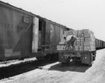
Railroad Freighting P.1
Image
dha_cp
1
-
25
of
458
<
1
2
3
4
5
6
7
8
9
10
>