Home
Browse
Ask Us
Chat
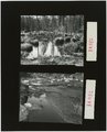
Harmful Language Statement
Log in
Advanced Search
Year
1925
1926
1927
1928
1929
1930
1931
1932
1933
1934
1935
1936
1937
1938
1939
1940
1941
1942
1943
1944
1945
1946
1947
1948
1949
1950
1951
1952
1953
1954
1955
1956
1957
1958
1959
1960
1961
1962
1963
1964
1965
1966
1967
1968
1969
1970
1971
1972
1973
1974
1975
1976
1977
1978
1979
1980
1981
1982
1983
1984
1985
1986
1987
1988
1989
1990
1991
1992
1993
1994
1995
1996
1997
1998
1999
2000
2001
2002
2003
TO
1925
1926
1927
1928
1929
1930
1931
1932
1933
1934
1935
1936
1937
1938
1939
1940
1941
1942
1943
1944
1945
1946
1947
1948
1949
1950
1951
1952
1953
1954
1955
1956
1957
1958
1959
1960
1961
1962
1963
1964
1965
1966
1967
1968
1969
1970
1971
1972
1973
1974
1975
1976
1977
1978
1979
1980
1981
1982
1983
1984
1985
1986
1987
1988
1989
1990
1991
1992
1993
1994
1995
1996
1997
1998
1999
2000
2001
2002
2003
Type
Text
4
Image/StillImage
1
Format
application/pdf
44
Collection
Photo Archives
40
Western Waters NEH
4
Filters:
Format:
"application/pdf"
Spatial Coverage:
"Uinta Mountains (Utah and Wyo.)"
1
-
25
of
44
<
1
2
>
Gallery view
Number of results to display per page
10
25
50
100
200
Sort by Relevance
Sort by Title A-Z
Sort by Title Z-A
Sort by Date Ascending
Sort by Date Descending
Sort by Last Modified Ascending
Sort by Last Modified Descending
Title
Date
Type
Setname
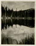
1
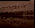
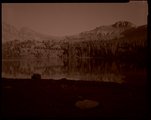
Mountain lake, Uintas?
1925; 1926; 1927; 1928; 1929; 1930; 1931; 1932; 1933; 1934; 1935; 1936; 1937; 1938; 1939; 1940
Image/StillImage
uum_map
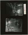
2
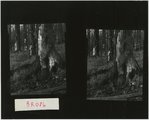
Stillwater number 12 and 13 [Contact prints]
2001-07-22
uum_map
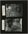
3
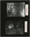
Stillwater number 14; Bear River Bottoms number 11 [Contact prints]
2001-07-22; 2001-09-21
uum_map
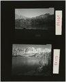
4
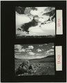
Stillwater number 7 and 8 [Contact prints]
2001-07-21
uum_map
5
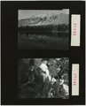
Stillwater number 9 and 10 [Contact prints]
2001-07-21
uum_map
6
Stream in winter; Proposed Washakie Reservoir 17 [Contact prints]
2002-03-20; 2002-04-22
uum_map
7
East Fork Bear River, burnt trees and grass number 17 and 18 [Contact prints]
2003-07-16
uum_map
8
East Fork Bear River: burnt trees and fireweed; burnt saplings and beaver pond [Contact prints]
2003-07-16
uum_map
9
Beaver Pond number 16; Black Canyon number 16 [Contact prints]
2001-09-20; 2001-10-10
uum_map
10
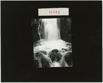
Ostler Falls [Contact prints]
2003-07-17
uum_map
11
Stillwater drainage, marshy meadow
2001-07-22
uum_map
12
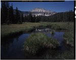
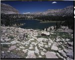
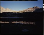
Stillwater drainage, Mount Agassiz
2001-07-22
uum_map
13
Stillwater drainage, Mount Agassiz [negative]
2001-07-22
uum_map
14
Stillwater drainage, pond with reeds and rocks [negative]
2001-07-22
uum_map
15
Stillwater drainage, pond with rocks [negative]
2001-07-22
uum_map
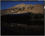
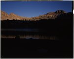
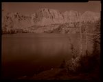
16
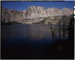
Stillwater drainage, Ryder Lake
2001-07-21
uum_map
17
Stillwater drainage, Ryder Lake
2001-07-21
uum_map
18
Stillwater drainage, Ryder Lake [negative] [1]
2001-07-21
uum_map
19
Stillwater drainage, Ryder Lake [negative] [2]
2001-07-21
uum_map
20
Stillwater drainage, Ryder Lake [negative] [3]
2001-07-21
uum_map
21
Stillwater drainage, Ryder Lake [negative] [4]
2001-07-21
uum_map
22
Stillwater drainage, Ryder Lake outlet
2001-07-21
uum_map
23
Stillwater drainage, small falls
2001-07-21
uum_map
24
Stillwater drainage, springs
2001-07-21
uum_map
25
Stillwater drainage, upper Middle Basin springs
2001-07-21
uum_map
1
-
25
of
44
<
1
2
>