|
|
Creator | Title | Description | Subject | Date |
| 1 |
 |
Brown, Francis Harold | The lower Omo basin | The boundaries of the Lower Omo Basin have been mapped by Fuchs (1939) and by Butzer (1970, 1971) in a general way. The structural features and physiography of the eastern and central part of the Lower Omo Basin are best expressed on the maps of Davidson et al. (1973). Walsh and Dodson (1969) have m... | | 1983 |
| 2 |
 |
Chapman, David S. | Exhumation of the central Wasatch Mountains, Utah: 1, Patterns and timing of exhumation deduced from low-temperature thermochronology data | The Wasatch Mountains are often cited as an example of normal fault growth and footwall flexure. They represent a tilted footwall at the edge of the Basin and Range extensional province, a major rift basin. Thus understanding the detailed spatial and elevation changes in coupled thermochronometer da... | Uplift; Exhumation; Wasatch Fault; Wasatch Mountains; Utah; Helium dating; Fission track; Tectonophysics; Extensional tectonics; Geothermal observations | 2002 |
| 3 |
 |
Brown, Francis Harold | Geological development of the Omo-Turkana Basin during the pliocene and pleistocene epochs | Pliocene and Pleistocene deposits of the Omo-Turkana Basin extend from 6?N latitude to about 2?N latitude (-450 km), and laterally from about 35.5?E to 36.5?E. Sediments are brought to the basin by the Omo River which rises in Ethiopia, and by the Turkwel and Kerio Rivers which rise in Kenya and Uga... | | 2004 |
| 4 |
 |
Brown, Francis Harold | Magnetostratigraphy of the shungura and usno formations, Southwestern Ethiopia: new data and comprehensive reanalysis | | | 1978 |
| 5 |
 |
Jarrard, Richard D. | Seismic stratigraphy and history of deep circulation and sediment drift development in Baffin Bay and the Labrador Sea | Drilling results and seismic-reflection records at and across Ocean Drilling Program (ODP) Sites 645 (western Baffin Bay), 646, and 647 (Labrador Sea) provide important constraints on the history of deep-water circulation and sedimentation in response to Cenozoic climatic change, as well as the tect... | | 1989 |
| 6 |
 |
Brown, Francis Harold | Horizontal sediments of the lower Omo valley: the kibish formation | The existence of old lacustrine deposits in the Lake Rudolf Basin was first recognized by Hohnel et al. (1891 : 20f., 134) and subsequently confirmed by the work of M. Sacchi (Angelis and Millosevich, 1900) and E. Brumpt (Bourg de Bozas, 1903: 107ff.), Fuchs (1935, 1939), Champion (1937), and Aramb... | | 1969 |
| 7 |
 |
Brown, Francis Harold | Magnetostratigraphy of the shungura and usno formations, lower Omo Valley, Ethiopia | | | 1976 |
| 8 |
 |
Jewell, Paul | Geochemistry and paleoceanographic setting of Central Nevada bedded barites | The bedded barite deposits of central Nevada are hosted by rocks of the Roberts Mountains allochthon and constitute the largest barite reserves in North America. Detailed geochemical studies of three barite deposits in the Devonian Slaven Chert indicate that rocks surrounding the barite have elevate... | Bedded barites; Roberts Mountains allochthon; Late Devonian | 1991 |
| 9 |
 |
Brown, Francis Harold | The evolution of neogene terrestrial ecosystems in Europe | The Pliocene-Pleistocene chronology of hominid and other vertebrate evolution in East Africa is largely constrained by isotopic dating and regional intercorrelation of volcanic ash layers. Some eruptions were of sufficient magnitude or duration that their widespread tephra dispersal defines a serie... | | 1999 |
| 10 |
 |
Chapman, David S.; Allis, Richard George | Late Neogene exhumation patterns in Taranaki Basin (New Zealand): evidence from offset porosity-depth trends | Taranaki Basin, New Zealand, is located adjacent to the Australian-Pacific Plate boundary where the tectonic regime changes from dominantly subduction-related to the north to transpression-related along the Alpine Fault to the south. During the Neogene, burial and exhumation varied extensively, in ... | Neogene; Uplift; Exhumation; Taranaki Basin; New Zealand | 1998 |
| 11 |
 |
Jewell, Paul | Paleoredox conditions and the origin of bedded barites along the Late Devonian North American continental margin | The most important controls of the redox state of natural waters are the flux of organic matter from the photic zone, the degree of physical mixing, and oxygen concentrations of any connecting water masses. In coastal upwelling zones, these factors can be described with a simple box model constraine... | Bedded barites; Late Devonian; Continental margin; Redox state | 1994 |
| 12 |
 |
Brown, Francis Harold | Some early pleistocene deposits of the lower Omo valley: the Usno formation | Early Pleistocene deposits of the Rudolf Basin have been described by E. Brumpt (Bourg de Bozas, 1903: 107 ff.), Arambourg (1943: 190 ff.), Fuchs (1939), Patterson (1966), and Butzer and Thurber (1969). These include the Omo Beds, first recognized by Brumpt in 1902 and subsequently studied by Arambo... | | 1969 |
| 13 |
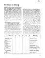 |
Brown, Francis Harold | Methods of dating | The fossil record of primates begins in the latest Cretaceous period, so primate palaeontologists are interested in techniques of dating applicable over the past 70 million years. Fossil bones themselves are rarely datable with any precision, and these are mainly of late Pleistocene or Holocene age.... | | 1992 |
| 14 |
 |
Brown, Francis Harold | Timing of volcanism and evolution of the northern Kenya Rift | The northern Kenya Rift is bounded on the west by uplands of Turkana which comprise horst-like blocks that include metamorphic basement rocks, locally overlain unconformably by the Cretaceous Lubur Sandstone, in turn overlain by predominantly volcanic sequences in which relatively thin sedimentary p... | | 2009 |
| 15 |
 |
Brown, Francis Harold | Radiometric dating and tuff mineralogy of omo group deposits | Through the efforts of the Omo Research Expedition and the East Rudolf Research Group, a large number of vertebrate fossils have been collected from the sedimentary deposits near the northern end of Lake Rudolf in Kenya and in the lower Omo valley in Ethiopia. The hominid fossils collected in this a... | | 1976 |
| 16 |
 |
Brown, Francis Harold | Gombe group basalts and initiation of pliocene deposition in the Turkana depression, northern Kenya and southern Ethiopia | A little before 4 Ma ago, deposition of Pliocene and Pleistocene strata described as the Omo Group began in the Turkana and Omo basins of northern Kenya and southern Ethiopia. Soon after, basaltic magma erupted as thin lava flows, and intruded as dykes into the oldest Pliocene strata of the basin. T... | | 2004 |
| 17 |
 |
Jewell, Paul | Geology and geothermal potential North of Wells, Nevada | This report was prepared as an account of work sponsored by an agency of the United States Government. Neither the United States Government nor any agency Thereof, nor any of their employees, makes any warranty, express or implied, or assumes any legal liability or responsibility for the accuracy, ... | Tertiary sediments; Siltstones; Conglomerates; Lithologies; Well logs; Aquifers; Step faults | 1982-01-01 |
| 18 |
 |
Chapman, David S. | Regional heat-flow variations across the sedimented Juan de Fuca Ridge eastern flank: constraints on lithospheric cooling and lateral hydrothermal heat transport | Seafloor heat flow has been estimated continuously along a transect on the sedimented eastern flank of the Juan de Fuca Ridge to provide constraints on the scale and rate of lateral heat and fluid transport in the upper igneous crust, and on the total flux from the young lithosphere beneath. The ... | Juan de Fuca Ridge; Seafloor; Lithospheric cooling; Hydrothermal heat transport | 1999 |
| 19 |
 |
Jewell, Paul | Circulation, salinity, and dissolved oxygen in the Cretaceous North American seaway | Critical paleoceanographic problems regarding the maximum transgressive phase of the Cretaceous North American seaway have been studied with a three-dimensional ocean circulation model. Four simulations employing minimum and maximum solar insolation winds from the Cretaceous and a wide range of pre... | Cretaceous North American Seaway | 1996 |
| 20 |
 |
Jewell, Paul | Controls of tufa development in Pleistocene Lake Bonneville, Utah | Prominent tufa localities along the Provo level (∼14,000 14C yr B.P.) shoreline in Pleistocene Lake Bonneville have been characterized in detail. Three types of tufa are recognized: capping tufa, beachrock, and capping tufa over beachrock. Capping tufa and beachrock are end members of a continuum ... | Tufa; Pleistocene; Pluvial lakes | 2006 |
| 21 |
 |
Zhdanov, Michael | Cross-well electromagnetic imaging in three dimensions | In this paper, we develop a new technique for 3D cross-well electromagnetic tomography, based on an EM borehole survey consisting of a moving vertical magnetic dipole transmitter, located in one or several boreholes, and a tri-axial induction receiver, located in the other boreholes. The method is b... | | 2003 |
| 22 |
 |
Zhdanov, Michael | Large-scale 3D inversion of marine magnetotelluric data: Case study from the Gemini prospect, Gulf of Mexico | Three-dimensional magnetotelluric (MT) inversion is an emerging technique for offshore hydrocarbon exploration. We have developed a new approach to the 3D inversion of MT data, based on the integral equation method. The Tikhonov regularization and physical constraint have been used to obtain a stab... | | 2011 |
| 23 |
 |
Chapman, David S. | Exhumation of the central Wasatch Mountains, Utah: 2, thermokinematic model of exhumation, erosion, and thermochronometer interpretation | The Wasatch fault is a ~370 km long normal fault in Utah that marks the boundary between the stable Colorado Plateau to the east and the extending Basin and Range to the west. Understanding the thermokinematic evolution of this fault can provide insights into intracontinental extensional tectonics a... | Uplift; Exhumation; Wasatch Fault; Wasatch Mountains; Utah; Helium dating; Fission track; Tectonophysics; Extensional tectonics; Geothermal observations | 2002 |
| 24 |
 |
Brown, Francis Harold | Magnetostratigraphy of the Koobi Fora Formation, Lake Turkana, Kenya | The Koobi Fora Formation, a Pliocene and Pleistocene sequence of sedimentary deposits northeast of Lake Turkana, has yielded numerous fossils and stone artifacts of early hominids. Stratigraphic correlation of the hominid-bearing deposits throughout the Turkana region was established primarily by th... | | 1986 |
| 25 |
 |
Jewell, Paul | The geology and geothermal setting of the Magic Reservoir Area, Blaine and Camas Counties, Idaho | The Magic Reservoir area straddles the Blaine- Camas county line in south-central Idaho, along the northern boundary of the central Snake River Plain. The rocks exposed at Magic Reservoir include a 5.8- million-year-old rhyolite flow, the Pliocene Square Mountain Basalt, multiple cooling units ... | | 1982 |