51 - 75 of 87
Number of results to display per page
TitleDateType
51 K. Gunn McKay Papers: general correspondence regarding the Intermountain Indian School and information about the Bureau of Indian Affairs1973; 1974Text
52 K. Gunn McKay Papers: general correspondence and press releases regarding the Intermountain Indian School1973Text
53 K. Gunn McKay Papers: general correspondence and reports regarding the Intermountain Indian School1973; 1974Text
54 K. Gunn McKay Papers: general correspondence, meeting attendance, and task force information regarding the Intermountain Indian School1973; 1974Text
55 K. Gunn McKay Papers: miscellaneous documents regarding the Intermountain Indian School1973Text
56 K. Gunn McKay Papers: protests against the closure of and other administrative information about the Intermountain Indian School1975Text
57 K. Gunn McKay Papers: resolutions regarding the Intermountain Indian School1973; 1974; 1975Text
58 K. Gunn McKay Papers: statistics and enrollment information regarding the Intermountain Indian School1973; 1974; 1975Text
59 Map of a portion of the Uncompahgre Ute Indian Reservation1908Image/StillImage
60 Map of a portion of the Uncompahgre Ute Indian Reservation, surveyed and subdivided for allotments to the Uncompahgre Ute Indians in accordance with the Act approved June 1880 by authority of Honorable N. C. McFarland, Commissioner General Land Office Daniel G. Major U.S. Surveyor 1882-18831882; 1883Image/StillImage
61 Map of Indian Reservation in the West, 1929Image/StillImage
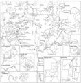
62 Map of Indian Reservations in the Western United StatesImage/StillImage
63 Map of Reservations of the Western United States and the Religions that Worked on the Reservations 1870's1873Image/StillImage
64 Map of the Northern Part of the Former Uintah Indian Reservation Showing the Irrigation SystemImage/StillImage
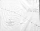
65 Map of the South West Boundary of the Uintah Indian Reserve Utah Territory.Image/StillImage
66 Map of the Southern Part of the Former Uintah Indian Reservation Showing the Irrigation System of Indian AllotmentsImage/StillImage
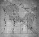
67 Map of Uintah Reservation. Green River AreaImage/StillImage
68 Map of Ute Reservation in Western Colorado, and Lands Ceded Over Time1882Image/StillImage
69 Moshoquop, the Avenger, as Loyal Friend1928; 1929; 1930; 1931; 1932; 1933Text
70 No Place To Pitch Their Teepees: Shoshone Adaptation To Mormon Settlers In Cache Valley, 1855-18701995Text
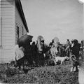
71 Scene at White Rocks on ration day showing baby carriers Summer '09Image/StillImage
72 Scene at White Rocks, ration day, Summer '09Image/StillImage
73 Scene at White Rocks, ration day, Summer '09Image/StillImage
74 Scene at White Rocks, Ration day, Summer '091909Image/StillImage
75 Scene in White Rocks on ration day showing baby carrier, Summer '09Image/StillImage
51 - 75 of 87