Home
Browse
Ask Us
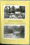
Chat
Harmful Language Statement
Log in
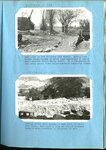
Advanced Search
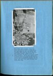
Year
1800
1801
1802
1803
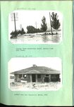
1804
1805
1806
1807
1808
1809
1810
1811
1812
1813
1814
1815
1816
1817
1818
1819
1820
1821
1822
1823
1824
1825
1826
1827
1828
1829
1830
1831
1832
1833
1834
1835
1836
1837
1838
1839
1840
1841
1842
1843
1844
1845
1846
1847
1848
1849
1850
1851
1852
1853
1854
1855
1856
1857
1858
1859
1860
1861
1862
1863
1864
1865
1866
1867
1868
1869
1870
1871
1872
1873
1874
1875
1876
1877
1878
1879
1880
1881
1882
1883
1884
1885
1886
1887
1888
1889
1890
1891
1892
1893
1894
1895
1896
1897
1898
1899
1900
1901
1902
1903
1904
1905
1906
1907
1908
1909
1910
1911
1912
1913
1914
1915
1916
1917
1918
1919
1920
1921
1922
1923
1924
1925
1926
1927
1928
1929
1930
1931
1932
1933
1934
1935
1936
1937
1938
1939
1940
1941
1942
1943
1944
1945
1946
1947
1948
1949
1950
1951
1952
1953
1954
1955
1956
1957
1958
1959
1960
1961
1962
1963
1964
1965
1966
1967
1968
1969
1970
1971
1972
1973
1974
1975
1976
1977
1978
1979
1980
1981
1982
1983
1984
1985
1986
1987
1988
1989
1990
1991
1992
1993
1994
1995
1996
1997
1998
1999
2000
2001
2002
2003
2004
2005
2006
2007
2008
2009
2010
TO
1800
1801
1802
1803
1804
1805
1806
1807
1808
1809
1810
1811
1812
1813
1814
1815
1816
1817
1818
1819
1820
1821
1822
1823
1824
1825
1826
1827
1828
1829
1830
1831
1832
1833
1834
1835
1836
1837
1838
1839
1840
1841
1842
1843
1844
1845
1846
1847
1848
1849
1850
1851
1852
1853
1854
1855
1856
1857
1858
1859
1860
1861
1862
1863
1864
1865
1866
1867
1868
1869
1870
1871
1872
1873
1874
1875
1876
1877
1878
1879
1880
1881
1882
1883
1884
1885
1886
1887
1888
1889
1890
1891
1892
1893
1894
1895
1896
1897
1898
1899
1900
1901
1902
1903
1904
1905
1906
1907
1908
1909
1910
1911
1912
1913
1914
1915
1916
1917
1918
1919
1920
1921
1922
1923
1924
1925
1926
1927
1928
1929
1930
1931
1932
1933
1934
1935
1936
1937
1938
1939
1940
1941
1942
1943
1944
1945
1946
1947
1948
1949
1950
1951
1952
1953
1954
1955
1956
1957
1958
1959
1960
1961
1962
1963
1964
1965
1966
1967
1968
1969
1970
1971
1972
1973
1974
1975
1976
1977
1978
1979
1980
1981
1982
1983
1984
1985
1986
1987
1988
1989
1990
1991
1992
1993
1994
1995
1996
1997
1998
1999
2000
2001
2002
2003
2004
2005
2006
2007
2008
2009
2010
Type
Image/StillImage
1,035
Text
76
Image
50
Sound
23
Format
image/jpeg
1,066
application/pdf
138
video/mp4
18
audio/mpeg
5
Collection
Daughters of Utah Pioneers, Phillips ...
20
Photo Archives
1,124
Ski and Snow Sports Archives
4
UAIDA Main Collection
1
Utah Humanities Research Foundation
2
Utah Quilt Heritage Records
53
Western Soundscape
23
More
Filters:
Spatial Coverage:
"Davis County (Utah)"
1
-
25
of
1,227
<
1
2
3
4
5
6
7
8
9
10
>
Gallery view
Number of results to display per page
10
25
50
100
200
Sort by Relevance
Sort by Title A-Z
Sort by Title Z-A
Sort by Date Ascending
Sort by Date Descending
Sort by Last Modified Ascending
Sort by Last Modified Descending
Title
Date
Type
Setname
1
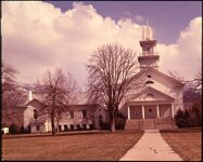
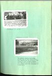
Bountiful Tabernacle [02]
1970; 1971; 1972; 1973; 1974; 1975; 1976; 1977; 1978; 1979; 1980
Image/StillImage
uum_map
2
Bountiful Tabernacle [01]
1970; 1971; 1972; 1973; 1974; 1975; 1976; 1977; 1978; 1979; 1980
Image/StillImage
uum_map
3
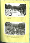
Erosion, North Salt Lake 1932 [and] Erosion west of Salt Lake, on north point of Oquirrh Mountains
1932
Image/StillImage
uum_map
4
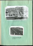
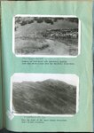
Farmington floods : Farmington flood barrier in its early stages of development [and] The same successfully controlling a heavy torrential flood on July 3, 1925
1925
Image/StillImage
uum_map
5
Farmington floods : Farmington flood barrier at the close of a season of excessive high water [and] Looking up stream from spillway into Farmington barrier basin
1926
Image/StillImage
uum_map
6
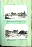
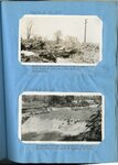
Parrish Creek and Centerville flooding : Parrish Creek showing Centerville school in the midst of an area devastated by the floods of 1930 [and] Remnants of a home on Parrish Creek near the Centerville school, September 1930
1930
Image/StillImage
uum_map
7
Ford Creek floods : Result of and flow from torrential flood, Ford Creek, August 13, 1923 [and] The disaster of 1923 repeated on Ford Creek in a series of three floods in 1930
1923; 1930
Image/StillImage
uum_map
8
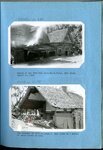
Farmington floods : Farmington spillway following a torrential flood [ad] Debris deposited above the Farmington barrier by the flood of July 3, 1926
1926
Image/StillImage
uum_map
9
Farmington floods : Farmington spillway of rubble-concrete during the first season of operation, April 1925 [and] The same in 1927
1925-04; 1927
Image/StillImage
uum_map
10
Ford Creek floods : Ford Creek in 1924 following 1923 floods [and] Looking across state highway at Ford Creek following 1930 flood
1924; 1930
Image/StillImage
uum_map
11
Ford Creek floods : Ford Creek, Davis County, after the third torrential flood in recent years
1930
Image/StillImage
uum_map
12
Parrish Creek and Centerville flooding : Highway below Centerville School, Parrish Creek 1930 floods [and] Another home near Centerville School 1930
1930
Image/StillImage
uum_map
13
Parrish Creek and Centerville flooding : Two pictures showing consistency of mud flows in Davis County floods
1930
Image/StillImage
uum_map
14
Highway fo Steed Creek crossing during torrential flood, looking upstream [and] A woven wire fence parallel to direction of flow held a torrential flood within bounds, just above highway crossing at Fiddler's Creek near Cedar City
1930; 1931; 1932
Image/StillImage
uum_map
15
Digging the state highway out after a typical Davis County flood [and] A minor flood from Steed Creek blocked the highway as indicated
1930; 1931; 1932
Image/StillImage
uum_map
16
Diversion dam on Canal Creek, after a terrific flood in July 1922 [and] Diversion dam on Haights Creek, buried by a devastating flood July 3, 1926
1922; 1926
Image/StillImage
uum_map
17
Erosion of foot hills near Bountiful, showing goat herd which grazes over the Bountiful water-shed [and] Near the crest of the Davis County water-shed where floods originate
1923; 1924; 1925; 1926; 1927; 1928; 1929; 1930; 1931; 1932; 1933
Image/StillImage
uum_map
18
Looking down Cottonwood Creek at Farmington after flood of 1922 and before barrier construction [and] Farmington spillway, first season of operation
1922; 1924; 1925
Image/StillImage
uum_map
19
Haights Creek Diversion dam in process of construction
1923; 1924; 1925; 1926; 1927; 1928; 1929; 1930; 1931; 1932; 1933
Image/StillImage
uum_map
20
Farmington, August 1924, commencement of spillway and barrier
1924
Image/StillImage
uum_map
21
Farmington spillway before first season of operation
1924; 1925
Image/StillImage
uum_map
22
Church for the deaf, Bountiful, Utah
1920; 1921; 1922; 1923; 1924; 1925; 1926; 1927; 1928; 1929; 1930
Image/StillImage
uum_map
23
Rail shop located at Hill Air Force Base
1966; 1967
Image/StillImage
uum_map
24
Kaysville Art Club social, 1988 [05]
1988
Image/StillImage
uum_map
25
Kaysville Art Club social, 1988 [10]
1988
Image/StillImage
uum_map
1
-
25
of
1,227
<
1
2
3
4
5
6
7
8
9
10
>