Home
Browse
Ask Us
Chat
Harmful Language Statement
Log in
Advanced Search
Year
1872
1873
1874
1875
1876
1877
1878
1879
1880
1881
1882
1883
1884
1885
1886
1887
1888
1889
1890
1891
1892
1893
1894
1895
1896
1897
1898
1899
1900
1901
1902
1903
1904
1905
1906
1907
1908
1909
1910
1911
1912
1913
1914
1915
1916
1917
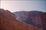
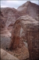
1918
1919
1920
1921
1922
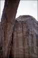
1923
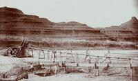
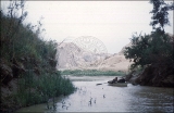
1924
1925
1926
1927
1928
1929
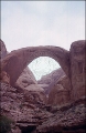
1930
1931
1932
1933
1934
1935
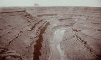
1936
1937
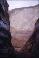
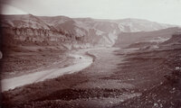
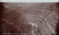
1938
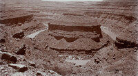
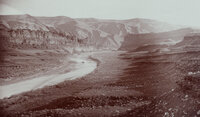
1939
1940
1941
1942
1943
1944
1945
1946
1947
1948
1949
1950
1951
1952
1953
1954
1955
1956
1957
1958
1959
1960
1961
1962
1963
1964
1965
1966
1967
1968
1969
1970
1971
1972
1973
1974
1975
1976
1977
1978
1979
1980
1981
1982
1983
1984
1985
1986
1987
1988
1989
1990
1991
1992
1993
1994
1995
1996
1997
1998
1999
2000
2001
2002
2003
2004
2005
2006
2007
2008
2009
2010
TO
1872
1873
1874
1875
1876
1877
1878
1879
1880
1881
1882
1883
1884
1885
1886
1887
1888
1889
1890
1891
1892
1893
1894
1895
1896
1897
1898
1899
1900
1901
1902
1903
1904
1905
1906
1907
1908
1909
1910
1911
1912
1913
1914
1915
1916
1917
1918
1919
1920
1921
1922
1923
1924
1925
1926
1927
1928
1929
1930
1931
1932
1933
1934
1935
1936
1937
1938
1939
1940
1941
1942
1943
1944
1945
1946
1947
1948
1949
1950
1951
1952
1953
1954
1955
1956
1957
1958
1959
1960
1961
1962
1963
1964
1965
1966
1967
1968
1969
1970
1971
1972
1973
1974
1975
1976
1977
1978
1979
1980
1981
1982
1983
1984
1985
1986
1987
1988
1989
1990
1991
1992
1993
1994
1995
1996
1997
1998
1999
2000
2001
2002
2003
2004
2005
2006
2007
2008
2009
2010
Type
Image/StillImage
2,013
Image
1,955
Text
286
Image/MovingImage
5
Sound
1
Format
image/jpeg
3,836
application/pdf
727
video/mp4
5
audio/mpeg
1
Collection
Beckwith Photograph Collection
2
Home Movie Collection
5
Photo Archives
1,412
Ski and Snow Sports Archives
43
UAIDA Main Collection
948
Utah Humanities Research Foundation
25
Utah Quilt Heritage Records
2
Utah River Running Photo Archives
2,136
Western Soundscape
1
Western Waters NEH
1
More
Filters:
Spatial Coverage:
"San Juan County (Utah)"
51
-
75
of
4,575
<
1
2
3
4
5
6
7
8
9
10
>
Gallery view
Number of results to display per page
10
25
50
100
200
Sort by Relevance
Sort by Title A-Z
Sort by Title Z-A
Sort by Date Ascending
Sort by Date Descending
Sort by Last Modified Ascending
Sort by Last Modified Descending
Title
Date
Type
Setname
51
"Moki Canyon looking up to Verona on ledge."
1951-05
uum_map_rr
52
"Mound Loop, San Juan River Canyon. Scene in oil field 30 miles west of Bluff, Utah. Two miles around loop and 800 feet deep."
1890; 1891; 1892; 1893; 1894; 1895; 1896; 1897; 1898; 1899; 1900
Image
uum_map_rr
53
"My favorite couch at Spring under the Bridge"
1957; 1958; 1959; 1960; 1961; 1962
uum_map_rr
54
"Mystery Canyon."
1951-05-14
uum_map_rr
55
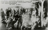
"Navajo Indians around a council fire, trying to hide their faces from the photographer Bluff, Utah"
1880; 1881; 1882; 1883; 1884; 1885; 1886; 1887; 1888; 1889; 1890; 1891; 1892; 1893; 1894; 1895; 1896; 1897; 1898; 1899; 1900; 1901; 1902; 1903; 1904; 1905; 1906; 1907; 1908; 1909; 1910
Image
uum_map
56
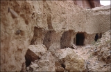
"Old Gerhart Mine site mile 131.5."
1951-05-12
uum_map_rr
57
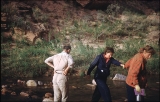
"One of the last of 32 crossings we made of Aztec Creek, more difficult by sudden rise of water coming from Navajo Mt."
1951-05-15
uum_map_rr
58
"Our first views from above as we prepared to descend from the top of Rainbow Bridge."
1951-05-15
uum_map_rr
59
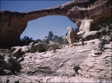
"Owachamo Bridge, 108 ft high, 200 ft span."
1951-05-10
uum_map_rr
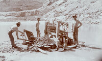
60
"Placer mining at foot of Honaker Trail in San Juan Canyon, Utah."
1894-12
Image
uum_map_rr
61
"Placer mining on San Juan River near Bluff, Utah."
1894-07
Image
uum_map_rr
62
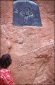
"Plaque to commemorate Pauite Nisjah Begay who first led white men to near Goshi."
1951-05-15
uum_map_rr
63
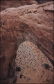
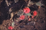
"Prickly Pear Cactus blooming above Aztec Creek as we neared our camp site. 5-15-51"
1951-05-15
uum_map_rr
64
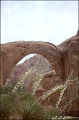
"Rainbow Bridge from East side yucca in bloom in foreground. 5-15-51"
1951-05-15
uum_map_rr
65
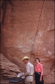
"Rainbow Bridge register #7301"
1951-05-15
uum_map_rr
66
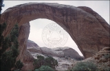
"Rainbow Bridge"
1951-05-15
uum_map_rr
67
"Rainbow Bridge"
1951-05-15
uum_map_rr
68
"Rainbow Bridge."
1951-05-15
uum_map_rr
69
"Rainbow Bridge."
1951-05-15
uum_map_rr
70
"Raplee's placer mining works in Oil Basin, 25 miles west of Bluff, Utah."
1894-12
Image
uum_map_rr
71
"Redbud Canyon leaving Mystery Creek."
1951-05
uum_map_rr
72
"San Juan Oil Basin at Raplee's Camp. Lime Ridge Dome in background."
1894-12
Image
uum_map_rr
73
"San Juan Oil Basin at Raplee's Camp. Lime Ridge Dome in background."
1894-12
Image
uum_map_rr
74
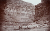
"San Juan River Canyon at Honaker Trail - 1500 Feet deep."
1894-12
Image
uum_map_rr
75
"San Juan River Canyon at Mendenhall Loop. 1000 feet deep. Alhambra Rock in the distance. Eruptive and 450 feet high, 600 feet long and 90 feet wide."
1894-12
Image
uum_map_rr
51
-
75
of
4,575
<
1
2
3
4
5
6
7
8
9
10
>