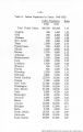
| OCR Text |
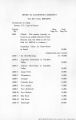
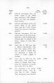
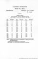
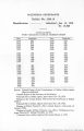
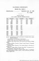
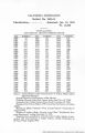
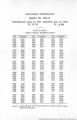
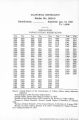
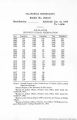
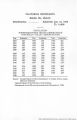
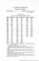
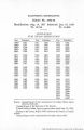
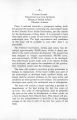
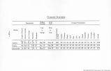
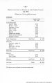
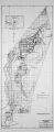
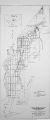
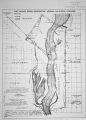
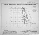
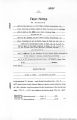
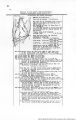
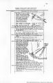
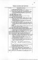
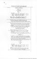
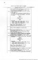
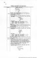
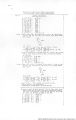
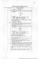
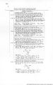
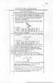
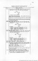
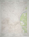
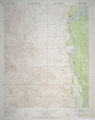
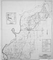
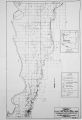
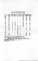
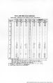
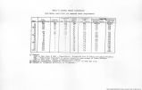
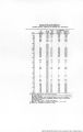
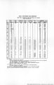
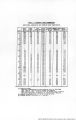
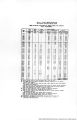
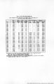
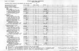
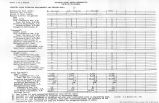
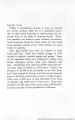
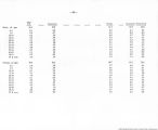
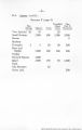
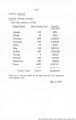
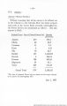
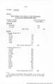
Show 16 Boundary of Port Mohave Indian Reservation (Formerly Camp Mohave Indian Reservation) ohains 1.60 4-SO a. 90 .22 2.07 Retracement contlnued. granite atone,14x6x6 ins.above around, firmly set, marked fV on Lt.face, P L on E.face, C If I R or v.'.faoe, and witnessed by a mound of atone W. of mor. This monument is now the 4£ mile mon. of the 7.H.I.P.. Bdy..and being in a good state of preservation no reconstruction is required. True course and dist.of 1st half of the 5tn mile of the F.M.I.R. Bdy. are therefore,S.O°29« ?"W.,40.10 cha.; and the closing cor. being on line, and in a good state of preservation, is neither reestablished or reconstruct ed. Resurvey. From 4* mile monument, 3.0*?5f 6HW..on true line, on 2nd half of the 5th mile of'F.M.I.R. Bdy. over rolling land,thru scattering undergrowth. West edge of mesa, bears NM. and SS. Descend 50 ft. over SW. slope to Foot of descent. Leave rolling and enter level bottom land of the Colorado River. Enter scattering timber, bears NW. and SE. Intersect point of original location of the 5 mile monument determined by record tie of 110 lka.S.57a°E. from a charred mesquite stump on which marking B T is still legible. No trace of original SW. bearing tree can be found. Recontruct the raile monument at original poirt as follows: set an iron post, 3 ft.long. 2 ins. dia.,26 ins.in the ground, with a bottle deposited at base of post, for 5 mile mon. of F.M.I.R. Bdy.,with brass cap marked T 19 * S 54 R 22 W 1S28 band, rolling and level. Soil, gravelly and sandy, 3rd and 2nd rate. Timber, mesquite. Undergrowth, sagebrush, greasewood and arrow-weed. S.0"?8' 6"W.,on true line,on part of the 1st half of the 6th raile of the P.H.I.?. Bdy . Over level botton land of the Colorado River, thru scattering timber and undergrowth. reestablished intersect point of original location of the^closing cor. of Frac. Ta.l8 and 19 ji.,B.?2 W. .Ariz. detemined by record ties trovx stumps of the two original, tearing treos, both meaouite, with mtiriilrgB obi.lter«-tpd. One bears .;.35i°3. , 22 ike. dist., and the other S.708H., 92 lks. dist., from cor. point, Reconstruct the closing cor. ir original position ab follows: set an iron post, ^ ft.long. 2 ins. dia.,28 ire.in the graund^with a bottle deposited at WBe of ooet, for ^^Toslnsr cor. of 'ruc.Te.l8 and 1? a.,R.22 W.,Ari^., with bruB8 cap marked 19 R 22 W diist. Vanfleet's honse, boare V/eat 2.^0 |
| Source |
Original book: [State of Arizona, complainant v. State of California, Palo Verde Irrigation District, Coachella Valley County Water District, Metropolitan Water District of Southern California, City of Los Angeles, California, City of San Diego, California, and County of San Diego, California, defendants, United States of America, State of Nevada, State of New Mexico, State of Utah, interveners] : |